Estimated Value: $163,394 - $277,000
3
Beds
1
Bath
1,722
Sq Ft
$118/Sq Ft
Est. Value
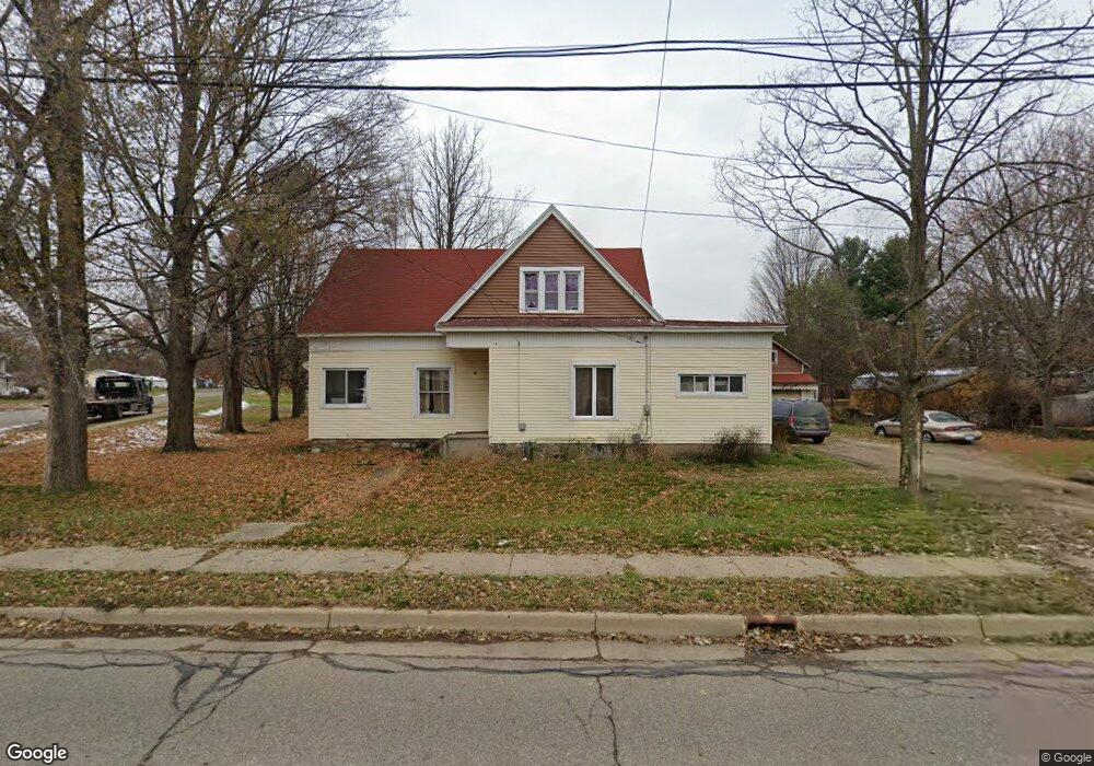
About This Home
This home is located at 605 E State St, Colon, MI 49040 and is currently estimated at $203,599, approximately $118 per square foot. 605 E State St is a home located in St. Joseph County.
Ownership History
Date
Name
Owned For
Owner Type
Purchase Details
Closed on
Jun 22, 2011
Sold by
Lundstrom Robert and Lundstrom Joyce
Bought by
Locker Curtis M
Current Estimated Value
Home Financials for this Owner
Home Financials are based on the most recent Mortgage that was taken out on this home.
Original Mortgage
$55,890
Outstanding Balance
$38,529
Interest Rate
4.63%
Mortgage Type
New Conventional
Estimated Equity
$165,070
Purchase Details
Closed on
Jan 1, 1901
Create a Home Valuation Report for This Property
The Home Valuation Report is an in-depth analysis detailing your home's value as well as a comparison with similar homes in the area
Purchase History
| Date | Buyer | Sale Price | Title Company |
|---|---|---|---|
| Locker Curtis M | $49,500 | Patrick Abstract & Title Off | |
| -- | -- | -- |
Source: Public Records
Mortgage History
| Date | Status | Borrower | Loan Amount |
|---|---|---|---|
| Open | Locker Curtis M | $55,890 |
Source: Public Records
Tax History
| Year | Tax Paid | Tax Assessment Tax Assessment Total Assessment is a certain percentage of the fair market value that is determined by local assessors to be the total taxable value of land and additions on the property. | Land | Improvement |
|---|---|---|---|---|
| 2025 | $784 | $60,000 | $11,000 | $49,000 |
| 2024 | $767 | $55,700 | $9,900 | $45,800 |
| 2023 | $835 | $52,000 | $9,900 | $42,100 |
| 2022 | $0 | $40,100 | $8,500 | $31,600 |
| 2021 | $682 | $37,900 | $8,500 | $29,400 |
| 2020 | $367 | $39,100 | $7,200 | $31,900 |
| 2019 | $281 | $33,100 | $7,200 | $25,900 |
| 2018 | $1,003 | $29,400 | $7,200 | $22,200 |
| 2017 | $979 | $30,300 | $30,300 | $0 |
| 2016 | -- | $29,200 | $29,200 | $0 |
| 2015 | -- | $28,300 | $0 | $0 |
| 2014 | -- | $29,000 | $29,000 | $0 |
| 2012 | -- | $23,700 | $23,700 | $0 |
Source: Public Records
Map
Nearby Homes
- 161 Palmer Ave
- 804 E State St
- 120 Palmer Ave
- 407 Barry St
- 210 E South St
- 0 N Burr Oak Rd
- 309 N Blackstone Ave
- 3741 N Blackstone Ave
- VL Bowman St
- 917 Elm St
- 58954 Lakeshore Dr
- 59178 Nora Dr
- 33273 E Palmer Lake Rd
- 31688 W Colon Rd
- 31908 Decker Rd
- 30725 Orla Engle Rd
- 0 Coohon Rd
- 30311 Michigan 86
- 60651 Bert Rd
- 55637 Bennett Rd
Your Personal Tour Guide
Ask me questions while you tour the home.