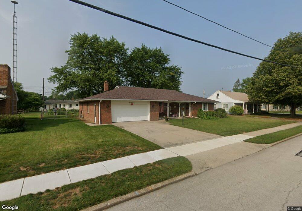
605 Erie St Woodville, OH 43469
Estimated Value: $231,107 - $246,000
2
Beds
2
Baths
1,960
Sq Ft
$122/Sq Ft
Est. Value
About This Home
This home is located at 605 Erie St, Woodville, OH 43469 and is currently estimated at $239,027, approximately $121 per square foot. 605 Erie St is a home located in Sandusky County with nearby schools including Woodmore Elementary School, Woodmore Middle School, and Solomon Lutheran School.
Ownership History
Date
Name
Owned For
Owner Type
Purchase Details
Closed on
May 16, 2014
Sold by
Hesselbart Wilbur F
Bought by
Potridge James W
Current Estimated Value
Purchase Details
Closed on
Aug 31, 2011
Sold by
Hundt William and Hundt Barbara J
Bought by
Hesselbart William F and Hesselbart Marilyn R
Purchase Details
Closed on
Mar 28, 1997
Sold by
Est Marie Mollgaard
Bought by
Krukemyer Todd H and Krukemyer Amy L
Home Financials for this Owner
Home Financials are based on the most recent Mortgage that was taken out on this home.
Original Mortgage
$99,000
Interest Rate
7.73%
Mortgage Type
Balloon
Create a Home Valuation Report for This Property
The Home Valuation Report is an in-depth analysis detailing your home's value as well as a comparison with similar homes in the area
Home Values in the Area
Average Home Value in this Area
Purchase History
| Date | Buyer | Sale Price | Title Company |
|---|---|---|---|
| Potridge James W | $110,000 | Attorney | |
| Hesselbart William F | $88,000 | Portage Valley Title | |
| Krukemyer Todd H | $110,000 | -- |
Source: Public Records
Mortgage History
| Date | Status | Borrower | Loan Amount |
|---|---|---|---|
| Previous Owner | Krukemyer Todd H | $99,000 |
Source: Public Records
Tax History Compared to Growth
Tax History
| Year | Tax Paid | Tax Assessment Tax Assessment Total Assessment is a certain percentage of the fair market value that is determined by local assessors to be the total taxable value of land and additions on the property. | Land | Improvement |
|---|---|---|---|---|
| 2024 | $3,438 | $66,750 | $13,480 | $53,270 |
| 2023 | $3,438 | $55,160 | $11,130 | $44,030 |
| 2022 | $3,291 | $55,160 | $11,130 | $44,030 |
| 2021 | $3,307 | $55,160 | $11,130 | $44,030 |
| 2020 | $3,082 | $49,140 | $11,130 | $38,010 |
| 2019 | $3,083 | $49,140 | $11,130 | $38,010 |
| 2018 | $3,241 | $49,140 | $11,130 | $38,010 |
| 2017 | $2,764 | $42,810 | $11,130 | $31,680 |
| 2016 | $2,681 | $42,810 | $11,130 | $31,680 |
| 2015 | $2,695 | $42,810 | $11,130 | $31,680 |
| 2014 | $2,320 | $44,840 | $10,610 | $34,230 |
| 2013 | $2,296 | $44,840 | $10,610 | $34,230 |
Source: Public Records
Map
Nearby Homes
- 739 Riverside Dr
- 612 W Main St
- 421 Parklane Dr
- 415 Fort Findlay Rd
- 219 Lime St
- 571 Parklane Dr
- 212 S Perry St
- 110 E 1st St
- 712 Lueke Ave Unit 572 p
- 20180 Us Highway 23
- 20240 W Portage River South Rd
- 0 Recker Rd
- 2067 Devils Hole Rd
- 1936 County Road 32
- 0 Pemberville Rd
- 19383 Courtland Ave
- 3291 Middleton Pike
- 510 Wilson St
- 514 West St
- 416 Castle Cove