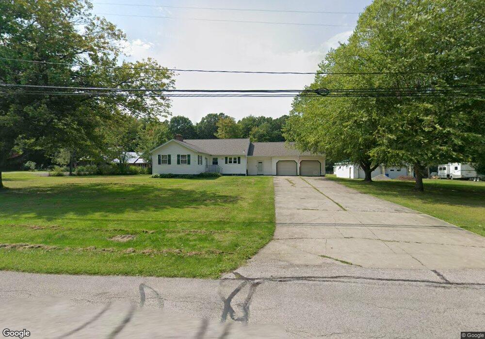
605 Furnace Rd Conneaut, OH 44030
Estimated Value: $184,000 - $373,000
4
Beds
1
Bath
1,704
Sq Ft
$162/Sq Ft
Est. Value
About This Home
This home is located at 605 Furnace Rd, Conneaut, OH 44030 and is currently estimated at $275,668, approximately $161 per square foot. 605 Furnace Rd is a home located in Ashtabula County with nearby schools including Lakeshore Primary Elementary School, Gateway Elementary School, and Conneaut Middle School.
Ownership History
Date
Name
Owned For
Owner Type
Purchase Details
Closed on
Sep 26, 2014
Sold by
Obeshaw Richard A and Obeshaw Linda S
Bought by
Cafone Mark
Current Estimated Value
Home Financials for this Owner
Home Financials are based on the most recent Mortgage that was taken out on this home.
Original Mortgage
$136,141
Outstanding Balance
$103,481
Interest Rate
3.87%
Mortgage Type
FHA
Estimated Equity
$172,187
Purchase Details
Closed on
Jun 9, 1995
Sold by
Campbell David R
Bought by
Obeshaw Richard A and Obeshaw Linda S
Home Financials for this Owner
Home Financials are based on the most recent Mortgage that was taken out on this home.
Original Mortgage
$79,000
Interest Rate
8.26%
Mortgage Type
VA
Create a Home Valuation Report for This Property
The Home Valuation Report is an in-depth analysis detailing your home's value as well as a comparison with similar homes in the area
Home Values in the Area
Average Home Value in this Area
Purchase History
| Date | Buyer | Sale Price | Title Company |
|---|---|---|---|
| Cafone Mark | $138,700 | None Available | |
| Obeshaw Richard A | $76,700 | -- |
Source: Public Records
Mortgage History
| Date | Status | Borrower | Loan Amount |
|---|---|---|---|
| Open | Cafone Mark | $136,141 | |
| Previous Owner | Obeshaw Richard A | $79,000 |
Source: Public Records
Tax History Compared to Growth
Tax History
| Year | Tax Paid | Tax Assessment Tax Assessment Total Assessment is a certain percentage of the fair market value that is determined by local assessors to be the total taxable value of land and additions on the property. | Land | Improvement |
|---|---|---|---|---|
| 2024 | $4,371 | $59,750 | $7,560 | $52,190 |
| 2023 | $2,784 | $59,750 | $7,560 | $52,190 |
| 2022 | $2,515 | $47,530 | $5,810 | $41,720 |
| 2021 | $2,558 | $47,530 | $5,810 | $41,720 |
| 2020 | $2,557 | $47,530 | $5,810 | $41,720 |
| 2019 | $2,414 | $44,140 | $4,200 | $39,940 |
| 2018 | $2,301 | $44,140 | $4,200 | $39,940 |
| 2017 | $2,181 | $44,140 | $4,200 | $39,940 |
| 2016 | $2,045 | $42,740 | $4,060 | $38,680 |
| 2015 | $2,066 | $42,740 | $4,060 | $38,680 |
| 2014 | $1,821 | $42,740 | $4,060 | $38,680 |
| 2013 | $1,996 | $48,130 | $5,110 | $43,020 |
Source: Public Records
Map
Nearby Homes
- 611 Furnace Rd
- 601 Furnace Rd
- 597 Furnace Rd
- 639 Furnace Rd
- 638 Furnace Rd
- 638 Furnace Rd
- 589 Furnace Rd
- 644 Furnace Rd
- 652 Furnace Rd
- 440 E Under Ridge Rd
- 657 Furnace Rd
- 420 E Under Ridge Rd
- 430 E Under Ridge Rd
- 658 Furnace Rd
- 447 E Under Ridge Rd
- 681 Furnace Rd
- 549 Furnace Rd
- 683 Furnace Rd
- 526 Furnace Rd
- 691 Furnace Rd