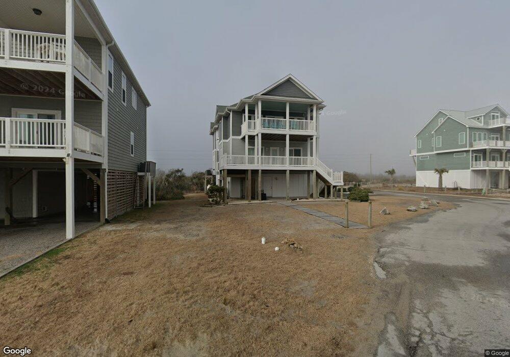
605 Hampton Colony Cir Sneads Ferry, NC 28460
Estimated Value: $1,650,000 - $1,815,463
6
Beds
6
Baths
3,260
Sq Ft
$525/Sq Ft
Est. Value
About This Home
This home is located at 605 Hampton Colony Cir, Sneads Ferry, NC 28460 and is currently estimated at $1,710,154, approximately $524 per square foot. 605 Hampton Colony Cir is a home with nearby schools including Dixon Elementary School, Coastal Elementary, and Dixon High School.
Ownership History
Date
Name
Owned For
Owner Type
Purchase Details
Closed on
Jun 12, 2006
Sold by
Fairley Robert E and Fairley Mary A
Bought by
Stapleton Thomas J and Chidlow Anne E
Current Estimated Value
Home Financials for this Owner
Home Financials are based on the most recent Mortgage that was taken out on this home.
Original Mortgage
$472,500
Outstanding Balance
$276,546
Interest Rate
6.49%
Mortgage Type
Purchase Money Mortgage
Estimated Equity
$1,433,608
Create a Home Valuation Report for This Property
The Home Valuation Report is an in-depth analysis detailing your home's value as well as a comparison with similar homes in the area
Home Values in the Area
Average Home Value in this Area
Purchase History
| Date | Buyer | Sale Price | Title Company |
|---|---|---|---|
| Stapleton Thomas J | $525,000 | None Available |
Source: Public Records
Mortgage History
| Date | Status | Borrower | Loan Amount |
|---|---|---|---|
| Open | Stapleton Thomas J | $472,500 |
Source: Public Records
Tax History Compared to Growth
Tax History
| Year | Tax Paid | Tax Assessment Tax Assessment Total Assessment is a certain percentage of the fair market value that is determined by local assessors to be the total taxable value of land and additions on the property. | Land | Improvement |
|---|---|---|---|---|
| 2025 | $14,413 | $1,328,354 | $312,000 | $1,016,354 |
| 2024 | $14,413 | $1,328,354 | $312,000 | $1,016,354 |
| 2023 | $14,413 | $1,328,354 | $312,000 | $1,016,354 |
| 2022 | $14,413 | $1,328,354 | $312,000 | $1,016,354 |
| 2021 | $8,377 | $719,080 | $106,500 | $612,580 |
| 2020 | $8,018 | $719,080 | $106,500 | $612,580 |
| 2019 | $8,018 | $719,080 | $106,500 | $612,580 |
| 2018 | $7,540 | $719,080 | $106,500 | $612,580 |
| 2017 | $6,847 | $640,960 | $150,000 | $490,960 |
| 2016 | $6,847 | $640,960 | $0 | $0 |
| 2015 | $6,847 | $640,960 | $0 | $0 |
| 2014 | $6,847 | $150,000 | $0 | $0 |
Source: Public Records
Map
Nearby Homes
- 000 Hampton Colony Cir
- 438 Hampton Colony Cir
- 145 Ocean View Ln
- 4414 Island Dr
- 4388 Island Dr
- 4340 Island Dr
- 4316 Island Dr
- 4264 Island Dr
- 4196 Island Dr
- 4110 Island Dr Unit 505
- Lot 86 Carolina St
- 81 Carolina St
- 117 Dock
- 508 N New River Inlet
- 532 New River Inlet Rd
- 31 Osprey Dr
- 110 Captains Ln
- 110 & 111 Quarter Deck
- 90 & 92 Pelican St
- Lot 151 Reel St
- 420 Hampton Colony Cir
- Lot 20 Hampton Colony Cir
- 20 Hampton Colony Cir
- Lot 3 Hampton Colony Cir
- Lot 28 Hampton Colony Cir
- Lot 27 Hampton Colony Cir
- 0 Hampton Colony Cir
- 606 Hampton Colony Cir
- 610 Hampton Colony Cir
- 429 Hampton Colony Cir
- 422 Hampton Colony Cir
- 612 Hampton Colony Cir
- 618 Hampton Colony Cir
- 616 Hampton Colony Cir
- 618 Hampton Colony Cir
- 602 Hampton Colony Cir
- 402 Hampton Colony Cir
- 404 Hampton Colony Cir
- 230 Island Dr
- 614 Hampton