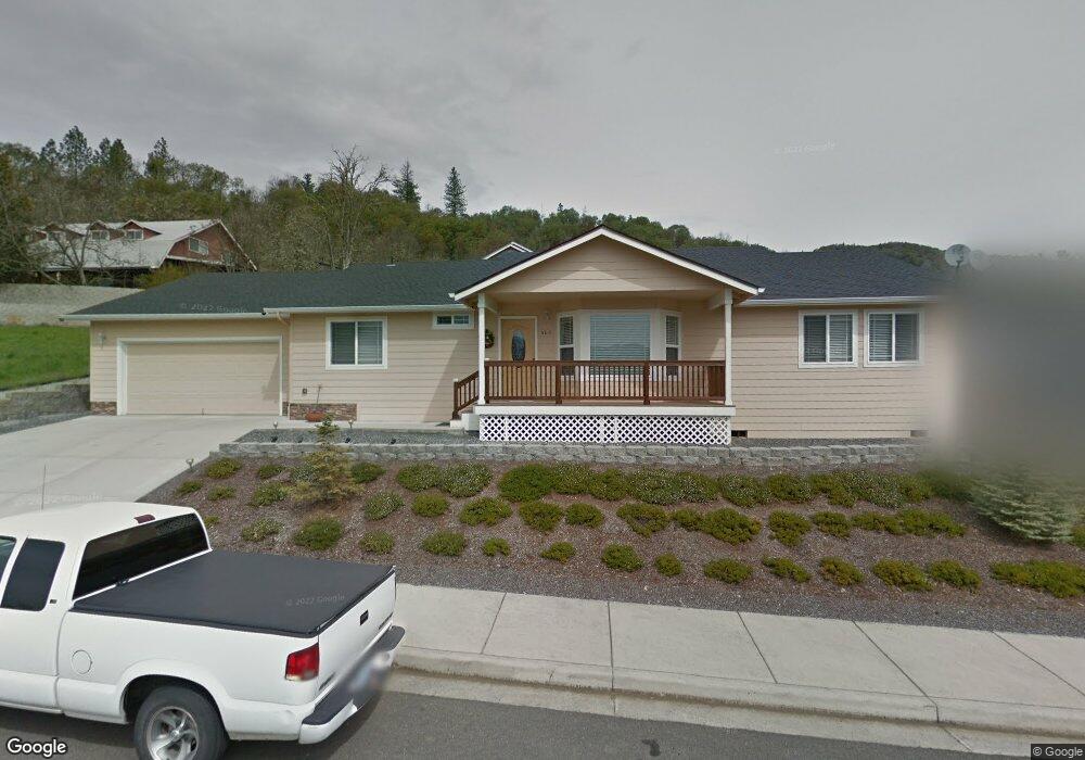
605 Lia Way Rogue River, OR 97537
Estimated Value: $435,751 - $511,000
3
Beds
2
Baths
1,847
Sq Ft
$256/Sq Ft
Est. Value
About This Home
This home is located at 605 Lia Way, Rogue River, OR 97537 and is currently estimated at $471,938, approximately $255 per square foot. 605 Lia Way is a home located in Jackson County with nearby schools including Rogue River Elementary School, South Valley Academy, and Rogue River Junior/Senior High School.
Ownership History
Date
Name
Owned For
Owner Type
Purchase Details
Closed on
Nov 16, 2015
Sold by
Ebipane Richard N and Ebipane Karla
Bought by
Ebipane Richard N and Ebipane Karla
Current Estimated Value
Purchase Details
Closed on
Jun 2, 2006
Sold by
Ebipane Richard N and Ebipane Karla
Bought by
Ebipane Richard N and Ebipane Karla
Home Financials for this Owner
Home Financials are based on the most recent Mortgage that was taken out on this home.
Original Mortgage
$120,000
Interest Rate
6.52%
Mortgage Type
Construction
Create a Home Valuation Report for This Property
The Home Valuation Report is an in-depth analysis detailing your home's value as well as a comparison with similar homes in the area
Home Values in the Area
Average Home Value in this Area
Purchase History
| Date | Buyer | Sale Price | Title Company |
|---|---|---|---|
| Ebipane Richard N | -- | None Available | |
| Ebipane Richard N | -- | First American | |
| Ebipane Richard N | -- | First American |
Source: Public Records
Mortgage History
| Date | Status | Borrower | Loan Amount |
|---|---|---|---|
| Closed | Ebipane Richard N | $120,000 |
Source: Public Records
Tax History Compared to Growth
Tax History
| Year | Tax Paid | Tax Assessment Tax Assessment Total Assessment is a certain percentage of the fair market value that is determined by local assessors to be the total taxable value of land and additions on the property. | Land | Improvement |
|---|---|---|---|---|
| 2025 | $3,649 | $255,530 | $89,420 | $166,110 |
| 2024 | $3,649 | $248,090 | $86,810 | $161,280 |
| 2023 | $3,530 | $240,870 | $84,290 | $156,580 |
| 2022 | $3,448 | $240,870 | $84,290 | $156,580 |
| 2021 | $3,416 | $233,860 | $81,830 | $152,030 |
| 2020 | $3,330 | $227,050 | $79,440 | $147,610 |
| 2019 | $3,251 | $214,020 | $74,880 | $139,140 |
| 2018 | $3,168 | $207,790 | $72,700 | $135,090 |
| 2017 | $3,098 | $207,790 | $72,700 | $135,090 |
| 2016 | $3,022 | $195,870 | $68,520 | $127,350 |
| 2015 | $2,939 | $195,870 | $74,620 | $121,250 |
| 2014 | $2,847 | $184,640 | $70,330 | $114,310 |
Source: Public Records
Map
Nearby Homes
- 105 Brolin Ct
- 305 Woodville Way
- 300 Woodville Way
- 904 Broadway St Unit 503
- 0 Oak St
- 182 Wards Creek Rd
- 2661 Wards Creek Rd
- 419 E Main St
- 111 Cedar St
- TL 1303 E Main St
- 405 Magerle Ln
- 815 Pine St Unit 10
- 202 Arbor St
- 5525 Red Tail Ln
- 5500 Red Tail Ln
- 4529 E Evans Creek Rd
- 207 Madrone St
- 208 W Main St
- 0 W Evans Creek Rd Unit 1000 220202360
- 0 W Evans Creek Rd Unit 1200 220202358