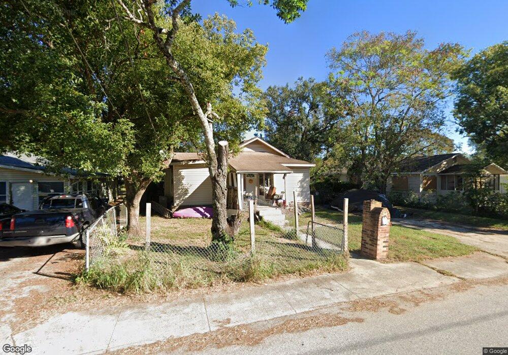
605 Lime St Auburndale, FL 33823
Estimated Value: $145,000 - $204,000
2
Beds
1
Bath
1,383
Sq Ft
$127/Sq Ft
Est. Value
About This Home
This home is located at 605 Lime St, Auburndale, FL 33823 and is currently estimated at $175,206, approximately $126 per square foot. 605 Lime St is a home located in Polk County with nearby schools including Auburndale Central Elementary School, Auburndale Senior High School, and Jewett School of the Arts.
Ownership History
Date
Name
Owned For
Owner Type
Purchase Details
Closed on
Jan 4, 2017
Sold by
Baxter Benjamin G
Bought by
Baxter Rickey D
Current Estimated Value
Purchase Details
Closed on
Nov 9, 2016
Sold by
Razorback Capital Llc
Bought by
Baxter Benjamin G
Purchase Details
Closed on
Sep 27, 2016
Sold by
U S Bank Na
Bought by
Razorback Capital Llc
Purchase Details
Closed on
Dec 29, 2015
Sold by
Burney Dianna and Sudlow Dianna Lynn
Bought by
Us Bank National Association
Purchase Details
Closed on
May 17, 1999
Sold by
Conn Shirley A
Bought by
Guy Joel and Guy Dianna
Home Financials for this Owner
Home Financials are based on the most recent Mortgage that was taken out on this home.
Original Mortgage
$47,700
Interest Rate
6.98%
Mortgage Type
New Conventional
Create a Home Valuation Report for This Property
The Home Valuation Report is an in-depth analysis detailing your home's value as well as a comparison with similar homes in the area
Home Values in the Area
Average Home Value in this Area
Purchase History
| Date | Buyer | Sale Price | Title Company |
|---|---|---|---|
| Baxter Rickey D | -- | None Available | |
| Baxter Benjamin G | $30,000 | Liberty Title & Escrow Llc | |
| Razorback Capital Llc | $20,500 | Servicelink Llc | |
| Us Bank National Association | $14,400 | None Available | |
| Guy Joel | $45,000 | -- |
Source: Public Records
Mortgage History
| Date | Status | Borrower | Loan Amount |
|---|---|---|---|
| Previous Owner | Guy Joel | $18,714 | |
| Previous Owner | Guy Joel | $47,700 |
Source: Public Records
Tax History Compared to Growth
Tax History
| Year | Tax Paid | Tax Assessment Tax Assessment Total Assessment is a certain percentage of the fair market value that is determined by local assessors to be the total taxable value of land and additions on the property. | Land | Improvement |
|---|---|---|---|---|
| 2025 | $465 | $62,285 | -- | -- |
| 2024 | $461 | $60,530 | -- | -- |
| 2023 | $461 | $58,767 | $0 | $0 |
| 2022 | $456 | $57,055 | $0 | $0 |
| 2021 | $462 | $55,393 | $0 | $0 |
| 2020 | $461 | $54,628 | $0 | $0 |
| 2018 | $801 | $44,601 | $16,197 | $28,404 |
| 2017 | $637 | $35,648 | $0 | $0 |
| 2016 | $743 | $40,867 | $0 | $0 |
| 2015 | $694 | $34,581 | $0 | $0 |
| 2014 | $604 | $31,437 | $0 | $0 |
Source: Public Records
Map
Nearby Homes