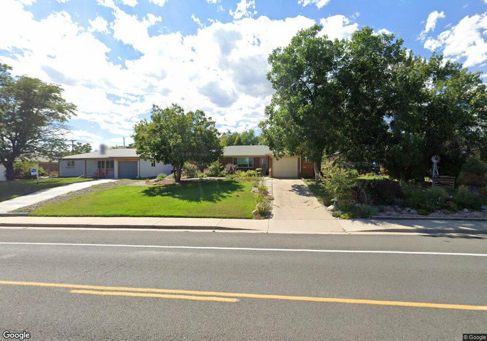
605 Main St Broomfield, CO 80020
Broomfield Heights NeighborhoodEstimated Value: $533,112 - $598,000
4
Beds
2
Baths
2,232
Sq Ft
$250/Sq Ft
Est. Value
About This Home
This home is located at 605 Main St, Broomfield, CO 80020 and is currently estimated at $557,028, approximately $249 per square foot. 605 Main St is a home located in Broomfield County with nearby schools including Kohl Elementary School, Broomfield Heights Middle School, and Broomfield High School.
Ownership History
Date
Name
Owned For
Owner Type
Purchase Details
Closed on
Nov 14, 2012
Sold by
Viets Christopher
Bought by
Dean Brad M and Dean Maria S
Current Estimated Value
Home Financials for this Owner
Home Financials are based on the most recent Mortgage that was taken out on this home.
Original Mortgage
$211,850
Outstanding Balance
$146,254
Interest Rate
3.37%
Mortgage Type
New Conventional
Estimated Equity
$410,774
Purchase Details
Closed on
Mar 23, 2011
Sold by
Bonneau Robyn
Bought by
Viets Christopher
Purchase Details
Closed on
Feb 17, 1977
Create a Home Valuation Report for This Property
The Home Valuation Report is an in-depth analysis detailing your home's value as well as a comparison with similar homes in the area
Home Values in the Area
Average Home Value in this Area
Purchase History
| Date | Buyer | Sale Price | Title Company |
|---|---|---|---|
| Dean Brad M | $223,000 | Fidelity National Title Insu | |
| Viets Christopher | $30,000 | None Available | |
| -- | $39,500 | -- |
Source: Public Records
Mortgage History
| Date | Status | Borrower | Loan Amount |
|---|---|---|---|
| Open | Dean Brad M | $211,850 |
Source: Public Records
Tax History
| Year | Tax Paid | Tax Assessment Tax Assessment Total Assessment is a certain percentage of the fair market value that is determined by local assessors to be the total taxable value of land and additions on the property. | Land | Improvement |
|---|---|---|---|---|
| 2025 | $3,322 | $37,170 | $8,140 | $29,030 |
| 2024 | $3,322 | $35,450 | $7,780 | $27,670 |
| 2023 | $3,315 | $40,600 | $8,910 | $31,690 |
| 2022 | $2,715 | $28,080 | $5,740 | $22,340 |
| 2021 | $2,701 | $28,890 | $5,910 | $22,980 |
| 2020 | $2,557 | $27,180 | $5,290 | $21,890 |
| 2019 | $2,552 | $27,360 | $5,320 | $22,040 |
| 2018 | $2,204 | $23,350 | $3,890 | $19,460 |
| 2017 | $2,171 | $25,820 | $4,300 | $21,520 |
| 2016 | $1,834 | $19,450 | $4,300 | $15,150 |
| 2015 | $1,771 | $13,510 | $4,550 | $8,960 |
| 2014 | $1,257 | $13,510 | $4,550 | $8,960 |
Source: Public Records
Map
Nearby Homes
- 425 W 4th Avenue Dr
- 465 W 4th Avenue Place
- 530 W Midway Blvd
- 1123 Oakhurst Dr
- 230 Agate Way
- 920 Hemlock Way
- 1306 Sequerra St Unit A
- 215 Beryl Way
- 245 Coral Way
- 1301 Madero St Unit A
- 1131 Birdie Rd
- 136 Agate Way
- 740 Lotus Way
- 765 Lotus Way
- 951 E 10th Ave
- 286 E 12th Ave
- 984 E 7th Ave
- 1380 Holly Dr W
- 1500 Abilene Dr
- 190 Hemlock St
Your Personal Tour Guide
Ask me questions while you tour the home.