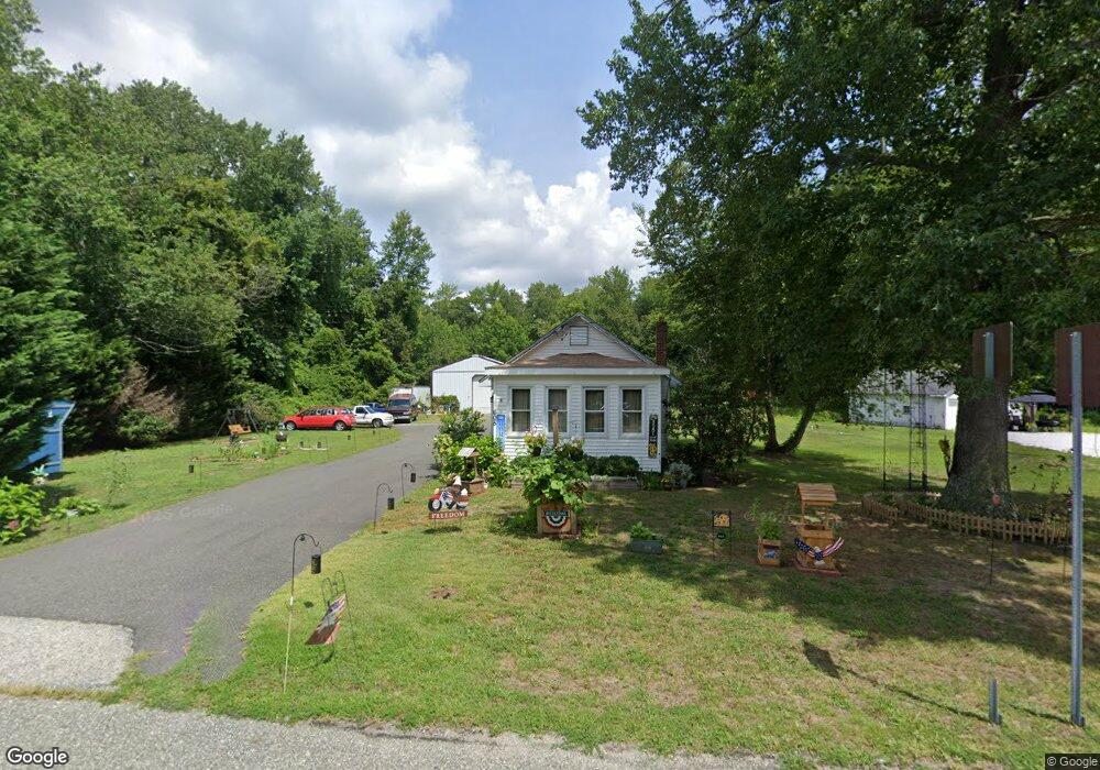
605 Main St Newport, NJ 08345
Estimated Value: $201,000 - $244,318
--
Bed
--
Bath
1,160
Sq Ft
$193/Sq Ft
Est. Value
About This Home
This home is located at 605 Main St, Newport, NJ 08345 and is currently estimated at $224,080, approximately $193 per square foot. 605 Main St is a home located in Cumberland County with nearby schools including Downe Township Elementary School.
Ownership History
Date
Name
Owned For
Owner Type
Purchase Details
Closed on
Sep 30, 2005
Sold by
Anderson Rae Amanda
Bought by
Simmerman Steven A and Turner Debbie S
Current Estimated Value
Home Financials for this Owner
Home Financials are based on the most recent Mortgage that was taken out on this home.
Original Mortgage
$109,112
Outstanding Balance
$58,696
Interest Rate
5.84%
Estimated Equity
$165,384
Create a Home Valuation Report for This Property
The Home Valuation Report is an in-depth analysis detailing your home's value as well as a comparison with similar homes in the area
Home Values in the Area
Average Home Value in this Area
Purchase History
| Date | Buyer | Sale Price | Title Company |
|---|---|---|---|
| Simmerman Steven A | $110,000 | -- |
Source: Public Records
Mortgage History
| Date | Status | Borrower | Loan Amount |
|---|---|---|---|
| Open | Simmerman Steven A | $109,112 |
Source: Public Records
Tax History Compared to Growth
Tax History
| Year | Tax Paid | Tax Assessment Tax Assessment Total Assessment is a certain percentage of the fair market value that is determined by local assessors to be the total taxable value of land and additions on the property. | Land | Improvement |
|---|---|---|---|---|
| 2025 | $3,868 | $133,500 | $30,000 | $103,500 |
| 2024 | $3,868 | $133,500 | $30,000 | $103,500 |
| 2023 | $3,566 | $133,500 | $30,000 | $103,500 |
| 2022 | $3,466 | $133,500 | $30,000 | $103,500 |
| 2021 | $3,276 | $133,500 | $30,000 | $103,500 |
| 2020 | $3,231 | $133,500 | $30,000 | $103,500 |
| 2019 | $3,183 | $133,500 | $30,000 | $103,500 |
| 2018 | $3,236 | $133,500 | $30,000 | $103,500 |
| 2017 | $3,112 | $133,500 | $30,000 | $103,500 |
| 2016 | $3,115 | $133,500 | $30,000 | $103,500 |
| 2015 | $2,936 | $133,500 | $30,000 | $103,500 |
| 2014 | $2,726 | $133,500 | $30,000 | $103,500 |
Source: Public Records
Map
Nearby Homes
- 554 Old Beaver Dam Rd
- 0 Relm Ave Unit NJCB2022890
- 0 Keln Ave Unit NJCB2022904
- 467 Hickman Ave Unit 469
- 898 Main St
- 912 Main St
- 914 Main St
- 281 Fortescue Rd
- 938 Union St
- 442 Shaws Mill Rd
- 13 Hall St
- 1029 Dragston Rd
- 1062 Hanseys Creek Rd
- 1073 Dragston Rd
- 184 Landing Rd
- 12 Lores Ln
- 297 Factory Rd
- 91 Landis Ave
- 873 875 Downe Ave
- 7 Princeton Ave
- 611 Old Beaver Dam Rd
- 611 Old Beaver Dam Rd
- 602-606 Main St
- 602 Main St
- 602 Main St
- 609 Turkey Point Rd
- 581 Main St
- 617 Main St
- 627 Old Beaver Dam Rd
- 590 Old Beaver Dam Rd
- 579 Main St
- 579 Main St Unit MAIN
- 610 Turkey Point Rd
- 632 Old Beaver Dam Rd
- 628 Old Beaver Dam Rd
- 623 Turkey Point Rd
- 641 Main St
- 641 Main St
- 647 Old Beaver Dam Rd
- 560 Old Beaver Dam Rd