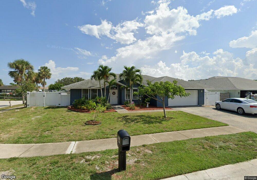
605 Mark and Randy Dr Satellite Beach, FL 32937
Estimated Value: $758,000 - $939,000
3
Beds
2
Baths
2,250
Sq Ft
$368/Sq Ft
Est. Value
About This Home
This home is located at 605 Mark and Randy Dr, Satellite Beach, FL 32937 and is currently estimated at $828,316, approximately $368 per square foot. 605 Mark and Randy Dr is a home located in Brevard County with nearby schools including Spessard L. Holland Elementary School, Satellite Senior High School, and DeLaura Middle School.
Ownership History
Date
Name
Owned For
Owner Type
Purchase Details
Closed on
Oct 31, 2008
Sold by
Hance Michael E and Hance Jayne M
Bought by
Hance Jayne M
Current Estimated Value
Home Financials for this Owner
Home Financials are based on the most recent Mortgage that was taken out on this home.
Original Mortgage
$210,113
Interest Rate
6.01%
Purchase Details
Closed on
Feb 7, 2003
Sold by
Hance Jayne M
Bought by
Giganti Ann Widick
Home Financials for this Owner
Home Financials are based on the most recent Mortgage that was taken out on this home.
Original Mortgage
$176,400
Interest Rate
3.38%
Purchase Details
Closed on
May 28, 1999
Sold by
Giles Donald P and Giles Minerva D
Bought by
Hance Michael E and Hance Jayne M
Home Financials for this Owner
Home Financials are based on the most recent Mortgage that was taken out on this home.
Original Mortgage
$193,200
Interest Rate
6.9%
Create a Home Valuation Report for This Property
The Home Valuation Report is an in-depth analysis detailing your home's value as well as a comparison with similar homes in the area
Home Values in the Area
Average Home Value in this Area
Purchase History
| Date | Buyer | Sale Price | Title Company |
|---|---|---|---|
| Hance Jayne M | -- | Ticor Title | |
| Giganti Ann Widick | $294,000 | State Title Partners Llp | |
| Hance Michael E | $241,500 | -- |
Source: Public Records
Mortgage History
| Date | Status | Borrower | Loan Amount |
|---|---|---|---|
| Previous Owner | Hance Jayne M | $210,113 | |
| Previous Owner | Giganti Ann Widick | $176,400 | |
| Previous Owner | Hance Michael E | $193,200 |
Source: Public Records
Tax History Compared to Growth
Tax History
| Year | Tax Paid | Tax Assessment Tax Assessment Total Assessment is a certain percentage of the fair market value that is determined by local assessors to be the total taxable value of land and additions on the property. | Land | Improvement |
|---|---|---|---|---|
| 2025 | $4,902 | $309,660 | -- | -- |
| 2024 | $4,835 | $300,940 | -- | -- |
| 2023 | $4,835 | $292,180 | $0 | $0 |
| 2022 | $4,626 | $283,670 | $0 | $0 |
| 2021 | $4,793 | $275,410 | $0 | $0 |
| 2020 | $4,784 | $271,610 | $0 | $0 |
| 2019 | $4,763 | $265,510 | $0 | $0 |
| 2018 | $4,776 | $260,560 | $0 | $0 |
| 2017 | $4,548 | $255,210 | $0 | $0 |
| 2016 | $4,571 | $249,970 | $220,000 | $29,970 |
| 2015 | $4,687 | $248,240 | $200,000 | $48,240 |
| 2014 | $4,699 | $246,270 | $175,000 | $71,270 |
Source: Public Records
Map
Nearby Homes
- 11 Barbara Ct
- 53 Emerald Ct
- 660 S Hedgecock Square
- 935 & 937 S Patrick Dr
- 27 Tortuga Trail
- 29 Tortuga Trail
- 31 Tortuga Trail
- 33 Tortuga Trail
- 35 Tortuga Trail
- 37 Tortuga Trail
- 429 S Neptune Dr
- 432 N Neptune Dr
- Pearson End Unit Plan at Tortuga Cay
- Pearson Interior Unit Plan at Tortuga Cay
- 437 N Neptune Dr
- 100 Matthews St
- 695 Jackson Ct
- 867 S Patrick Dr
- 36 Sunset St
- 336 Jupiter Dr
- 615 Mark and Randy Dr
- 43 Arthur Ct
- 17 Barbara Ct
- 39 Arthur Ct
- 625 Mark and Randy Dr
- 35 Arthur Ct
- 31 Arthur Ct Unit 31
- 31 Arthur Ct
- 642 N Hedgecock Square
- 27 Arthur Ct
- 632 N Hedgecock Square
- 14 Barbara Ct
- 23 Arthur Ct
- 652 N Hedgecock Square
- 19 Arthur Ct
- 622 N Hedgecock Square
- 635 Mark and Randy Dr
- 11 Arthur Ct
- 662 N Hedgecock Square
- 44 Adams Ct