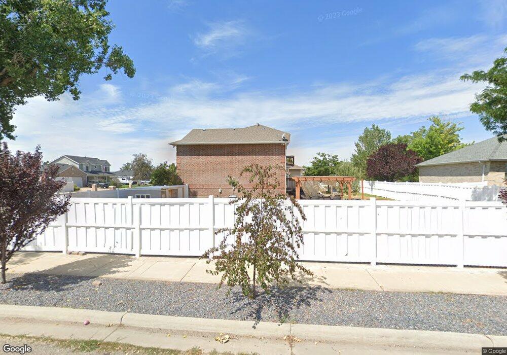
605 N 4000 W West Point, UT 84015
Estimated Value: $606,000 - $680,000
7
Beds
4
Baths
3,986
Sq Ft
$160/Sq Ft
Est. Value
About This Home
This home is located at 605 N 4000 W, West Point, UT 84015 and is currently estimated at $638,270, approximately $160 per square foot. 605 N 4000 W is a home located in Davis County with nearby schools including West Point School, West Point Junior High School, and Syracuse High School.
Ownership History
Date
Name
Owned For
Owner Type
Purchase Details
Closed on
Jun 27, 2023
Sold by
Schulz Rodney and Schulz Kristi Kay
Bought by
Barber Tomas and Barber Jamie
Current Estimated Value
Home Financials for this Owner
Home Financials are based on the most recent Mortgage that was taken out on this home.
Original Mortgage
$450,000
Outstanding Balance
$433,900
Interest Rate
4.75%
Mortgage Type
New Conventional
Estimated Equity
$204,370
Purchase Details
Closed on
Jun 25, 2020
Sold by
Schulz Rodney
Bought by
Schulz Rodney and Schulz Kristi Kay
Purchase Details
Closed on
Oct 21, 2019
Sold by
Schuiz Camille Dawn
Bought by
Schulz Rodney
Home Financials for this Owner
Home Financials are based on the most recent Mortgage that was taken out on this home.
Original Mortgage
$353,250
Interest Rate
3.5%
Mortgage Type
New Conventional
Purchase Details
Closed on
Aug 22, 2012
Sold by
Hunter David W and Hunter Carol P
Bought by
Schulz Rodney
Home Financials for this Owner
Home Financials are based on the most recent Mortgage that was taken out on this home.
Original Mortgage
$287,201
Interest Rate
3.75%
Mortgage Type
FHA
Purchase Details
Closed on
Feb 9, 2010
Sold by
Mccrary David and Mccrary Lori
Bought by
Hunter David W and Hunter Carol P
Home Financials for this Owner
Home Financials are based on the most recent Mortgage that was taken out on this home.
Original Mortgage
$241,789
Interest Rate
5.5%
Mortgage Type
FHA
Purchase Details
Closed on
Jan 13, 2004
Sold by
Espiritu Dale L and Espiritu Marinda K
Bought by
Mccrary David and Mccrary Lori
Home Financials for this Owner
Home Financials are based on the most recent Mortgage that was taken out on this home.
Original Mortgage
$221,000
Interest Rate
6.37%
Mortgage Type
Purchase Money Mortgage
Purchase Details
Closed on
Nov 21, 1997
Sold by
Craythorne Construction Inc
Bought by
Espiritu Dale L and Espiritu Marinda K
Home Financials for this Owner
Home Financials are based on the most recent Mortgage that was taken out on this home.
Original Mortgage
$211,000
Interest Rate
6%
Create a Home Valuation Report for This Property
The Home Valuation Report is an in-depth analysis detailing your home's value as well as a comparison with similar homes in the area
Home Values in the Area
Average Home Value in this Area
Purchase History
| Date | Buyer | Sale Price | Title Company |
|---|---|---|---|
| Barber Tomas | -- | Cottonwood Title | |
| Barber Tomas | -- | Cottonwood Title | |
| Schulz Rodney | -- | Cottonwood Title Ins | |
| Schulz Rodney | -- | Cottonwood Title Ins | |
| Schulz Rodney | -- | Bonneville Superior Ti | |
| Hunter David W | -- | Executive Title Ins Agen | |
| Mccrary David | -- | Bonneville Title Company Inc | |
| Espiritu Dale L | -- | Bonneville Title Company Inc |
Source: Public Records
Mortgage History
| Date | Status | Borrower | Loan Amount |
|---|---|---|---|
| Open | Barber Tomas | $450,000 | |
| Closed | Barber Tomas | $450,000 | |
| Previous Owner | Schulz Rodney | $353,250 | |
| Previous Owner | Schulz Rodney | $287,201 | |
| Previous Owner | Hunter David W | $241,789 | |
| Previous Owner | Mccrary David | $221,000 | |
| Previous Owner | Espiritu Dale L | $211,000 | |
| Closed | Mccrary David | $55,250 |
Source: Public Records
Tax History Compared to Growth
Tax History
| Year | Tax Paid | Tax Assessment Tax Assessment Total Assessment is a certain percentage of the fair market value that is determined by local assessors to be the total taxable value of land and additions on the property. | Land | Improvement |
|---|---|---|---|---|
| 2025 | $3,815 | $357,500 | $117,068 | $240,432 |
| 2024 | $3,518 | $331,100 | $105,343 | $225,757 |
| 2023 | $3,459 | $599,000 | $134,501 | $464,499 |
| 2022 | $3,766 | $356,950 | $70,870 | $286,080 |
| 2021 | $3,597 | $510,000 | $107,250 | $402,750 |
| 2020 | $3,030 | $424,000 | $90,726 | $333,274 |
| 2019 | $3,008 | $415,000 | $87,835 | $327,165 |
| 2018 | $2,838 | $386,000 | $86,468 | $299,532 |
| 2016 | $2,639 | $188,815 | $33,516 | $155,299 |
| 2015 | $2,498 | $169,345 | $33,516 | $135,829 |
| 2014 | $2,236 | $153,741 | $33,516 | $120,225 |
| 2013 | -- | $138,153 | $37,363 | $100,790 |
Source: Public Records
Map
Nearby Homes
- 357 N 4000 W
- 3932 W 825 N Unit WF5
- 3918 W 825 N Unit WF6
- Charleston Plan at Bluff View
- 4352 W 300 N
- 4469 W 1000 N Unit 120
- 114 3830 W
- 4366 W 200 N
- 120 N 4325 W
- 477 N 4500 W
- 4362 West St Unit 106
- 4358 West St Unit 105
- 399 N 3425 W
- 4325 W 75 N
- 9 S 3830 W Unit 441
- 27 S 3830 W Unit 437
- 28 S 3830 W Unit 424
- 3851 W 50 S Unit 425
- 3847 W 50 S Unit 428
- 3849 W 50 S Unit 426