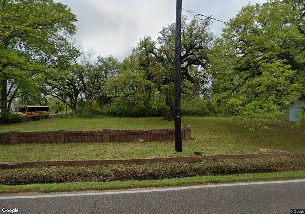
605 N Cherry St Hammond, LA 70401
Estimated Value: $118,000
Studio
--
Bath
30,000
Sq Ft
$4/Sq Ft
Est. Value
About This Home
This home is located at 605 N Cherry St, Hammond, LA 70401 and is currently estimated at $118,000, approximately $3 per square foot. 605 N Cherry St is a home located in Tangipahoa Parish with nearby schools including Woodland Park Magnet, Greenville Park Leadership Academy, and Hammond High Magnet School.
Ownership History
Date
Name
Owned For
Owner Type
Purchase Details
Closed on
Oct 25, 2018
Sold by
Cesire Joseph F
Bought by
Porters Trees Tg Llc
Current Estimated Value
Purchase Details
Closed on
May 16, 2007
Sold by
Weber Richard and Weber Gayle
Bought by
Porter James
Purchase Details
Closed on
Jun 7, 2006
Sold by
Freeman Ramsey
Bought by
Weber Gayle and Weber Richard
Purchase Details
Closed on
Jul 15, 2005
Sold by
Ramsey Freeman
Bought by
Ramsey Freeman
Purchase Details
Closed on
May 11, 2005
Sold by
Ramsey Freeman
Bought by
Ramsey Freeman
Create a Home Valuation Report for This Property
The Home Valuation Report is an in-depth analysis detailing your home's value as well as a comparison with similar homes in the area
Home Values in the Area
Average Home Value in this Area
Purchase History
| Date | Buyer | Sale Price | Title Company |
|---|---|---|---|
| Porters Trees Tg Llc | $2,300 | -- | |
| Porter James | $258 | None Available | |
| Weber Gayle | $250 | None Available | |
| Ramsey Freeman | -- | None Available | |
| Ramsey Freeman | -- | None Available |
Source: Public Records
Tax History
| Year | Tax Paid | Tax Assessment Tax Assessment Total Assessment is a certain percentage of the fair market value that is determined by local assessors to be the total taxable value of land and additions on the property. | Land | Improvement |
|---|---|---|---|---|
| 2024 | $250 | $3,024 | $3,024 | $0 |
| 2023 | $234 | $2,800 | $2,800 | $0 |
| 2022 | $234 | $2,800 | $2,800 | $0 |
| 2021 | $299 | $2,800 | $2,800 | $0 |
| 2020 | $293 | $2,800 | $2,800 | $0 |
| 2019 | $292 | $2,800 | $2,800 | $0 |
| 2018 | $293 | $2,800 | $2,800 | $0 |
| 2017 | $723 | $6,907 | $2,800 | $4,107 |
| 2016 | $821 | $7,845 | $2,800 | $5,045 |
| 2015 | $657 | $7,845 | $2,800 | $5,045 |
| 2014 | $625 | $7,845 | $2,800 | $5,045 |
Source: Public Records
Map
Nearby Homes
- 404 E Colorado St
- 1301 N Holly St
- 412 E Michigan St
- 500 E Church St
- 312 N Oak St
- 1010-12 Martin Luther King Ave
- 101 E David Dr
- 1102 N Cherry St
- 1100 N Oak St
- 1304 N Cherry St
- 9.88 acres U S Highway 190
- 17458 Highway 190
- 2025 Highway 190
- 10452 Highway 190
- 44476 E Thomas St
- 600 E Hanson Ave
- 401 S Cypress St
- 1005 E Thomas St
- 1004 S Magnolia St
- 301 E Michigan St
- 303 E Michigan St
- 205 E Michigan St
- 201 E Michigan St
- 307 E Michigan St
- 305 E Colorado St
- 210 E Michigan St
- 200 E Michigan St
- 204 E Michigan St
- 311 E Michigan St
- 306 E Michigan St
- 309 E Colorado St
- 405 E Colorado St
- 409 E Colorado St
- 44524 & 44520 Tiffany Lynn Ct
- 710 N Cherry St
- 604 N Holly St
- 400 E Colorado St
- 503 N Cherry St
- 505 N Holly St Unit B
