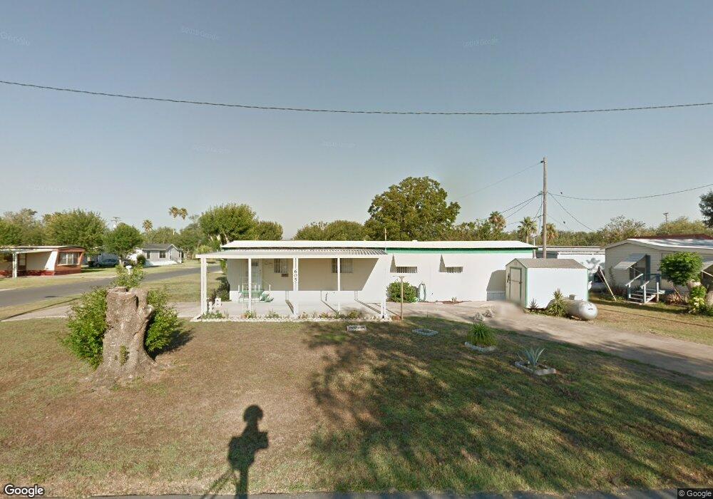
605 N Hisbiscus Dr La Feria, TX 78559
Estimated Value: $66,000 - $97,000
2
Beds
1
Bath
784
Sq Ft
$98/Sq Ft
Est. Value
About This Home
This home is located at 605 N Hisbiscus Dr, La Feria, TX 78559 and is currently estimated at $77,141, approximately $98 per square foot. 605 N Hisbiscus Dr is a home with nearby schools including C.E. Vail Elementary School, Sam Houston Elementary School, and David G. Sanchez Elementary School.
Ownership History
Date
Name
Owned For
Owner Type
Purchase Details
Closed on
Feb 22, 2021
Sold by
Masten Samuel E and Masten Julia L
Bought by
Salazar Eusebio M and Salazar Estella P
Current Estimated Value
Purchase Details
Closed on
Mar 25, 2015
Sold by
Gardner Richard and Gardner Sharon
Bought by
Masten Sammy E and Masten Julia L
Purchase Details
Closed on
Nov 23, 2009
Sold by
Rockvam Ruth Elaine
Bought by
Gardner Richard and Gardner Sharon
Purchase Details
Closed on
Jan 16, 2003
Sold by
Braun Victor W and Braun Rose M
Bought by
Rockvam Donald George and Rockvam Ruth Elaine
Purchase Details
Closed on
Apr 5, 2002
Sold by
Cook Marvin and Cook Mary
Bought by
Davis John E and Davis Linda D
Create a Home Valuation Report for This Property
The Home Valuation Report is an in-depth analysis detailing your home's value as well as a comparison with similar homes in the area
Home Values in the Area
Average Home Value in this Area
Purchase History
| Date | Buyer | Sale Price | Title Company |
|---|---|---|---|
| Salazar Eusebio M | -- | None Available | |
| Salazar Eusebio M | -- | None Available | |
| Masten Sammy E | -- | Edwards Abstract | |
| Gardner Richard | -- | None Available | |
| Rockvam Donald George | -- | -- | |
| Davis John E | -- | Cameron County Title |
Source: Public Records
Tax History Compared to Growth
Tax History
| Year | Tax Paid | Tax Assessment Tax Assessment Total Assessment is a certain percentage of the fair market value that is determined by local assessors to be the total taxable value of land and additions on the property. | Land | Improvement |
|---|---|---|---|---|
| 2025 | $746 | $57,641 | $30,569 | $27,072 |
| 2024 | $746 | $49,375 | -- | -- |
| 2023 | $971 | $41,146 | $19,003 | $22,143 |
| 2022 | $693 | $29,153 | $13,219 | $15,934 |
| 2021 | $721 | $29,359 | $13,219 | $16,140 |
| 2020 | $734 | $29,359 | $13,219 | $16,140 |
| 2019 | $741 | $29,359 | $13,219 | $16,140 |
| 2018 | $740 | $29,359 | $13,219 | $16,140 |
| 2017 | $739 | $29,359 | $13,219 | $16,140 |
| 2016 | $739 | $29,359 | $13,219 | $16,140 |
| 2015 | $325 | $13,219 | $13,219 | $0 |
| 2014 | $325 | $13,219 | $0 | $0 |
Source: Public Records
Map
Nearby Homes
- 719 Cactus Ln
- 805 Anaqua St
- 720 N Retama St
- 708 E Palmera Dr Unit 21
- 801 Milania Dr
- 600 E Palmera Dr
- 704 E Palmera Dr Unit Lots 22 and 23
- 704 E Palmera Dr Unit 20,21, 22 & 23
- 712 E Palmera Dr Unit 20
- 11070 Memorial Dr
- 137 2nd St Unit 86367 / 86368
- 718 Ava Dr
- 00 Rabb Rd
- 0000 W Expressway 83
- 408 W 6th St
- 29.3 AC Solis Rd
- 29.3 Old Solis Rd
- 414 W 6th St
- 0 U S 83 Business Unit 29741348
- 150 6th St
- 605 Hibiscus Unit 35
- Lot 34 Milania Dr
- Lot 34 Milania Dr Unit 34
- 613 Hibiscus
- 1209 Colgate Ln
- 1209 Colgate Ln
- 1212 S Palmera Dr
- 608 N Hibiscus
- 601 N Hibiscus
- 1201 S Palmera Dr
- Lot # 26 Milania Dr Unit Lot 26
- 612 Hibiscus
- 1209 S Palmera Dr
- 1213 Colgate Ln
- 1205 S Palmera Dr
- 1125 S Palmera Dr
- 1125 S Palmera Dr Unit 24
- 612 N Hibiscus
- 1121 S Palmera Dr
- 1217 Colgate Ave