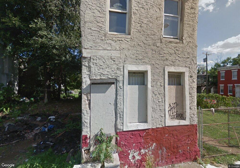
605 N Hutton St Philadelphia, PA 19104
Haverford North NeighborhoodEstimated Value: $122,000 - $162,000
3
Beds
1
Bath
1,004
Sq Ft
$135/Sq Ft
Est. Value
About This Home
This home is located at 605 N Hutton St, Philadelphia, PA 19104 and is currently estimated at $135,226, approximately $134 per square foot. 605 N Hutton St is a home located in Philadelphia County with nearby schools including Alain Locke School, West Philadelphia High School, and Belmont Charter Elementary School.
Ownership History
Date
Name
Owned For
Owner Type
Purchase Details
Closed on
Nov 3, 2017
Sold by
Brown Steven K and Phillips Shannon T
Bought by
Yinyx Llc
Current Estimated Value
Purchase Details
Closed on
Oct 26, 2015
Sold by
Phillips Rose M
Bought by
Brown Steven K and Phillips Shannon T
Purchase Details
Closed on
Mar 30, 1990
Bought by
Brown Rose M
Create a Home Valuation Report for This Property
The Home Valuation Report is an in-depth analysis detailing your home's value as well as a comparison with similar homes in the area
Home Values in the Area
Average Home Value in this Area
Purchase History
| Date | Buyer | Sale Price | Title Company |
|---|---|---|---|
| Yinyx Llc | $38,700 | Transfer Real Estate Intelli | |
| Brown Steven K | -- | None Available | |
| Brown Rose M | -- | -- |
Source: Public Records
Tax History Compared to Growth
Tax History
| Year | Tax Paid | Tax Assessment Tax Assessment Total Assessment is a certain percentage of the fair market value that is determined by local assessors to be the total taxable value of land and additions on the property. | Land | Improvement |
|---|---|---|---|---|
| 2026 | $508 | $61,900 | $12,380 | $49,520 |
| 2025 | $508 | $61,900 | $12,380 | $49,520 |
| 2024 | $508 | $61,900 | $12,380 | $49,520 |
| 2023 | $508 | $36,300 | $7,260 | $29,040 |
| 2022 | $248 | $36,300 | $7,260 | $29,040 |
| 2021 | $248 | $0 | $0 | $0 |
| 2020 | $248 | $0 | $0 | $0 |
| 2019 | $239 | $0 | $0 | $0 |
| 2018 | $234 | $0 | $0 | $0 |
| 2017 | $234 | $0 | $0 | $0 |
| 2016 | $234 | $0 | $0 | $0 |
| 2015 | $268 | $0 | $0 | $0 |
| 2014 | -- | $20,000 | $3,825 | $16,175 |
| 2012 | -- | $1,824 | $260 | $1,564 |
Source: Public Records
Map
Nearby Homes
- 629 N Hutton St
- 617 N Hutton St
- 638 Hutton St
- 627 Hutton St
- 619 Hutton St
- 636 Hutton St
- 4220 Wallace St
- 4234 Aspen St
- 4310 Wallace St
- 4130 42 Aspen St
- 4207 Aspen St
- 4231 Haverford Ave
- 661 Brooklyn St
- 644 Brooklyn St
- 770 Brooklyn St
- 4303 Haverford Ave
- 4207 Lancaster Ave
- 737 N 42nd St
- 1719 N 42nd St
- 731 N 42nd St
- 601 Hutton St
- 603 N Hutton St
- 609 N Hutton St
- 611 N Hutton St
- 4228 Wallace St
- 4236 Wallace St
- 640 N Brooklyn St
- 650 N Brooklyn St
- 4230 Wallace St
- 4232 Wallace St
- 4234 Wallace St
- 652 N Brooklyn St
- 652 N Brooklyn St Unit 3
- 638 N Brooklyn St
- 636 N Brooklyn St
- 654 N Brooklyn St
- 634 N Brooklyn St
- 656 N Brooklyn St
- 656 N Brooklyn St Unit 1ST FL & G
- 656 N Brooklyn St Unit 2ND & 3RD FLOORS