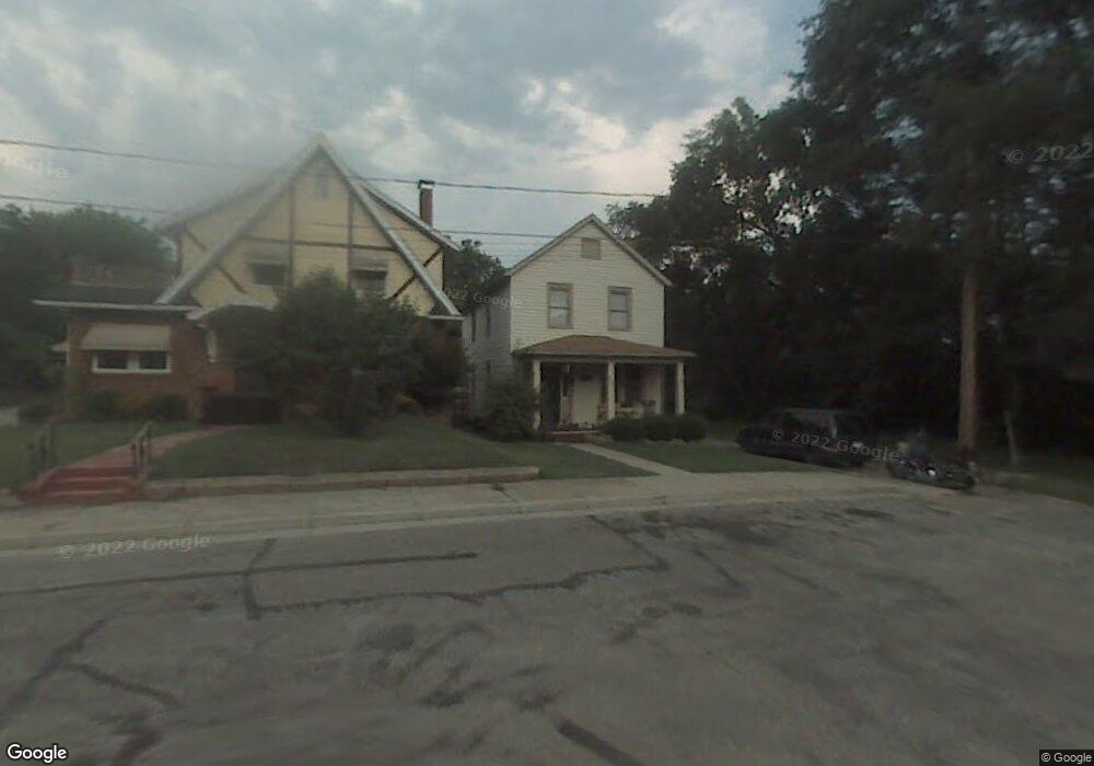
605 N Light St Springfield, OH 45504
Estimated Value: $84,000 - $131,000
3
Beds
2
Baths
1,360
Sq Ft
$79/Sq Ft
Est. Value
About This Home
This home is located at 605 N Light St, Springfield, OH 45504 and is currently estimated at $106,875, approximately $78 per square foot. 605 N Light St is a home located in Clark County with nearby schools including Snyder Park Elementary School, Roosevelt Middle School, and Springfield High School.
Ownership History
Date
Name
Owned For
Owner Type
Purchase Details
Closed on
Oct 3, 2014
Sold by
Federal Home Loan Mortgage Corporation
Bought by
Jones Judith A
Current Estimated Value
Purchase Details
Closed on
Aug 20, 2014
Sold by
Sparks Roger L
Bought by
Federal Home Loan Mortgage Corporation
Purchase Details
Closed on
Jun 24, 1996
Sold by
Shaffer Howard E
Bought by
Sparks Roger L and Sparks Penny
Home Financials for this Owner
Home Financials are based on the most recent Mortgage that was taken out on this home.
Original Mortgage
$40,000
Interest Rate
8.29%
Mortgage Type
New Conventional
Create a Home Valuation Report for This Property
The Home Valuation Report is an in-depth analysis detailing your home's value as well as a comparison with similar homes in the area
Home Values in the Area
Average Home Value in this Area
Purchase History
| Date | Buyer | Sale Price | Title Company |
|---|---|---|---|
| Jones Judith A | -- | Partners Land Title Agency | |
| Federal Home Loan Mortgage Corporation | $23,334 | Attorney | |
| Sparks Roger L | $22,000 | -- |
Source: Public Records
Mortgage History
| Date | Status | Borrower | Loan Amount |
|---|---|---|---|
| Previous Owner | Sparks Roger L | $40,000 |
Source: Public Records
Tax History Compared to Growth
Tax History
| Year | Tax Paid | Tax Assessment Tax Assessment Total Assessment is a certain percentage of the fair market value that is determined by local assessors to be the total taxable value of land and additions on the property. | Land | Improvement |
|---|---|---|---|---|
| 2024 | $1,208 | $15,210 | $2,810 | $12,400 |
| 2023 | $773 | $15,210 | $2,810 | $12,400 |
| 2022 | $404 | $15,210 | $2,810 | $12,400 |
| 2021 | $691 | $12,580 | $2,330 | $10,250 |
| 2020 | $693 | $12,580 | $2,330 | $10,250 |
| 2019 | $695 | $12,580 | $2,330 | $10,250 |
| 2018 | $751 | $13,060 | $2,740 | $10,320 |
| 2017 | $751 | $13,055 | $2,737 | $10,318 |
| 2016 | $752 | $13,055 | $2,737 | $10,318 |
| 2015 | $395 | $13,850 | $2,737 | $11,113 |
| 2014 | $393 | $13,850 | $2,737 | $11,113 |
| 2013 | $779 | $13,850 | $2,737 | $11,113 |
Source: Public Records
Map
Nearby Homes
- 423 N Jackson St Unit 425
- 222 N Race St Unit 224
- 522 W North St Unit 524
- 101`103 N Western
- 366 N Isabella St
- 1009 N Lowry Ave
- 120 E Ward St
- 0 S Plum St
- 1120 W High St
- 1009 W High St
- 1015 Hillcrest Ave
- 1222 Beverly Ave
- 629 Snowhill Blvd
- 20 N Center St
- 1205 W High St
- 29 E Ward St
- 25 Mill Run Place
- 33-35 E Ward St
- 681 W Jefferson St Unit 683
- 624 Snowhill Blvd
- 601 N Light St
- 609 N Light St
- 714 Rubsam St
- 613 N Light St
- 535 N Light St Unit 537
- 718 Rubsam St Unit 720
- 527 N Light St
- 722 Rubsam St Unit 724
- 538 N Light St
- 640 Rubsam St
- 525 N Light St
- 534 N Light St
- 726 Rubsam St Unit 728
- 528 N Light St
- 634 Rubsam St
- 519 N Light St Unit 521
- 721 Rubsam St
- 730 Rubsam St Unit 732
- 730-732 Rubsam St
- 526 N Light St