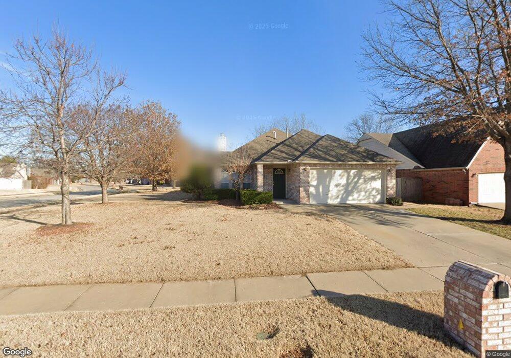
605 N Nyssa Ave Broken Arrow, OK 74012
Country Aire Estates NeighborhoodEstimated Value: $240,493 - $294,000
3
Beds
2
Baths
1,764
Sq Ft
$154/Sq Ft
Est. Value
About This Home
This home is located at 605 N Nyssa Ave, Broken Arrow, OK 74012 and is currently estimated at $271,123, approximately $153 per square foot. 605 N Nyssa Ave is a home located in Tulsa County with nearby schools including Peters Elementary School, Union 8th Grade Center, and Union 6th-7th Grade Center.
Ownership History
Date
Name
Owned For
Owner Type
Purchase Details
Closed on
Mar 1, 2006
Sold by
Staggs Rhonda and Staggs Roy
Bought by
Patton John M and Patton Deborah A
Current Estimated Value
Home Financials for this Owner
Home Financials are based on the most recent Mortgage that was taken out on this home.
Original Mortgage
$147,000
Outstanding Balance
$82,488
Interest Rate
6.05%
Mortgage Type
VA
Estimated Equity
$188,635
Purchase Details
Closed on
Jun 1, 1995
Purchase Details
Closed on
Mar 1, 1995
Create a Home Valuation Report for This Property
The Home Valuation Report is an in-depth analysis detailing your home's value as well as a comparison with similar homes in the area
Home Values in the Area
Average Home Value in this Area
Purchase History
| Date | Buyer | Sale Price | Title Company |
|---|---|---|---|
| Patton John M | $147,000 | None Available | |
| -- | $105,000 | -- | |
| -- | $24,000 | -- |
Source: Public Records
Mortgage History
| Date | Status | Borrower | Loan Amount |
|---|---|---|---|
| Open | Patton John M | $147,000 |
Source: Public Records
Tax History Compared to Growth
Tax History
| Year | Tax Paid | Tax Assessment Tax Assessment Total Assessment is a certain percentage of the fair market value that is determined by local assessors to be the total taxable value of land and additions on the property. | Land | Improvement |
|---|---|---|---|---|
| 2024 | $2,129 | $16,498 | $2,460 | $14,038 |
| 2023 | $2,129 | $17,498 | $2,543 | $14,955 |
| 2022 | $2,147 | $16,497 | $2,987 | $13,510 |
| 2021 | $2,154 | $16,497 | $2,987 | $13,510 |
| 2020 | $2,168 | $16,498 | $3,367 | $13,131 |
| 2019 | $2,165 | $16,498 | $3,367 | $13,131 |
| 2018 | $2,158 | $16,498 | $3,367 | $13,131 |
| 2017 | $2,187 | $17,498 | $3,571 | $13,927 |
| 2016 | $2,091 | $16,988 | $3,467 | $13,521 |
| 2015 | $2,028 | $16,493 | $3,366 | $13,127 |
| 2014 | $2,016 | $16,493 | $3,366 | $13,127 |
Source: Public Records
Map
Nearby Homes
- 409 N Palm Ave
- 3309 W Freeport St
- 208 N Nyssa Ave
- 3408 W College St
- 705 N Indianwood Ave
- 701 N Indianwood Ave
- 4201 W Detroit St
- 3108 W Norman Cir
- 3033 W Oakland St
- 3200 W Lansing St
- 3812 W El Paso St
- 2909 W Oakland St
- 2509 W Iola St
- 1313 N Hemlock Ave
- 507 S Redwood Ave
- 2605 W Detroit St
- 708 N Aster Ave
- 2604 W Broadway St
- 2640 W Dallas St
- 3902 W Kenosha St
- 601 N Nyssa Ave
- 3413 W Hartford St
- 505 N Nyssa Ave
- 701 N Nyssa Ave
- 3409 W Hartford St
- 604 N Nyssa Ave
- 608 N Nyssa Ave
- 3408 W Freeport St
- 600 N Nyssa Ave
- 3404 W Freeport St
- 700 N Nyssa Ave
- 705 N Nyssa Ave
- 508 N Nyssa Ave
- 501 N Nyssa Ave
- 3405 W Hartford St
- 700 N Magnolia Ave
- 3400 W Freeport St
- 504 N Nyssa Ave
- 709 N Nyssa Ave
- 3332 W Freeport St
