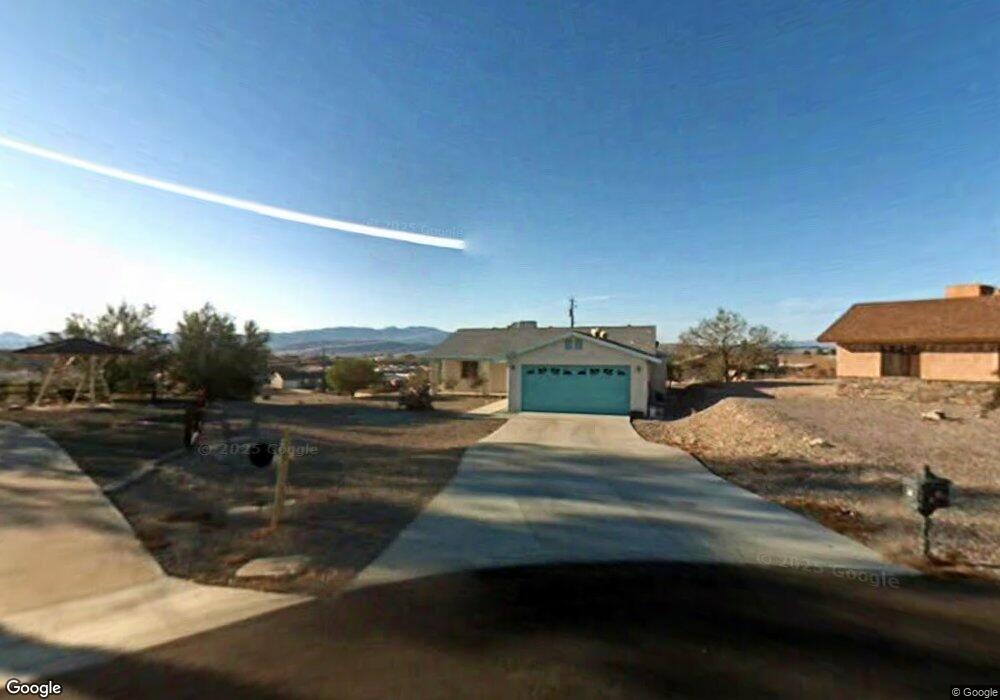
605 Roamer Ln Lake Havasu City, AZ 86403
Estimated Value: $441,000 - $486,000
2
Beds
1
Bath
1,354
Sq Ft
$337/Sq Ft
Est. Value
About This Home
This home is located at 605 Roamer Ln, Lake Havasu City, AZ 86403 and is currently estimated at $456,076, approximately $336 per square foot. 605 Roamer Ln is a home located in Mohave County with nearby schools including Smoketree Elementary School, Thunderbolt Middle School, and Lake Havasu High School.
Ownership History
Date
Name
Owned For
Owner Type
Purchase Details
Closed on
Jul 7, 2022
Sold by
Eric Eisenacher Donald and Lee Laura
Bought by
Eisenacher Living Trust
Current Estimated Value
Purchase Details
Closed on
Aug 5, 2008
Sold by
Mclearn Gary G and Mclearn Sharon R
Bought by
Eisenacher Donald Eric and Eisenacher Laura Lee
Home Financials for this Owner
Home Financials are based on the most recent Mortgage that was taken out on this home.
Original Mortgage
$106,200
Interest Rate
6.59%
Mortgage Type
New Conventional
Create a Home Valuation Report for This Property
The Home Valuation Report is an in-depth analysis detailing your home's value as well as a comparison with similar homes in the area
Home Values in the Area
Average Home Value in this Area
Purchase History
| Date | Buyer | Sale Price | Title Company |
|---|---|---|---|
| Eisenacher Living Trust | -- | Rahnema Law Pllc | |
| Eisenacher Donald Eric | $118,000 | Transnation Title Ins Co |
Source: Public Records
Mortgage History
| Date | Status | Borrower | Loan Amount |
|---|---|---|---|
| Previous Owner | Eisenacher Donald Eric | $106,200 |
Source: Public Records
Tax History Compared to Growth
Tax History
| Year | Tax Paid | Tax Assessment Tax Assessment Total Assessment is a certain percentage of the fair market value that is determined by local assessors to be the total taxable value of land and additions on the property. | Land | Improvement |
|---|---|---|---|---|
| 2026 | $626 | -- | -- | -- |
| 2025 | $1,268 | $37,912 | $0 | $0 |
| 2024 | $1,268 | $40,868 | $0 | $0 |
| 2023 | $1,268 | $34,609 | $0 | $0 |
| 2022 | $1,221 | $24,593 | $0 | $0 |
| 2021 | $1,410 | $23,456 | $0 | $0 |
| 2019 | $1,341 | $19,334 | $0 | $0 |
| 2018 | $1,297 | $17,660 | $0 | $0 |
| 2017 | $1,275 | $16,838 | $0 | $0 |
| 2016 | $1,070 | $13,859 | $0 | $0 |
| 2015 | $1,043 | $12,342 | $0 | $0 |
Source: Public Records
Map
Nearby Homes
- 640 Acoma Blvd N
- 2200 Clarke Dr
- 1986 Bahama Ave
- 583 Robin Ln
- 2021 Industrial
- 1960 Pirate Ln
- 1790 Rainbow Ave S
- 2301 Sahara Dr
- 532 Acoma Blvd N
- 2100 Chaparral Dr
- 675 Knobhill Ln
- 2090 San Juan Dr
- 2311 Rainbow Ave N
- 2320 Tigertail Dr
- 320 Chipeta Ln
- 2349 Clarke Dr
- 2030 Commander Dr
- 1911 Holly Ave
- 1901 Holly Ave
- 1541 Holly Ave
- 611 Roamer Ln
- 626 Riverboat Dr
- 610 Roamer Ln
- 2087 Rainbow Ave N
- 622 Riverboat Dr
- 630 Riverboat Dr
- 2095 Rainbow Ave N
- 2079 Rainbow Ave N
- 2087 Rainbow Ave N
- 614 Roamer Ln
- 2103 Rainbow Ave N
- 634 Riverboat Dr
- 2071 Rainbow Ave N
- 618 Riverboat Dr
- 618 Roamer Ln
- 623 Roamer Ln
- 621 Acoma Blvd N
- 2063 Rainbow Ave N
- 638 Riverboat Dr
- 621 Riverboat Dr