Estimated Value: $243,000 - $370,000
3
Beds
3
Baths
1,408
Sq Ft
$216/Sq Ft
Est. Value
About This Home
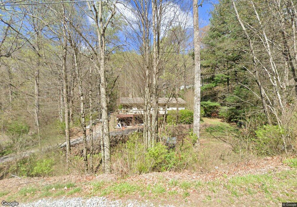
This home is located at 605 Rufus Robinson Rd, Sylva, NC 28779 and is currently estimated at $303,646, approximately $215 per square foot. 605 Rufus Robinson Rd is a home located in Jackson County with nearby schools including Smokey Mountain Elementary School and Smoky Mountain High School.
Ownership History
Date
Name
Owned For
Owner Type
Purchase Details
Closed on
Apr 6, 2023
Sold by
Schaad Laurens F and Schaad Lilliam Maria
Bought by
Schaad Nichole and Phillips Daniel
Current Estimated Value
Home Financials for this Owner
Home Financials are based on the most recent Mortgage that was taken out on this home.
Original Mortgage
$182,000
Outstanding Balance
$176,259
Interest Rate
5.9%
Mortgage Type
New Conventional
Estimated Equity
$127,387
Create a Home Valuation Report for This Property
The Home Valuation Report is an in-depth analysis detailing your home's value as well as a comparison with similar homes in the area
Home Values in the Area
Average Home Value in this Area
Purchase History
| Date | Buyer | Sale Price | Title Company |
|---|---|---|---|
| Schaad Nichole | $360 | None Listed On Document |
Source: Public Records
Mortgage History
| Date | Status | Borrower | Loan Amount |
|---|---|---|---|
| Open | Schaad Nichole | $182,000 |
Source: Public Records
Tax History
| Year | Tax Paid | Tax Assessment Tax Assessment Total Assessment is a certain percentage of the fair market value that is determined by local assessors to be the total taxable value of land and additions on the property. | Land | Improvement |
|---|---|---|---|---|
| 2025 | $948 | $249,409 | $44,200 | $205,209 |
| 2024 | $760 | $199,890 | $68,460 | $131,430 |
| 2023 | $885 | $199,890 | $68,460 | $131,430 |
| 2022 | $885 | $199,890 | $68,460 | $131,430 |
| 2021 | $760 | $199,890 | $68,460 | $131,430 |
| 2020 | $795 | $187,020 | $58,460 | $128,560 |
| 2019 | $795 | $187,020 | $58,460 | $128,560 |
| 2018 | $795 | $187,020 | $58,460 | $128,560 |
| 2017 | $776 | $187,020 | $58,460 | $128,560 |
| 2015 | $689 | $187,020 | $58,460 | $128,560 |
| 2011 | -- | $216,210 | $80,880 | $135,330 |
Source: Public Records
Map
Nearby Homes
- Lot B Bart Cove Rd
- Lot A Bart Cove Rd
- 1186 Thornhill Dr
- 1391 Still Branch Rd
- Lot #46 Hazel Hollow Dr
- 6 Deep Spring Rd
- 7 Deep Spring Rd
- 5 Deep Spring Rd
- 9 Deep Spring Rd
- 8 Deep Spring Rd
- 00 Long Branch Creek Rd
- 84 Ahoya Trail
- 708 Thornhill Dr
- 00 Jarrett Hills Rd
- 34 Coosa Ridge Dr
- 189 Crocus Ln
- 241 Crocus Ln
- 74 & 78 Hill St
- 824 Dillsboro Rd
- 365 Duckback Trail
- 29 Princess Tree Rd
- 597 Rufus Robinson Rd
- 16 Princess Tree Rd
- 561 Rufus Robinson Rd
- 0 Princess Tree Rd
- 48 Soap Stone Rd
- 724 Rufus Robinson Rd
- 1386 Rufus Robinson Rd
- Lot2B Rufus Robinson Rd
- 785 Rufus Robinson Rd
- 20 Royal Fern Dr
- 18 Royal Fern Dr
- 40 Royal Fern Rd
- 40 Royal Fern Dr
- 40 Royal Fern Dr
- 625 Deep Gap Rd
- 53 Royal Fern Dr
- 687 Deep Gap Rd
- Lot 55 Still Branch Rd
- 46 Still Branch Rd
Your Personal Tour Guide
Ask me questions while you tour the home.