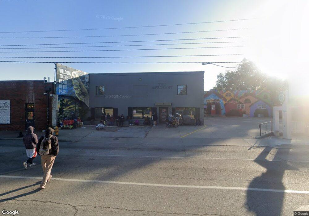
605 S Peoria Ave Tulsa, OK 74120
Forest Orchard NeighborhoodEstimated Value: $326,412
--
Bed
--
Bath
7,000
Sq Ft
$47/Sq Ft
Est. Value
About This Home
This home is located at 605 S Peoria Ave, Tulsa, OK 74120 and is currently estimated at $326,412, approximately $46 per square foot. 605 S Peoria Ave is a home located in Tulsa County with nearby schools including Kendall-Whittier Elementary School, Hale Middle School, and Nathan Hale High School.
Ownership History
Date
Name
Owned For
Owner Type
Purchase Details
Closed on
Dec 21, 2007
Sold by
Harrison Ronald L
Bought by
Good Day Properties Llc
Current Estimated Value
Purchase Details
Closed on
Jan 15, 1999
Sold by
Kopp Melisande and Rogers Frank A
Bought by
Harrison Ronald L
Purchase Details
Closed on
Jan 7, 1998
Sold by
Kopp Walter H
Bought by
Harrison Ronald L
Purchase Details
Closed on
Feb 19, 1997
Sold by
Kopp Mildred Ann
Bought by
Harrison Ronald L
Create a Home Valuation Report for This Property
The Home Valuation Report is an in-depth analysis detailing your home's value as well as a comparison with similar homes in the area
Home Values in the Area
Average Home Value in this Area
Purchase History
| Date | Buyer | Sale Price | Title Company |
|---|---|---|---|
| Good Day Properties Llc | $150,000 | Commercial Title & Escrow Se | |
| Harrison Ronald L | -- | -- | |
| Harrison Ronald L | -- | -- | |
| Harrison Ronald L | $6,500 | -- |
Source: Public Records
Tax History Compared to Growth
Tax History
| Year | Tax Paid | Tax Assessment Tax Assessment Total Assessment is a certain percentage of the fair market value that is determined by local assessors to be the total taxable value of land and additions on the property. | Land | Improvement |
|---|---|---|---|---|
| 2025 | $2,687 | $20,053 | $5,368 | $14,685 |
| 2024 | $2,545 | $20,053 | $5,368 | $14,685 |
| 2023 | $2,545 | $20,053 | $5,368 | $14,685 |
| 2022 | $2,673 | $20,053 | $5,368 | $14,685 |
| 2021 | $2,648 | $20,053 | $5,368 | $14,685 |
| 2020 | $2,612 | $20,053 | $5,368 | $14,685 |
| 2019 | $2,748 | $20,053 | $5,368 | $14,685 |
| 2018 | $2,754 | $20,053 | $5,368 | $14,685 |
| 2017 | $2,618 | $19,101 | $5,113 | $13,988 |
| 2016 | $2,442 | $18,192 | $4,540 | $13,651 |
| 2015 | $2,330 | $20,053 | $5,005 | $15,048 |
| 2014 | $2,198 | $16,500 | $5,005 | $11,495 |
Source: Public Records
Map
Nearby Homes
- 711 S Norfolk Ave
- 1049 E 8th St
- 1011 S Rockford Ave
- 818 S Troost Ave
- 1633 E 4th St
- 1215 S Quincy Ave
- 1225 S Owasso Ave
- 1535 E 2nd St S
- 410 W 7th St Unit 1824
- 410 W 7th St Unit 2026
- 410 W 7th St Unit 1622
- 410 W 7th St Unit 324
- 410 W 7th St Unit 1230
- 410 W 7th St Unit 1823
- 410 W 7th St Unit 923
- 410 W 7th St Unit 727
- 410 W 7th St Unit 1921
- 410 W 7th St Unit 1928
- 410 W 7th St Unit 421
- 410 W 7th St Unit 1722
- 605 south N Peoria St
- 609 S Peoria Ave
- 611 S Peoria Ave
- 606 S Quaker Ave
- 623 S Peoria Ave
- 610 S Quaker Ave
- 1311 E 6th St
- 602 S Quaker Ave
- 620 S Quaker Ave
- 1323 E 6th St
- 624 S Quaker Ave
- 628 S Quaker Ave
- 607 S Quaker Ave
- 631 S Peoria Ave
- 632 S Quaker Ave
- 634 S Quaker Ave
- 1345&1349 E 6th St
- 1631 E 6th St
- 1627-1631 E 6th St
- 624 S Peoria Ave