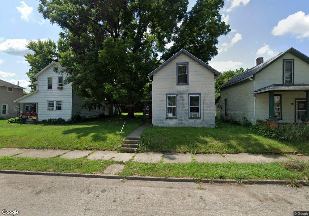
605 Sherman Ave Springfield, OH 45503
Estimated Value: $49,000 - $128,000
3
Beds
1
Bath
1,026
Sq Ft
$78/Sq Ft
Est. Value
About This Home
This home is located at 605 Sherman Ave, Springfield, OH 45503 and is currently estimated at $79,615, approximately $77 per square foot. 605 Sherman Ave is a home located in Clark County with nearby schools including Lagonda Elementary School, Roosevelt Middle School, and Springfield High School.
Ownership History
Date
Name
Owned For
Owner Type
Purchase Details
Closed on
Mar 29, 2022
Sold by
Shank David R and Shank Doris
Bought by
Caupp Ruth Ann
Current Estimated Value
Purchase Details
Closed on
Dec 12, 2018
Sold by
Shank Joseph R
Bought by
Caupp Ruth Ann
Home Financials for this Owner
Home Financials are based on the most recent Mortgage that was taken out on this home.
Original Mortgage
$13,600
Interest Rate
4.8%
Mortgage Type
Land Contract Argmt. Of Sale
Purchase Details
Closed on
Aug 18, 1993
Sold by
Shank Joseph R and Shank Christine E
Bought by
Shank Joseph R
Purchase Details
Closed on
Sep 1, 1979
Create a Home Valuation Report for This Property
The Home Valuation Report is an in-depth analysis detailing your home's value as well as a comparison with similar homes in the area
Home Values in the Area
Average Home Value in this Area
Purchase History
| Date | Buyer | Sale Price | Title Company |
|---|---|---|---|
| Caupp Ruth Ann | $57,000 | Stegner Dennis E | |
| Caupp Ruth Ann | $15,000 | None Available | |
| Shank Joseph R | -- | -- | |
| -- | $2,600 | -- |
Source: Public Records
Mortgage History
| Date | Status | Borrower | Loan Amount |
|---|---|---|---|
| Previous Owner | Caupp Ruth Ann | $13,600 |
Source: Public Records
Tax History Compared to Growth
Tax History
| Year | Tax Paid | Tax Assessment Tax Assessment Total Assessment is a certain percentage of the fair market value that is determined by local assessors to be the total taxable value of land and additions on the property. | Land | Improvement |
|---|---|---|---|---|
| 2024 | $635 | $12,850 | $2,910 | $9,940 |
| 2023 | $635 | $12,850 | $2,910 | $9,940 |
| 2022 | $650 | $12,850 | $2,910 | $9,940 |
| 2021 | $523 | $9,510 | $2,150 | $7,360 |
| 2020 | $524 | $9,510 | $2,150 | $7,360 |
| 2019 | $525 | $9,510 | $2,150 | $7,360 |
| 2018 | $495 | $8,610 | $2,150 | $6,460 |
| 2017 | $495 | $8,618 | $2,153 | $6,465 |
| 2016 | $496 | $8,618 | $2,153 | $6,465 |
| 2015 | $491 | $8,373 | $2,153 | $6,220 |
| 2014 | $489 | $8,373 | $2,153 | $6,220 |
| 2013 | $484 | $8,373 | $2,153 | $6,220 |
Source: Public Records
Map
Nearby Homes
- 726 E Madison Ave
- 510 E Madison Ave
- 820 Olive St Unit 822
- 557 E Cassilly St Unit 559
- 301 Chestnut Ave
- 368 E Madison Ave
- 836-838 Rodgers Dr
- 240 E College Ave
- 315 E Madison Ave
- 0 Mitchell Blvd
- 1009 Elm St
- 114-116 E Ward St
- 836 E Northern Ave
- 110 E Madison Ave
- 33-35 E Ward St
- 29 E Ward St
- 1105 Farlow St
- 227 E Northern Ave
- 828 E Main St
- 1030 Sherman Ave Unit 1032
- 601 Sherman Ave
- 603 Sherman Ave
- 611 Sherman Ave
- 617 Sherman Ave
- 531 N Murray St Unit 533
- 618 Sherman Ave Unit 620
- 608 Sherman Ave Unit 610
- 602 Sherman Ave
- 555 Sherman Ave
- 527 N Murray St
- 570 Sherman Ave
- 564 Sherman Ave
- 564 Sherman Ave
- 523 N Murray St
- 617 N Murray St Unit 619
- 702 Sherman Ave
- 560 Sherman Ave
- 542 N Murray St
- 538 N Murray St
- 558 Sherman Ave