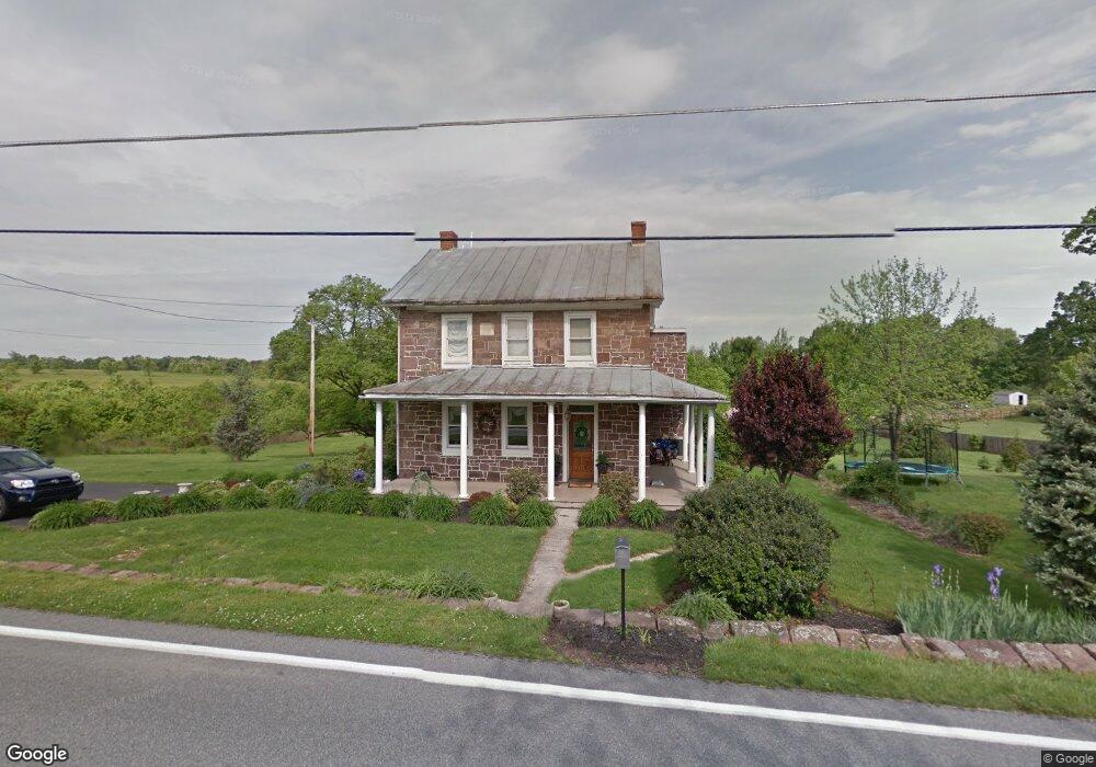
605 Whisler Rd Etters, PA 17319
Estimated Value: $382,603 - $467,000
5
Beds
2
Baths
2,630
Sq Ft
$161/Sq Ft
Est. Value
About This Home
This home is located at 605 Whisler Rd, Etters, PA 17319 and is currently estimated at $422,401, approximately $160 per square foot. 605 Whisler Rd is a home located in York County with nearby schools including Red Mill Elementary School, Crossroads Middle School, and Red Land Senior High School.
Ownership History
Date
Name
Owned For
Owner Type
Purchase Details
Closed on
Jun 30, 2000
Sold by
Hain Earl A and Hain Margaret M
Bought by
Concannon Matthew G and Concannon Jennifer A
Current Estimated Value
Home Financials for this Owner
Home Financials are based on the most recent Mortgage that was taken out on this home.
Original Mortgage
$123,920
Outstanding Balance
$45,347
Interest Rate
8.55%
Estimated Equity
$377,054
Purchase Details
Closed on
Jan 30, 1991
Bought by
Hain Earl A and Hain Margaret M
Create a Home Valuation Report for This Property
The Home Valuation Report is an in-depth analysis detailing your home's value as well as a comparison with similar homes in the area
Home Values in the Area
Average Home Value in this Area
Purchase History
| Date | Buyer | Sale Price | Title Company |
|---|---|---|---|
| Concannon Matthew G | $154,900 | -- | |
| Hain Earl A | $79,500 | -- |
Source: Public Records
Mortgage History
| Date | Status | Borrower | Loan Amount |
|---|---|---|---|
| Open | Concannon Matthew G | $123,920 | |
| Closed | Concannon Matthew G | $23,235 |
Source: Public Records
Tax History Compared to Growth
Tax History
| Year | Tax Paid | Tax Assessment Tax Assessment Total Assessment is a certain percentage of the fair market value that is determined by local assessors to be the total taxable value of land and additions on the property. | Land | Improvement |
|---|---|---|---|---|
| 2025 | $4,586 | $165,560 | $42,910 | $122,650 |
| 2024 | $5,995 | $165,560 | $42,910 | $122,650 |
| 2023 | $4,100 | $165,560 | $42,910 | $122,650 |
| 2022 | $4,087 | $165,560 | $42,910 | $122,650 |
| 2021 | $3,852 | $165,560 | $42,910 | $122,650 |
| 2020 | $3,807 | $165,560 | $42,910 | $122,650 |
| 2019 | $3,709 | $165,560 | $42,910 | $122,650 |
| 2018 | $3,679 | $165,560 | $42,910 | $122,650 |
| 2017 | $3,580 | $165,560 | $42,910 | $122,650 |
| 2016 | $0 | $165,560 | $42,910 | $122,650 |
| 2015 | -- | $165,560 | $42,910 | $122,650 |
| 2014 | -- | $165,560 | $42,910 | $122,650 |
Source: Public Records
Map
Nearby Homes
- 20 Crabapple Dr
- 5 Winterberry Ln
- 15 Winterberry Ln
- Lot 48 Scarlet Oak Dr
- Lot 29 Scarlet Oak Dr
- Lot 50 Scarlet Oak Dr
- Lot 49 Scarlet Oak Dr
- Lot 47 Scarlet Oak Dr
- Lot 46 Scarlet Oak Dr
- Lot 45 Scarlet Oak Dr
- 55 Ashton Dr
- 210 Lark Dr
- 511 N Reeser Dr
- 1335 York Haven Rd
- 60 S Ben Hogan Dr
- 6 Bentley Ct
- 6-15 Bentley Ct
- 95 Madison Dr
- Pearl Plan at Lexington Estates
- Opal Plan at Lexington Estates