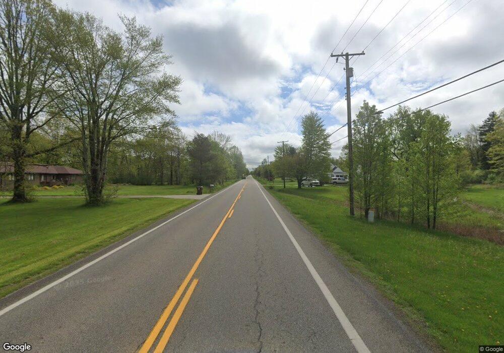
605 Wilson Sharpsville Rd Cortland, OH 44410
Estimated Value: $233,000 - $334,657
3
Beds
1
Bath
1,824
Sq Ft
$153/Sq Ft
Est. Value
About This Home
This home is located at 605 Wilson Sharpsville Rd, Cortland, OH 44410 and is currently estimated at $278,414, approximately $152 per square foot. 605 Wilson Sharpsville Rd is a home with nearby schools including Champion Central Elementary School, Champion Middle School, and Champion High School.
Ownership History
Date
Name
Owned For
Owner Type
Purchase Details
Closed on
Aug 18, 2003
Sold by
Armstrong Rebecca D
Bought by
Armstrong Thomas E
Current Estimated Value
Purchase Details
Closed on
Dec 29, 1995
Sold by
Klinger Kevin R
Bought by
Armstrong Thomas E and Armstrong Rebecca
Home Financials for this Owner
Home Financials are based on the most recent Mortgage that was taken out on this home.
Original Mortgage
$80,514
Interest Rate
7.42%
Mortgage Type
VA
Purchase Details
Closed on
Jan 1, 1990
Bought by
Kevin R Klinger
Create a Home Valuation Report for This Property
The Home Valuation Report is an in-depth analysis detailing your home's value as well as a comparison with similar homes in the area
Home Values in the Area
Average Home Value in this Area
Purchase History
| Date | Buyer | Sale Price | Title Company |
|---|---|---|---|
| Armstrong Thomas E | -- | -- | |
| Armstrong Thomas E | $83,500 | -- | |
| Kevin R Klinger | -- | -- |
Source: Public Records
Mortgage History
| Date | Status | Borrower | Loan Amount |
|---|---|---|---|
| Previous Owner | Armstrong Thomas E | $80,514 |
Source: Public Records
Tax History Compared to Growth
Tax History
| Year | Tax Paid | Tax Assessment Tax Assessment Total Assessment is a certain percentage of the fair market value that is determined by local assessors to be the total taxable value of land and additions on the property. | Land | Improvement |
|---|---|---|---|---|
| 2024 | $2,415 | $46,700 | $5,570 | $41,130 |
| 2023 | $2,415 | $46,700 | $5,570 | $41,130 |
| 2022 | $2,125 | $34,620 | $5,220 | $29,400 |
| 2021 | $2,117 | $34,620 | $5,220 | $29,400 |
| 2020 | $2,096 | $34,620 | $5,220 | $29,400 |
| 2019 | $2,050 | $31,570 | $4,830 | $26,740 |
| 2018 | $2,070 | $31,570 | $4,830 | $26,740 |
| 2017 | $2,024 | $31,570 | $4,830 | $26,740 |
| 2016 | $2,155 | $32,520 | $4,830 | $27,690 |
| 2015 | $2,076 | $32,520 | $4,830 | $27,690 |
| 2014 | $1,913 | $32,520 | $4,830 | $27,690 |
| 2013 | $1,976 | $34,300 | $4,830 | $29,470 |
Source: Public Records
Map
Nearby Homes
- 5349 Alva Ave NW
- 0 Durst Dr NW
- 4389 Kincaid Rd
- 5925 Downs Rd NW
- 6 Nezbar Dr NW
- 5 Nezbar Dr NW
- 4 Nezbar Dr NW
- 1 Nezbar Dr NW
- 176 Durst Dr NW
- 149 Edward St
- 5110 Sabrina Ln NW
- 207 Hidden Trail Dr NW Unit 207
- 2276 Clearview Dr
- 6206 Downs Rd NW
- 6227 Mahoning Ave NW
- 238 Raymond Ave NW
- 5319 Leslie Ave NW
- 6388 Brianna Way NW
- 294 Champion Ave E
- 5546 Shaffer Rd NW Unit A & B
- 591 Center St W
- 633 Center St W
- 612 Center St W
- 577 Center St W
- 653 Center St W
- 601 Center St W
- 556 Center St W
- 663 Center St W
- 683 Center St W
- 536 Center St W
- 690 Center St W
- 703 Center St W
- 512 Center St W
- 700 Center St W
- 499 Center St W
- 490 Center St W
- 733 State Rd NW Unit 305
- 733 Center St W
- 743 Center St W
- 743 State Rd NW Unit 305
