Estimated Value: $431,000 - $485,000
4
Beds
3
Baths
2,710
Sq Ft
$168/Sq Ft
Est. Value
About This Home
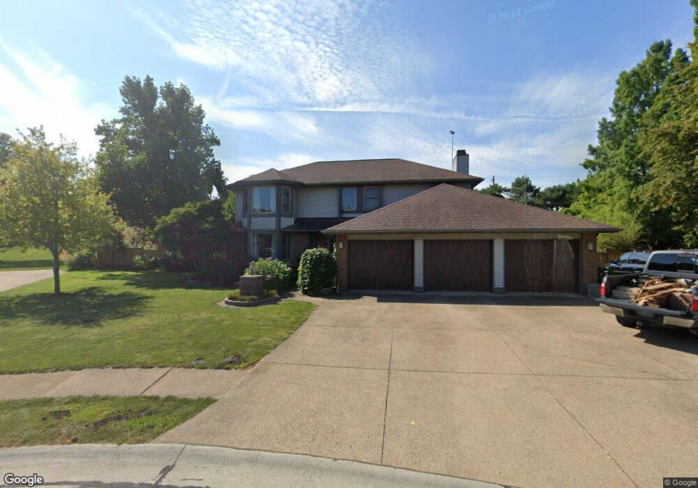
This home is located at 605 Winthrop Ct, Huron, OH 44839 and is currently estimated at $454,911, approximately $167 per square foot. 605 Winthrop Ct is a home located in Erie County with nearby schools including Woodlands Intermediate School, Shawnee Elementary School, and McCormick Junior High School.
Ownership History
Date
Name
Owned For
Owner Type
Purchase Details
Closed on
Oct 11, 2023
Sold by
Holzaepfel Thomas H and Holzaepfel Judith N
Bought by
Studer Brian E
Current Estimated Value
Home Financials for this Owner
Home Financials are based on the most recent Mortgage that was taken out on this home.
Original Mortgage
$335,000
Outstanding Balance
$328,413
Interest Rate
7.12%
Mortgage Type
VA
Estimated Equity
$126,498
Purchase Details
Closed on
Jan 1, 1987
Bought by
Holzaepfel Thomas H and Holzaepfel Judith N
Create a Home Valuation Report for This Property
The Home Valuation Report is an in-depth analysis detailing your home's value as well as a comparison with similar homes in the area
Home Values in the Area
Average Home Value in this Area
Purchase History
| Date | Buyer | Sale Price | Title Company |
|---|---|---|---|
| Studer Brian E | $166 | Ohio Real Title | |
| Holzaepfel Thomas H | -- | -- |
Source: Public Records
Mortgage History
| Date | Status | Borrower | Loan Amount |
|---|---|---|---|
| Open | Studer Brian E | $335,000 |
Source: Public Records
Tax History
| Year | Tax Paid | Tax Assessment Tax Assessment Total Assessment is a certain percentage of the fair market value that is determined by local assessors to be the total taxable value of land and additions on the property. | Land | Improvement |
|---|---|---|---|---|
| 2024 | $3,693 | $134,865 | $20,765 | $114,100 |
| 2023 | $4,578 | $94,353 | $18,375 | $75,978 |
| 2022 | $3,915 | $94,356 | $18,375 | $75,981 |
| 2021 | $3,904 | $94,360 | $18,380 | $75,980 |
| 2020 | $3,939 | $92,770 | $18,380 | $74,390 |
| 2019 | $4,113 | $92,770 | $18,380 | $74,390 |
| 2018 | $4,135 | $92,770 | $18,380 | $74,390 |
| 2017 | $3,672 | $80,080 | $18,010 | $62,070 |
| 2016 | $3,555 | $80,080 | $18,010 | $62,070 |
| 2015 | $3,551 | $80,080 | $18,010 | $62,070 |
| 2014 | $3,398 | $75,730 | $18,010 | $57,720 |
| 2013 | $3,349 | $75,730 | $18,010 | $57,720 |
Source: Public Records
Map
Nearby Homes
- 721 Creekside Dr
- 706 Creekside Dr
- 1 Cleveland Rd W
- 1208 Cleveland Rd W
- 919 Glenview Dr
- 11 Turtle Bay
- 932 Glenview Dr
- 1361 Cleveland Rd W Unit C
- 0 Bucyrus Ave
- 0 W Cleveland Rd
- 0 Bogart Rd
- 201 Dayton Ave
- 2016 Cleveland Rd W
- 0 Main St
- 28 Turtle Bay
- 676 Salem Dr
- 41 Poplar St
- 224 Atwood Place
- 927 Dallas Dr
- 220 Overlook Rd
- 606 Winthrop Ct
- 603 Winthrop Ct
- 604 Winthrop Ct
- 601 Winthrop Ct
- 602 Winthrop Ct
- 714 Gloucester Dr
- 712 Gloucester Dr
- 716 Gloucester Dr
- 714 Salem Dr
- 521 Westport Blvd
- 718 Gloucester Dr
- 705 Salem Dr
- 716 Salem Dr
- 711 Gloucester Dr
- 720 Gloucester Dr
- 715 Salem Dr
- 713 Gloucester Dr
- 718 Salem Dr
- 519 Westport Blvd
- 520 Westport Blvd
Your Personal Tour Guide
Ask me questions while you tour the home.