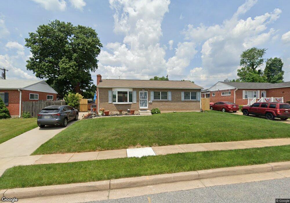
6050 Moorehead Rd Catonsville, MD 21228
Estimated Value: $293,000 - $385,000
Studio
2
Baths
1,519
Sq Ft
$228/Sq Ft
Est. Value
About This Home
This home is located at 6050 Moorehead Rd, Catonsville, MD 21228 and is currently estimated at $346,078, approximately $227 per square foot. 6050 Moorehead Rd is a home located in Baltimore County with nearby schools including Johnnycake Elementary School, Southwest Academy, and Woodlawn High School.
Ownership History
Date
Name
Owned For
Owner Type
Purchase Details
Closed on
May 18, 2006
Sold by
Kerry E
Bought by
Perry Jo Ann
Current Estimated Value
Home Financials for this Owner
Home Financials are based on the most recent Mortgage that was taken out on this home.
Original Mortgage
$237,000
Outstanding Balance
$138,278
Interest Rate
6.53%
Mortgage Type
Purchase Money Mortgage
Estimated Equity
$207,800
Purchase Details
Closed on
May 8, 2006
Sold by
Kerry E
Bought by
Perry Jo Ann
Home Financials for this Owner
Home Financials are based on the most recent Mortgage that was taken out on this home.
Original Mortgage
$237,000
Outstanding Balance
$138,278
Interest Rate
6.53%
Mortgage Type
Purchase Money Mortgage
Estimated Equity
$207,800
Purchase Details
Closed on
Mar 3, 1978
Sold by
Bychick Jack A
Bought by
Null Kerry E
Create a Home Valuation Report for This Property
The Home Valuation Report is an in-depth analysis detailing your home's value as well as a comparison with similar homes in the area
Home Values in the Area
Average Home Value in this Area
Purchase History
| Date | Buyer | Sale Price | Title Company |
|---|---|---|---|
| Perry Jo Ann | $237,000 | -- | |
| Perry Jo Ann | $237,000 | -- | |
| Null Kerry E | $42,000 | -- |
Source: Public Records
Mortgage History
| Date | Status | Borrower | Loan Amount |
|---|---|---|---|
| Open | Perry Jo Ann | $237,000 | |
| Closed | Perry Jo Ann | $237,000 |
Source: Public Records
Tax History
| Year | Tax Paid | Tax Assessment Tax Assessment Total Assessment is a certain percentage of the fair market value that is determined by local assessors to be the total taxable value of land and additions on the property. | Land | Improvement |
|---|---|---|---|---|
| 2025 | $3,001 | $251,767 | -- | -- |
| 2024 | $3,001 | $236,800 | $77,600 | $159,200 |
| 2023 | $1,458 | $227,300 | $0 | $0 |
| 2022 | $2,924 | $217,800 | $0 | $0 |
| 2021 | $2,536 | $208,300 | $77,600 | $130,700 |
| 2020 | $2,536 | $195,700 | $0 | $0 |
| 2019 | $2,444 | $183,100 | $0 | $0 |
| 2018 | $2,394 | $170,500 | $64,100 | $106,400 |
| 2017 | $2,929 | $160,633 | $0 | $0 |
| 2016 | $1,879 | $150,767 | $0 | $0 |
| 2015 | $1,879 | $140,900 | $0 | $0 |
| 2014 | $1,879 | $140,900 | $0 | $0 |
Source: Public Records
Map
Nearby Homes
- 912 Marksworth Rd
- 6035 Moorehead Rd
- 1008 Collwood Rd
- 910 Prestwood Rd
- 1019 Crosby Rd
- 914 Vanderwood Rd
- 6003 Johnnycake Rd
- 1000 Southridge Rd
- 1113 Kent Ave
- 1338 Middleford Rd
- 1111 Mirga Cir
- 6104 Chanceford Rd
- 6112 Chesworth Rd
- 1120 Ingleside Ave
- 1204 Canberwell Rd
- 517 Winters Ln
- 1407 Adamsview Rd
- 1215 Kent Ave
- 1215 Dorchester Ave
- 0 Carroll St
- 6052 Moorehead Rd
- 6048 Moorehead Rd
- 935 Fordwood Cir
- 937 Fordwood Cir
- 6054 Moorehead Rd
- 6046 Moorehead Rd
- 939 Fordwood Cir
- 933 Fordwood Ct
- 6043 Moorehead Rd
- 6045 Moorehead Rd
- 931 Fordwood Ct
- 6044 Moorehead Rd
- 6047 Moorehead Rd
- 6006 Sherrill Rd
- 6003 Sherrill Rd
- 6038 Craigmont Rd
- 6042 Moorehead Rd
- 1000 Hallimont Rd
- 936 Fordwood Cir
- 6004 Sherrill Rd
Your Personal Tour Guide
Ask me questions while you tour the home.