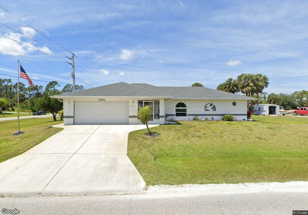
6051 Jennings Blvd Port Charlotte, FL 33981
Englewood East NeighborhoodEstimated Value: $314,000 - $382,000
3
Beds
2
Baths
1,556
Sq Ft
$225/Sq Ft
Est. Value
About This Home
This home is located at 6051 Jennings Blvd, Port Charlotte, FL 33981 and is currently estimated at $350,289, approximately $225 per square foot. 6051 Jennings Blvd is a home with nearby schools including Myakka River Elementary School, L.A. Ainger Middle School, and Lemon Bay High School.
Ownership History
Date
Name
Owned For
Owner Type
Purchase Details
Closed on
Aug 29, 2006
Sold by
Morella Vincent J and Morella Patricia A
Bought by
Morella Vincent J and Morella Patricia A
Current Estimated Value
Purchase Details
Closed on
Aug 24, 2005
Sold by
Morella Gina Louise
Bought by
Morella Vincent J
Purchase Details
Closed on
Aug 18, 1997
Sold by
Morella Vincent J and Morella Patricia A
Bought by
Morella Gina L
Purchase Details
Closed on
Nov 2, 1993
Sold by
Klunk Cyril F and Klunk Linda D
Bought by
Morella Vincent J and Morella Patricia A
Create a Home Valuation Report for This Property
The Home Valuation Report is an in-depth analysis detailing your home's value as well as a comparison with similar homes in the area
Home Values in the Area
Average Home Value in this Area
Purchase History
| Date | Buyer | Sale Price | Title Company |
|---|---|---|---|
| Morella Vincent J | -- | None Available | |
| Morella Vincent J | -- | -- | |
| Morella Gina L | -- | -- | |
| Morella Vincent J | $4,000 | -- |
Source: Public Records
Tax History Compared to Growth
Tax History
| Year | Tax Paid | Tax Assessment Tax Assessment Total Assessment is a certain percentage of the fair market value that is determined by local assessors to be the total taxable value of land and additions on the property. | Land | Improvement |
|---|---|---|---|---|
| 2023 | $2,224 | $106,724 | $0 | $0 |
| 2022 | $2,381 | $115,559 | $0 | $0 |
| 2021 | $2,350 | $112,193 | $0 | $0 |
| 2020 | $1,188 | $110,644 | $0 | $0 |
| 2019 | $1,981 | $108,156 | $0 | $0 |
| 2018 | $1,680 | $106,139 | $0 | $0 |
| 2017 | $1,658 | $103,956 | $0 | $0 |
| 2016 | $1,642 | $101,818 | $0 | $0 |
| 2015 | $1,051 | $101,110 | $0 | $0 |
| 2014 | $1,045 | $100,308 | $0 | $0 |
Source: Public Records
Map
Nearby Homes
- 12577 Willmington Blvd
- 11481 Willmington Blvd
- 11877 van Loon Ave
- 11966 van Loon Ave
- 12169 van Loon Ave
- 12063 Xavier Ave
- 12051 Foresman Blvd
- 11748 Willmington Blvd
- 12039 Dubarry Ave
- 11911 Foresman Blvd
- 6138 Tedder St
- 12057 Du Barry Ave
- 11903 Foresman Blvd
- 6169 Le Harve St
- 11902 van Loon Ave
- 5489 Callaway St
- 6207 Pringle St
- 11635 Willmington Blvd
- 11642 Willmington Blvd
- 5472 Jennings Blvd
- 11520 Willmington Blvd
- 11512 Willmington Blvd
- 12005 Xavier Ave
- 11546 Willmington Blvd
- 11977 Xavier Ave
- 11504 Willmington Blvd
- 11529 Willmington Blvd
- 11982 van Loon Ave
- 11994 Xavier Ave
- 11513 Willmington Blvd
- 11537 Willmington Blvd
- 11969 Xavier Ave
- 11554 Willmington Blvd
- 11984 Xavier Ave
- 11496 Willmington Blvd
- 11370 Willmington Blvd
- 11603 Willmington Blvd
- 12607 Willmington Blvd
- 11610 Willmington Blvd
- 11700 Willmington Blvd