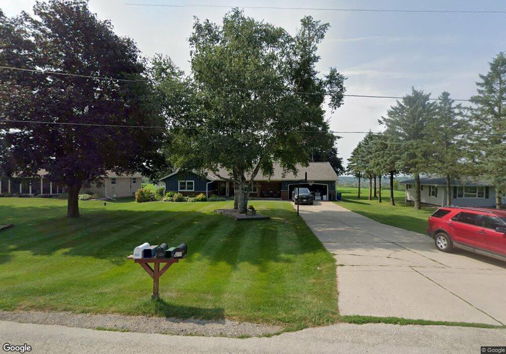
6051 St Anthony Rd West Bend, WI 53090
Estimated Value: $415,000 - $521,000
--
Bed
--
Bath
--
Sq Ft
0.75
Acres
About This Home
This home is located at 6051 St Anthony Rd, West Bend, WI 53090 and is currently estimated at $471,114. 6051 St Anthony Rd is a home located in Washington County with nearby schools including Slinger High School.
Ownership History
Date
Name
Owned For
Owner Type
Purchase Details
Closed on
Jul 10, 2015
Sold by
Durian Michael D and Durian Sherry L
Bought by
Tennies Thomas and Tennies Katie
Current Estimated Value
Purchase Details
Closed on
Mar 3, 2006
Sold by
Schaefer Michael F and Schaefer Daniel W
Bought by
Durian Michael D and Durian Sherry L
Home Financials for this Owner
Home Financials are based on the most recent Mortgage that was taken out on this home.
Original Mortgage
$184,000
Interest Rate
6.33%
Mortgage Type
New Conventional
Create a Home Valuation Report for This Property
The Home Valuation Report is an in-depth analysis detailing your home's value as well as a comparison with similar homes in the area
Home Values in the Area
Average Home Value in this Area
Purchase History
| Date | Buyer | Sale Price | Title Company |
|---|---|---|---|
| Tennies Thomas | $222,500 | -- | |
| Durian Michael D | $230,000 | Abstract & Title Company | |
| Durian Michaei D | $230,000 | -- |
Source: Public Records
Mortgage History
| Date | Status | Borrower | Loan Amount |
|---|---|---|---|
| Previous Owner | Durian Michaei D | $184,000 |
Source: Public Records
Tax History Compared to Growth
Tax History
| Year | Tax Paid | Tax Assessment Tax Assessment Total Assessment is a certain percentage of the fair market value that is determined by local assessors to be the total taxable value of land and additions on the property. | Land | Improvement |
|---|---|---|---|---|
| 2024 | $2,837 | $233,100 | $53,700 | $179,400 |
| 2023 | $2,642 | $233,100 | $53,700 | $179,400 |
| 2022 | $2,602 | $233,100 | $53,700 | $179,400 |
| 2021 | $2,617 | $233,100 | $53,700 | $179,400 |
| 2020 | $2,661 | $233,100 | $53,700 | $179,400 |
| 2019 | $2,607 | $233,100 | $53,700 | $179,400 |
| 2018 | $2,721 | $233,100 | $53,700 | $179,400 |
| 2017 | $2,765 | $233,100 | $53,700 | $179,400 |
| 2016 | $2,833 | $233,100 | $53,700 | $179,400 |
| 2015 | $2,941 | $233,100 | $53,700 | $179,400 |
| 2014 | $2,941 | $241,800 | $53,700 | $188,100 |
| 2013 | $3,342 | $241,800 | $53,700 | $188,100 |
Source: Public Records
Map
Nearby Homes
- 818 Church St Unit 1
- 6372 Wildlife Rd
- 6372 Yellowstone Trail N
- 7087 Nenno Rd
- 5136 William Tell Dr
- 7721 Aurora Rd
- 6386 Alpine Dr
- 7165 Town Line Rd
- 6336 County Highway U
- 4735 Beaver Dam Rd
- Lt13 Eagle View Dr
- Lt4 Eagle View Dr
- Lt1 Eagle View Dr
- 8480 Fairview Dr
- 4538 Church Dr
- 5260 Aurora Rd
- 6043 State Highway 144
- Lt4 Wilson Dr
- Lt3 Wilson Dr
- Lt2 Wilson Dr
- 6045 St Anthony Rd
- 6059 St Anthony Rd
- 6071 St Anthony Rd
- 6079 St Anthony Rd
- 6882 County Rd W
- 6091 St Anthony Rd
- 6874 County Rd W
- 6912 County Rd W
- 6868 County Rd W
- 6920 County Rd W
- 6928 County Rd W
- 6928 Highway W
- 6897 County Rd W
- 6877 County Rd W
- 6931 County Rd W
- 6943 County Rd W
- 6949 Highway W
- 6949 County Rd W
- 6917 County Rd W
- 6955 County Rd W