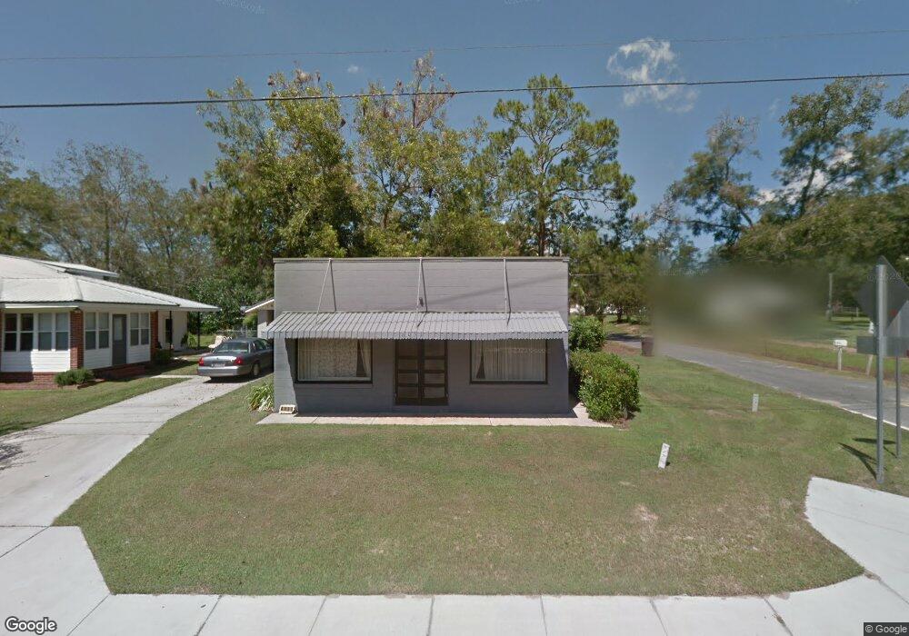
6051 Us Highway 319 N Norman Park, GA 31771
Estimated Value: $157,000 - $192,000
--
Bed
2
Baths
1,359
Sq Ft
$128/Sq Ft
Est. Value
About This Home
This home is located at 6051 Us Highway 319 N, Norman Park, GA 31771 and is currently estimated at $173,709, approximately $127 per square foot. 6051 Us Highway 319 N is a home located in Colquitt County with nearby schools including Norman Park Elementary School, C.A. Gray Junior High School, and Willie J. Williams Middle School.
Ownership History
Date
Name
Owned For
Owner Type
Purchase Details
Closed on
May 16, 2011
Sold by
Whittington James E
Bought by
Department Of Transportation
Current Estimated Value
Purchase Details
Closed on
Mar 21, 1986
Sold by
Pearce B C Etal
Bought by
Whittington James E
Purchase Details
Closed on
Jan 10, 1985
Sold by
Bennett J F
Bought by
Pearce B C Etal
Purchase Details
Closed on
Aug 1, 1951
Bought by
Bennett J F
Create a Home Valuation Report for This Property
The Home Valuation Report is an in-depth analysis detailing your home's value as well as a comparison with similar homes in the area
Home Values in the Area
Average Home Value in this Area
Purchase History
| Date | Buyer | Sale Price | Title Company |
|---|---|---|---|
| Department Of Transportation | -- | -- | |
| Whittington James E | $33,000 | -- | |
| Pearce B C Etal | -- | -- | |
| Bennett J F | -- | -- |
Source: Public Records
Tax History Compared to Growth
Tax History
| Year | Tax Paid | Tax Assessment Tax Assessment Total Assessment is a certain percentage of the fair market value that is determined by local assessors to be the total taxable value of land and additions on the property. | Land | Improvement |
|---|---|---|---|---|
| 2024 | $992 | $52,665 | $696 | $51,969 |
| 2023 | $1,068 | $41,975 | $696 | $41,279 |
| 2022 | $791 | $35,237 | $618 | $34,619 |
| 2021 | $505 | $22,778 | $618 | $22,160 |
| 2020 | $514 | $22,778 | $618 | $22,160 |
| 2019 | $571 | $22,778 | $618 | $22,160 |
| 2018 | $583 | $22,778 | $618 | $22,160 |
| 2017 | $567 | $22,850 | $690 | $22,160 |
| 2016 | $575 | $22,850 | $690 | $22,160 |
| 2015 | $579 | $22,850 | $690 | $22,160 |
| 2014 | $568 | $22,850 | $690 | $22,160 |
| 2013 | -- | $22,849 | $690 | $22,159 |
Source: Public Records
Map
Nearby Homes
- 160 Main Street Crosland
- 1396 Livingston Bridge Rd
- 000 Star Cir
- 000 U S Highway 319
- 173 Middlebrooks St
- 146 Lamar St
- 142 Lamar St
- 122 New St
- 1427 S Ty Omega Rd
- 1852 Doerun Norman Park Rd
- 0 Sleepy Bear Rd
- 0 Mark Orton Ln
- 0 Old Norman Park Rd
- 3332 Ellenton Norman Park Rd
- 0 Murray McCranie Rd Unit 25079284
- 0 Murray McCranie Rd Unit 11586683
- 210 Arrowhead Dr
- 209 Cherokee Dr
- 441 Cherokee Dr
- 171 Ellis Bryan Rd
- 108 Jp Perry Rd
- 6052 Us Highway 319 N
- 124 Lynch St
- 0 J P Perry Rd Unit 10230223
- 6026 Us Highway 319 N
- 111 Main Street Crosland
- 128 Jp Perry Rd
- 136 Lynch St
- 143 Lynch St
- 6082 Us Highway 319 N
- 127 Main Street Crosland
- 6023 Us Highway 319 N
- 107 Royal St
- 125 Jp Perry Rd
- 126 Main Street Crosland
- 136 Main St
- 6114 Us Highway 319 N
- 6118 Us Highway 319 N
- 136 Main Street Crosland
- 160 Main Street Crosland