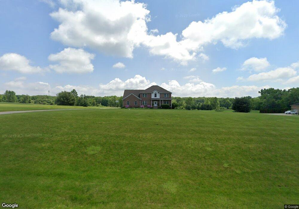
6055 Spangler Dr New Franklin, OH 44216
Estimated Value: $436,000 - $690,000
5
Beds
3
Baths
3,302
Sq Ft
$175/Sq Ft
Est. Value
About This Home
This home is located at 6055 Spangler Dr, New Franklin, OH 44216 and is currently estimated at $577,486, approximately $174 per square foot. 6055 Spangler Dr is a home located in Summit County.
Ownership History
Date
Name
Owned For
Owner Type
Purchase Details
Closed on
Dec 19, 2000
Sold by
Coler Patricia
Bought by
Mattioli Anthony J and Mattioli Angela J
Current Estimated Value
Create a Home Valuation Report for This Property
The Home Valuation Report is an in-depth analysis detailing your home's value as well as a comparison with similar homes in the area
Home Values in the Area
Average Home Value in this Area
Purchase History
| Date | Buyer | Sale Price | Title Company |
|---|---|---|---|
| Mattioli Anthony J | $62,500 | Wigley Title Agency Inc |
Source: Public Records
Tax History Compared to Growth
Tax History
| Year | Tax Paid | Tax Assessment Tax Assessment Total Assessment is a certain percentage of the fair market value that is determined by local assessors to be the total taxable value of land and additions on the property. | Land | Improvement |
|---|---|---|---|---|
| 2025 | $7,817 | $156,370 | $31,903 | $124,467 |
| 2024 | $7,816 | $156,370 | $31,903 | $124,467 |
| 2023 | $7,817 | $156,370 | $31,903 | $124,467 |
| 2022 | $7,870 | $122,770 | $23,632 | $99,138 |
| 2021 | $7,898 | $122,770 | $23,632 | $99,138 |
| 2020 | $7,761 | $122,770 | $23,630 | $99,140 |
| 2019 | $9,098 | $129,010 | $22,050 | $106,960 |
| 2018 | $7,849 | $129,010 | $22,050 | $106,960 |
| 2017 | $7,181 | $129,010 | $22,050 | $106,960 |
| 2016 | $7,097 | $106,910 | $22,050 | $84,860 |
| 2015 | $7,181 | $106,910 | $22,050 | $84,860 |
| 2014 | $7,127 | $106,910 | $22,050 | $84,860 |
| 2013 | $7,077 | $106,940 | $22,050 | $84,890 |
Source: Public Records
Map
Nearby Homes
- 6090 Manchester Rd Unit 6096
- 781 Leeman Dr
- 6387 Hampsher Rd
- 715 Highland Park Dr
- 5983 Weaver Rd
- 451 Yager Rd
- 4851 Manchester Rd
- 6407 Southview Dr
- 4698 Manchester Rd
- 0 W Comet Rd Unit 5079117
- 7060 Manchester Rd
- S/L 14,15 Shakes Hotel Dr
- 2200 W Comet Rd
- 4567 Rex Lake Dr
- 7 Shrakes Hotel Dr
- 6 Shrakes Hotel Dr
- 4 Shrakes Hotel Dr
- 5 Shrakes Hotel Dr
- 8714 Greenmeadow Ave NW
- 3 Shrakes Hotel Dr
- 6087 Spangler Dr
- 6025 Spangler Dr
- 6072 Spangler Dr
- 6020 Spangler Dr
- 6001 Spangler Dr
- 6125 Spangler Dr
- 1198 Maple Grove Cir
- 6134 Spangler Dr
- 5971 Spangler Dr
- 1232 Maple Grove Cir
- 5974 Spangler Dr
- 6163 Spangler Dr
- 1283 Maple Grove Cir
- 1264 Maple Grove Cir
- 6182 Spangler Dr
- 1321 Maple Grove Cir
- 6205 Spangler Dr
- 1300 Maple Grove Cir
- 1121 Stump Rd
- 1347 Maple Grove Cir