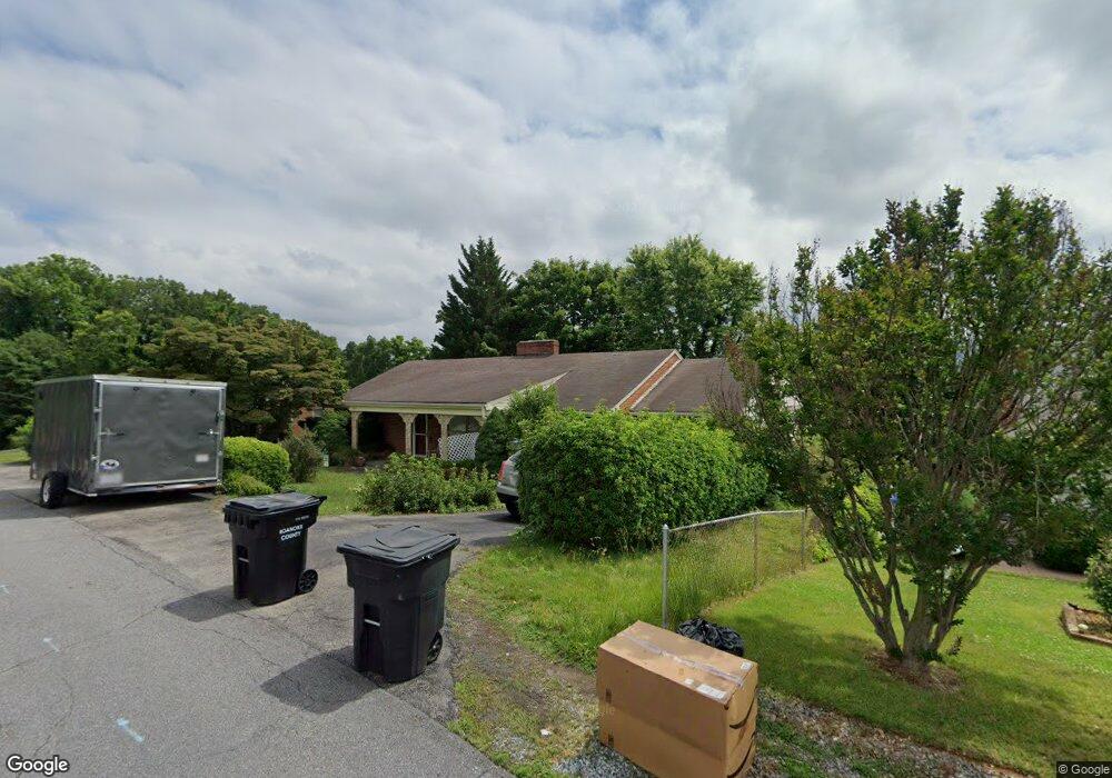
6057 Thornrose Rd Roanoke, VA 24012
Estimated Value: $188,000 - $362,263
5
Beds
3
Baths
3,567
Sq Ft
$79/Sq Ft
Est. Value
About This Home
This home is located at 6057 Thornrose Rd, Roanoke, VA 24012 and is currently estimated at $280,816, approximately $78 per square foot. 6057 Thornrose Rd is a home located in Roanoke County with nearby schools including Burlington Elementary School, Northside Middle School, and Northside High School.
Ownership History
Date
Name
Owned For
Owner Type
Purchase Details
Closed on
Nov 25, 2025
Sold by
Quick Fix Real Estate Llc
Bought by
Afterburner Incorporated
Current Estimated Value
Home Financials for this Owner
Home Financials are based on the most recent Mortgage that was taken out on this home.
Original Mortgage
$255,000
Outstanding Balance
$255,000
Interest Rate
6.27%
Mortgage Type
Construction
Estimated Equity
$25,816
Purchase Details
Closed on
Nov 24, 2025
Sold by
Lee Joyce B
Bought by
Quick Fix Real Estate Llc
Home Financials for this Owner
Home Financials are based on the most recent Mortgage that was taken out on this home.
Original Mortgage
$255,000
Outstanding Balance
$255,000
Interest Rate
6.27%
Mortgage Type
Construction
Estimated Equity
$25,816
Purchase Details
Closed on
Oct 12, 2010
Sold by
Branch Banking And Trust Co
Bought by
Sheetz Brian L and Lee Joyce B
Home Financials for this Owner
Home Financials are based on the most recent Mortgage that was taken out on this home.
Original Mortgage
$94,000
Interest Rate
4.22%
Mortgage Type
Purchase Money Mortgage
Purchase Details
Closed on
Dec 3, 2009
Sold by
Jarvis Betty L and Collins Betty L
Bought by
Branch Banking And Trust
Create a Home Valuation Report for This Property
The Home Valuation Report is an in-depth analysis detailing your home's value as well as a comparison with similar homes in the area
Purchase History
We collect this data history from publicly available records. To have your information removed, we recommend requesting removal directly through your county’s website.
| Date | Buyer | Sale Price | Title Company |
|---|---|---|---|
| Afterburner Incorporated | $189,900 | First American Title | |
| Quick Fix Real Estate Llc | $167,000 | First American Title | |
| Sheetz Brian L | $99,750 | Century Title Services Inc | |
| Branch Banking And Trust | $204,900 | None Available |
Source: Public Records
Mortgage History
We collect this data history from publicly available records. To have your information removed, we recommend requesting removal directly through your county’s website.
| Date | Status | Borrower | Loan Amount |
|---|---|---|---|
| Open | Afterburner Incorporated | $255,000 | |
| Previous Owner | Sheetz Brian L | $94,000 |
Source: Public Records
Tax History
| Year | Tax Paid | Tax Assessment Tax Assessment Total Assessment is a certain percentage of the fair market value that is determined by local assessors to be the total taxable value of land and additions on the property. | Land | Improvement |
|---|---|---|---|---|
| 2025 | $3,462 | $336,100 | $49,000 | $287,100 |
| 2024 | $3,196 | $307,300 | $39,000 | $268,300 |
| 2023 | $3,051 | $287,800 | $39,000 | $248,800 |
| 2022 | $2,678 | $245,700 | $34,000 | $211,700 |
| 2021 | $2,414 | $221,500 | $32,000 | $189,500 |
| 2020 | $2,277 | $208,900 | $29,000 | $179,900 |
| 2019 | $2,262 | $207,500 | $29,000 | $178,500 |
| 2018 | $2,094 | $193,700 | $29,000 | $164,700 |
| 2017 | $2,094 | $192,100 | $29,000 | $163,100 |
| 2016 | $2,096 | $192,300 | $29,000 | $163,300 |
| 2015 | $2,075 | $190,400 | $29,000 | $161,400 |
| 2014 | $2,064 | $189,400 | $30,000 | $159,400 |
Source: Public Records
Map
Nearby Homes
- 710 Anchor Dr
- 5838 Sierra Dr
- 6339 Greenway Dr
- 5715 Santa Anita Terrace
- 6623 Jojo Ln
- 169 Tampa Dr
- 6651 Stonelyn Cottage Ct
- 139 Return Rd
- 5131 Hazelridge Rd NW
- 7043 Northway Dr
- 5107 Hollyhock Rd NW
- 5571 Capito St
- 5001 Hildebrand Rd NW
- 5962 Village Ln
- 5334 Oakland Blvd NW
- 5333 Oakland Blvd
- 918 Whitney Ave NW
- 5949 Village Ln
- 6936 Plantation Rd
- 6632 Wood Haven Rd
- 6051 Thornrose Rd
- 6065 Thornrose Rd
- 6056 Thornrose Rd
- 6045 Thornrose Rd
- 6060 Thornrose Rd
- 6050 Thornrose Rd
- 810 Commander Dr
- 6066 Thornrose Rd
- 6044 Thornrose Rd
- 827 Commander Dr
- 815 Commander Dr
- 0 Palmyra Dr Unit 780652
- 0 Palmyra Dr Unit 807152
- 0 Palmyra Dr Unit 820718
- 0 Palmyra Dr Unit 879749
- 6038 Thornrose Rd
- 802 Commander Dr
- 901 Commander Dr
- 318 Dent Rd
- 801 Commander Dr
Your Personal Tour Guide
Ask me questions while you tour the home.