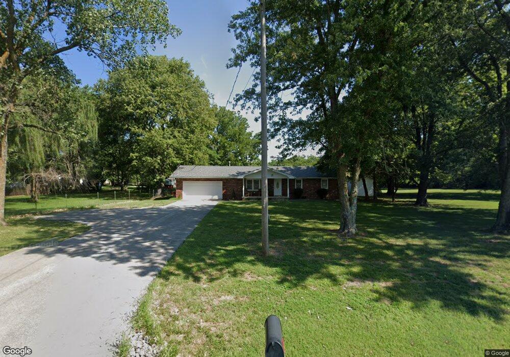
6057 W State Highway Ee Springfield, MO 65802
Estimated Value: $288,000 - $351,000
3
Beds
2
Baths
2,048
Sq Ft
$158/Sq Ft
Est. Value
About This Home
This home is located at 6057 W State Highway Ee, Springfield, MO 65802 and is currently estimated at $323,528, approximately $157 per square foot. 6057 W State Highway Ee is a home located in Greene County with nearby schools including Willard Central Elementary School, Willard Intermediate School North, and Willard High School.
Ownership History
Date
Name
Owned For
Owner Type
Purchase Details
Closed on
Aug 24, 2009
Sold by
Us Bank Na
Bought by
Crawford Matthew G and Crawford Deanna L
Current Estimated Value
Home Financials for this Owner
Home Financials are based on the most recent Mortgage that was taken out on this home.
Original Mortgage
$120,650
Outstanding Balance
$78,624
Interest Rate
5.2%
Mortgage Type
New Conventional
Estimated Equity
$244,904
Purchase Details
Closed on
Apr 10, 2009
Sold by
Gehlbach Joseph K
Bought by
Bank Of America Na
Purchase Details
Closed on
Jan 19, 2007
Sold by
Jackson Brian K and Jackson Christina R
Bought by
Gehlbach Joseph K
Home Financials for this Owner
Home Financials are based on the most recent Mortgage that was taken out on this home.
Original Mortgage
$35,980
Interest Rate
5.88%
Mortgage Type
Stand Alone Second
Create a Home Valuation Report for This Property
The Home Valuation Report is an in-depth analysis detailing your home's value as well as a comparison with similar homes in the area
Home Values in the Area
Average Home Value in this Area
Purchase History
| Date | Buyer | Sale Price | Title Company |
|---|---|---|---|
| Crawford Matthew G | -- | None Available | |
| Bank Of America Na | $112,000 | None Available | |
| Gehlbach Joseph K | -- | None Available |
Source: Public Records
Mortgage History
| Date | Status | Borrower | Loan Amount |
|---|---|---|---|
| Open | Crawford Matthew G | $120,650 | |
| Previous Owner | Gehlbach Joseph K | $35,980 | |
| Previous Owner | Gehlbach Joseph K | $143,920 |
Source: Public Records
Tax History Compared to Growth
Tax History
| Year | Tax Paid | Tax Assessment Tax Assessment Total Assessment is a certain percentage of the fair market value that is determined by local assessors to be the total taxable value of land and additions on the property. | Land | Improvement |
|---|---|---|---|---|
| 2025 | $1,714 | $34,200 | $9,120 | $25,080 |
| 2024 | $1,714 | $29,790 | $6,460 | $23,330 |
| 2023 | $1,708 | $29,790 | $6,460 | $23,330 |
| 2022 | $1,547 | $27,650 | $6,460 | $21,190 |
| 2021 | $1,547 | $27,650 | $6,460 | $21,190 |
| 2020 | $1,389 | $24,400 | $6,460 | $17,940 |
| 2019 | $1,381 | $24,400 | $6,460 | $17,940 |
| 2018 | $1,218 | $21,280 | $6,460 | $14,820 |
| 2017 | $1,208 | $21,280 | $6,460 | $14,820 |
| 2016 | $1,202 | $21,280 | $6,460 | $14,820 |
| 2015 | $1,193 | $21,280 | $6,460 | $14,820 |
| 2014 | $1,203 | $21,280 | $6,460 | $14,820 |
Source: Public Records
Map
Nearby Homes
- 6092 W Farm Road 114
- 2588 N Farm Road 103
- 2571 N Honeysuckle Way
- 2506 N Meadow Lake Dr
- 6830 W Lone Oak St
- 6919 W Lone Oak St
- 6984 W Cottonwood Rd
- 11550 N Farm Road 101
- 7047 W Lone Oak St
- 2548 Arrow Ln N
- 2225 N Plainview Rd
- 3610 N Farm Road 115
- 4620 W Willard Rd
- 7593 W Farm Road 124
- 1700 N Farm Road 93
- 6085 W Farm Road 94
- 4107 W Kearney St
- 719 Shelley St
- 000 W Independence Dr
- 5817 W Alexa Ln
- 6089 W State Highway Ee
- 6027 W State Highway Ee
- 6119 W State Highway Ee
- 2376 N Farm Road 105
- 6157 W State Highway Ee
- 2368 N Farm Road 105
- 2356 N Farm Road 105
- 2312 N Farm Road 105
- 2355 N Farm Road 105
- 6184 W State Highway Ee
- 2343 N Farm Road 105
- 6208 W State Highway Ee
- 2290 N Farm Road 105
- 2315 N Farm Road 105
- 6231 W State Highway Ee
- 2297 N Farm Road 105
- 6236 W State Highway Ee
- 2540 N Farm Road 103
- 2285 N Farm Road 105
- 2516 N Farm Road 103