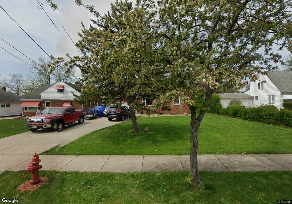
6058 Dunham Rd Maple Heights, OH 44137
Estimated Value: $177,000 - $203,000
4
Beds
2
Baths
1,492
Sq Ft
$127/Sq Ft
Est. Value
About This Home
This home is located at 6058 Dunham Rd, Maple Heights, OH 44137 and is currently estimated at $189,535, approximately $127 per square foot. 6058 Dunham Rd is a home located in Cuyahoga County with nearby schools including Abraham Lincoln Elementary School, Rockside/ J.F. Kennedy School, and Barack Obama School.
Ownership History
Date
Name
Owned For
Owner Type
Purchase Details
Closed on
Dec 9, 2002
Sold by
Gyekenyesi Heather
Bought by
Gyekenyesi Heather
Current Estimated Value
Purchase Details
Closed on
Nov 22, 2002
Sold by
Tarnovecky Michael and Tarnovecky Selma
Bought by
Gyekenyesi Heather
Purchase Details
Closed on
May 29, 1999
Sold by
Tarnowecky Michael and Tarnowecky Selma
Bought by
Gyekenyesi Heather A
Home Financials for this Owner
Home Financials are based on the most recent Mortgage that was taken out on this home.
Original Mortgage
$53,800
Interest Rate
6.99%
Purchase Details
Closed on
Oct 6, 1976
Sold by
Gyekenyesi Andrew J
Bought by
Tarnowecky Michael
Purchase Details
Closed on
Jul 7, 1975
Sold by
Brown Marie T
Bought by
Gyekenyesi Andrew J
Purchase Details
Closed on
Jan 1, 1975
Bought by
Brown Marie T
Create a Home Valuation Report for This Property
The Home Valuation Report is an in-depth analysis detailing your home's value as well as a comparison with similar homes in the area
Home Values in the Area
Average Home Value in this Area
Purchase History
| Date | Buyer | Sale Price | Title Company |
|---|---|---|---|
| Gyekenyesi Heather | -- | -- | |
| Gyekenyesi Heather | -- | -- | |
| Gyekenyesi Heather A | -- | Executive Title Agency Corp | |
| Tarnowecky Michael | -- | -- | |
| Gyekenyesi Andrew J | $44,000 | -- | |
| Brown Marie T | -- | -- |
Source: Public Records
Mortgage History
| Date | Status | Borrower | Loan Amount |
|---|---|---|---|
| Previous Owner | Gyekenyesi Heather A | $53,800 |
Source: Public Records
Tax History
| Year | Tax Paid | Tax Assessment Tax Assessment Total Assessment is a certain percentage of the fair market value that is determined by local assessors to be the total taxable value of land and additions on the property. | Land | Improvement |
|---|---|---|---|---|
| 2025 | $4,137 | $51,765 | $11,165 | $40,600 |
| 2024 | $4,603 | $51,765 | $11,165 | $40,600 |
| 2023 | $3,411 | $32,660 | $8,540 | $24,120 |
| 2022 | $3,399 | $32,660 | $8,540 | $24,120 |
| 2021 | $3,628 | $32,660 | $8,540 | $24,120 |
| 2020 | $3,304 | $26,780 | $7,000 | $19,780 |
| 2019 | $3,285 | $76,500 | $20,000 | $56,500 |
| 2018 | $3,137 | $26,780 | $7,000 | $19,780 |
| 2017 | $3,226 | $25,770 | $6,200 | $19,570 |
| 2016 | $3,116 | $25,770 | $6,200 | $19,570 |
| 2015 | $2,972 | $25,770 | $6,200 | $19,570 |
| 2014 | $2,972 | $26,570 | $6,370 | $20,200 |
Source: Public Records
Map
Nearby Homes
- 6089 Dunham Rd
- 6045 Dunham Rd
- 14956 Carol Dr
- 15401 Walvern Blvd
- 15405 Turney Rd
- 15513 Walvern Blvd
- 5948 Dunham Rd
- 15522 Turney Rd
- 15701 Walvern Blvd
- 14357 Turney Rd
- 15712 Mendota Ave
- 15521 Corkhill Rd
- SL15 Rocky Top Ct
- 14808 James Ave
- 15 Rockytop Ct
- 16014 Turney Rd
- 14320 Janice Dr
- 6378 Valley Ranch Dr
- 6372 Valley Ranch Dr
- 13810 Martin Dr
- 6054 Dunham Rd
- 6086 Dunham Rd
- 14951 Carol Dr
- 6090 Dunham Rd
- 6040 Dunham Rd
- 15001 Carol Dr
- 6100 Dunham Rd
- 6028 Dunham Rd
- 6085 Dunham Rd
- 6075 Dunham Rd
- 15000 Carol Dr
- 6087 Dunham Rd
- 14988 Carol Dr
- 15104 Summit Ave
- 14992 Carol Dr
- 14984 Carol Dr
- 6065 Dunham Rd
- 15100 Summit Ave
- 14983 Carol Dr
- 6024 Dunham Rd
Your Personal Tour Guide
Ask me questions while you tour the home.