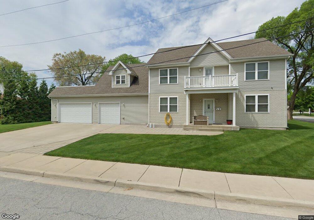
606 119th St Whiting, IN 46394
Estimated Value: $290,000 - $500,000
4
Beds
3
Baths
3,531
Sq Ft
$114/Sq Ft
Est. Value
About This Home
This home is located at 606 119th St, Whiting, IN 46394 and is currently estimated at $403,257, approximately $114 per square foot. 606 119th St is a home with nearby schools including Benjamin Franklin Elementary School, Eggers Middle School, and Hammond High School.
Ownership History
Date
Name
Owned For
Owner Type
Purchase Details
Closed on
Mar 18, 2011
Sold by
Franco Victor M and Franco Guillermina
Bought by
Franco Victor M and Franco Guillermina
Current Estimated Value
Home Financials for this Owner
Home Financials are based on the most recent Mortgage that was taken out on this home.
Original Mortgage
$196,000
Outstanding Balance
$138,905
Interest Rate
5.09%
Mortgage Type
New Conventional
Estimated Equity
$264,352
Purchase Details
Closed on
Aug 8, 2007
Sold by
Vrabel George S and Ann L Vrabel Revocable Living
Bought by
Franco Victor M and Franco Guillermina
Create a Home Valuation Report for This Property
The Home Valuation Report is an in-depth analysis detailing your home's value as well as a comparison with similar homes in the area
Home Values in the Area
Average Home Value in this Area
Purchase History
| Date | Buyer | Sale Price | Title Company |
|---|---|---|---|
| Franco Victor M | -- | Chicago Title Insurance Co | |
| Franco Victor M | -- | Chicago Title Insurance Co |
Source: Public Records
Mortgage History
| Date | Status | Borrower | Loan Amount |
|---|---|---|---|
| Open | Franco Victor M | $196,000 |
Source: Public Records
Tax History
| Year | Tax Paid | Tax Assessment Tax Assessment Total Assessment is a certain percentage of the fair market value that is determined by local assessors to be the total taxable value of land and additions on the property. | Land | Improvement |
|---|---|---|---|---|
| 2025 | $6,512 | $511,900 | $60,700 | $451,200 |
| 2024 | $22,990 | $468,700 | $60,700 | $408,000 |
| 2023 | $6,391 | $481,000 | $79,200 | $401,800 |
| 2022 | $6,391 | $468,800 | $79,200 | $389,600 |
| 2021 | $5,714 | $417,200 | $39,800 | $377,400 |
| 2020 | $5,291 | $385,700 | $39,800 | $345,900 |
| 2019 | $5,118 | $363,200 | $39,800 | $323,400 |
| 2018 | $5,165 | $337,800 | $39,800 | $298,000 |
| 2017 | $5,697 | $327,400 | $39,800 | $287,600 |
| 2016 | $4,815 | $320,300 | $39,800 | $280,500 |
| 2014 | $4,460 | $294,200 | $39,800 | $254,400 |
| 2013 | $4,527 | $312,100 | $39,800 | $272,300 |
Source: Public Records
Map
Nearby Homes
- 1944 Warwick Ave
- 1806 Brown Ave
- 1709 Parkview Ave
- 1828 Stanton Ave
- 1609 Caroline Ave
- 2231 Davis Ave
- 1121 Benedict Ave
- 1463 Indianapolis Blvd
- 1430 Stanton Ave
- 2134 Lincoln Ave
- 1710 Atchison Ave
- 1643 Roberts Ave
- 1207 Lakeview Ave
- 1409 Lake Ave
- 1422 Roberts Ave
- 1631 Cleveland Ave
- 1704 Central Ave
- 1316 Lake Ave
- 1711 Central Ave
- 1314 121st St
Your Personal Tour Guide
Ask me questions while you tour the home.