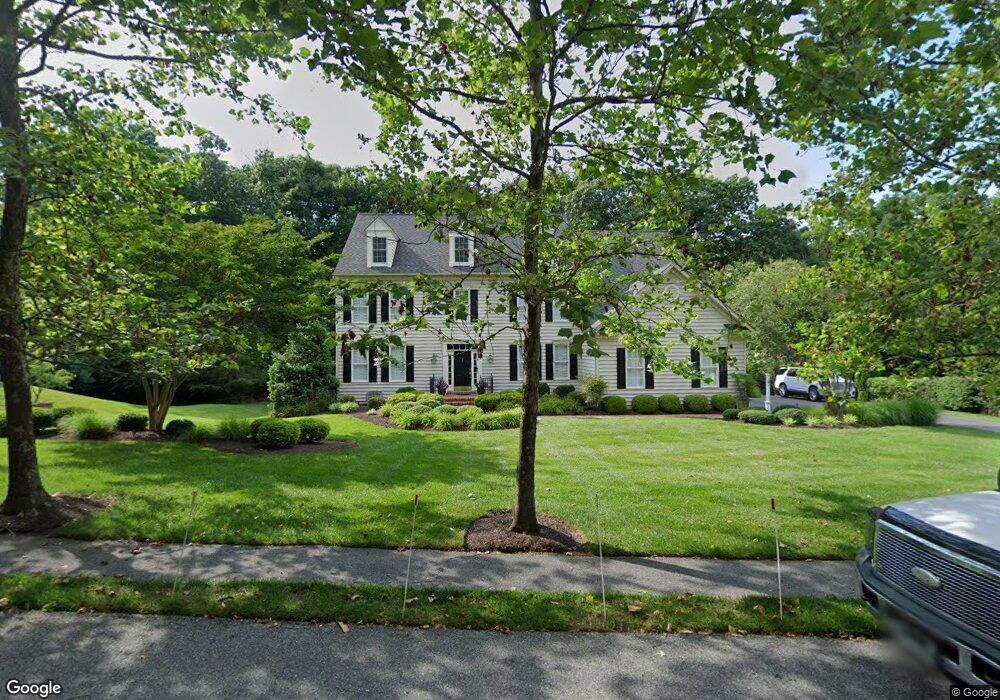
606 Brookstone Dr Crownsville, MD 21032
Estimated Value: $1,109,446 - $1,246,000
--
Bed
5
Baths
3,960
Sq Ft
$302/Sq Ft
Est. Value
About This Home
This home is located at 606 Brookstone Dr, Crownsville, MD 21032 and is currently estimated at $1,196,612, approximately $302 per square foot. 606 Brookstone Dr is a home located in Anne Arundel County with nearby schools including South Shore Elementary School, Old Mill High School, and Indian Creek School.
Ownership History
Date
Name
Owned For
Owner Type
Purchase Details
Closed on
Dec 16, 2004
Sold by
Norwood Properties L L C
Bought by
Mcgrath Shawn B and Mcgrath Laurie A
Current Estimated Value
Purchase Details
Closed on
Dec 7, 2004
Sold by
Norwood Properties L L C
Bought by
Mcgrath Shawn B and Mcgrath Laurie A
Create a Home Valuation Report for This Property
The Home Valuation Report is an in-depth analysis detailing your home's value as well as a comparison with similar homes in the area
Home Values in the Area
Average Home Value in this Area
Purchase History
| Date | Buyer | Sale Price | Title Company |
|---|---|---|---|
| Mcgrath Shawn B | $843,864 | -- | |
| Mcgrath Shawn B | $843,864 | -- |
Source: Public Records
Mortgage History
| Date | Status | Borrower | Loan Amount |
|---|---|---|---|
| Closed | Mcgrath Shawn B | -- |
Source: Public Records
Tax History Compared to Growth
Tax History
| Year | Tax Paid | Tax Assessment Tax Assessment Total Assessment is a certain percentage of the fair market value that is determined by local assessors to be the total taxable value of land and additions on the property. | Land | Improvement |
|---|---|---|---|---|
| 2025 | $10,573 | $1,036,400 | $191,600 | $844,800 |
| 2024 | $10,573 | $985,133 | $0 | $0 |
| 2023 | $10,283 | $933,867 | $0 | $0 |
| 2022 | $9,604 | $882,600 | $216,600 | $666,000 |
| 2021 | $9,214 | $863,400 | $0 | $0 |
| 2020 | $9,214 | $844,200 | $0 | $0 |
| 2019 | $9,049 | $825,000 | $246,600 | $578,400 |
| 2018 | $8,162 | $804,933 | $0 | $0 |
| 2017 | $8,483 | $784,867 | $0 | $0 |
| 2016 | -- | $764,800 | $0 | $0 |
| 2015 | -- | $764,800 | $0 | $0 |
| 2014 | -- | $764,800 | $0 | $0 |
Source: Public Records
Map
Nearby Homes
- 0 Generals Hwy
- 1603 Upton Scott Way
- 0 Old Herald Harbor Rd Unit MDAA2109542
- 0 Old Herald Harbor Rd Unit MDAA2115958
- 0 Yew Trail Unit MDAA2121932
- 938 Diggs Rd
- 902 Hine Trail
- 975 Diggs Rd
- 478 Mountain Rd
- 0 Herald Harbor Rd Unit MDAA2123892
- 1404 Cotton Ct
- 872 Redwood Trail
- 359 Hall Rd
- Lots 25 and 26 Redwood Trail
- Lots 27 and 28 Redwood Trail
- Lots 23 and 24 Redwood Trail
- 0 Redwood Trail Unit MDAA2111808
- 0 Redwood Trail Unit MDAA2111804
- 852 Birch Trail
- 1080 Generals Hwy
- 602 Brookstone Dr
- 610 Brookstone Dr
- 605 Brookstone Dr
- 609 Brookstone Dr
- 601 Brookstone Dr
- 614 Brookstone Dr
- 613 Brookstone Dr
- 1421 Landmark Terrace
- 1400 Gies Ln
- 1425 Landmark Terrace
- 617 Brookstone Dr
- 1404 Gies Ln
- 1408 Gies Ln
- 1420 Landmark Terrace
- 622 Brookstone Dr
- 711 Herald Harbor Rd
- 621 Brookstone Dr
- 1303 Fairgrove Ln
- 745 Herald Harbor Rd
- 1307 Fairgrove Ln