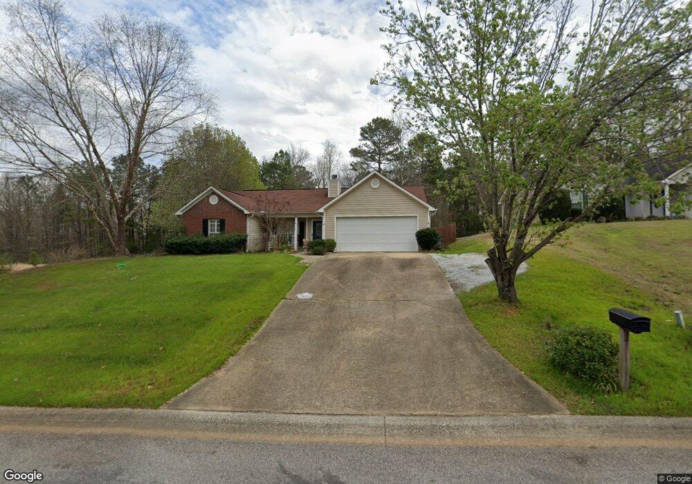
606 Brookstone Dr Lagrange, GA 30241
Estimated Value: $209,000 - $233,801
3
Beds
2
Baths
1,406
Sq Ft
$157/Sq Ft
Est. Value
About This Home
This home is located at 606 Brookstone Dr, Lagrange, GA 30241 and is currently estimated at $220,450, approximately $156 per square foot. 606 Brookstone Dr is a home located in Troup County with nearby schools including Callaway Elementary School, Hogansville Elementary School, and Callaway Middle School.
Ownership History
Date
Name
Owned For
Owner Type
Purchase Details
Closed on
Dec 6, 2004
Sold by
Mullican Vickie B
Bought by
Carrne Michael R
Current Estimated Value
Purchase Details
Closed on
Aug 20, 1999
Sold by
Dri Homes Llc
Bought by
Mullican Vickie B
Purchase Details
Closed on
Mar 3, 1999
Sold by
Sbd
Bought by
Dri Homes Llc
Purchase Details
Closed on
Aug 12, 1994
Bought by
Sbd
Create a Home Valuation Report for This Property
The Home Valuation Report is an in-depth analysis detailing your home's value as well as a comparison with similar homes in the area
Purchase History
| Date | Buyer | Sale Price | Title Company |
|---|---|---|---|
| Carrne Michael R | $119,000 | -- | |
| Carrne Michael R | $119,000 | -- | |
| Mullican Vickie B | $104,000 | -- | |
| Dri Homes Llc | $58,000 | -- | |
| Sbd | -- | -- |
Source: Public Records
Tax History
| Year | Tax Paid | Tax Assessment Tax Assessment Total Assessment is a certain percentage of the fair market value that is determined by local assessors to be the total taxable value of land and additions on the property. | Land | Improvement |
|---|---|---|---|---|
| 2025 | $1,894 | $84,080 | $14,000 | $70,080 |
| 2024 | $1,894 | $69,440 | $14,000 | $55,440 |
| 2023 | $1,886 | $69,160 | $14,000 | $55,160 |
| 2022 | $1,600 | $57,320 | $10,000 | $47,320 |
| 2021 | $1,602 | $53,120 | $8,000 | $45,120 |
| 2020 | $1,602 | $53,120 | $8,000 | $45,120 |
| 2019 | $1,444 | $47,880 | $8,000 | $39,880 |
| 2018 | $1,259 | $41,760 | $6,000 | $35,760 |
| 2017 | $1,259 | $41,760 | $6,000 | $35,760 |
| 2016 | $1,239 | $41,089 | $6,000 | $35,089 |
| 2015 | $1,241 | $41,089 | $6,000 | $35,089 |
| 2014 | $1,187 | $39,242 | $6,000 | $33,242 |
| 2013 | -- | $39,840 | $6,000 | $33,840 |
Source: Public Records
Map
Nearby Homes
- 124 Woodridge Cir
- 119 Sir Lancelot St
- 105 Ridgefield Dr
- 300 Old Pond Rd
- 304 Bridgette Blvd
- 101 Sarah Ln
- 227 River Meadow Dr Unit H14
- 227 River Meadow Dr
- 412 Sweetwood Ct Unit A36
- 509 Youngs Mill Rd
- 793 Celebration Blvd
- 112 Celebration Blvd
- 107 N Barnard Ave
- 0 N Barnard Ave
- 305 Lenox Cir
- 5 Gulfstream Dr
- 3 Gulfstream Dr
- 124 Shenandoah Ln
- 129 Celebration Blvd
- 110 Lenox Cir
- 604 Brookstone Dr
- 602 Brookstone Dr Unit 18
- 602 Brookstone Dr
- 605 Brookstone Dr
- 149 Woodridge Cir
- 149 Woodridge Cir Unit XXX
- 147 Woodridge Cir
- 145 Woodridge Cir
- 603 Brookstone Dr
- 600 Brookstone Dr
- 126 Woodridge Cir
- 143 Woodridge Cir
- 601 Brookstone Dr
- 506 Brookstone Dr
- 141 Woodridge Cir
- 102 Woodridge Ct
- 103 Woodridge Ct
- 504 Brookstone Dr
- 139 Woodridge Cir
- 101 Woodridge Ct