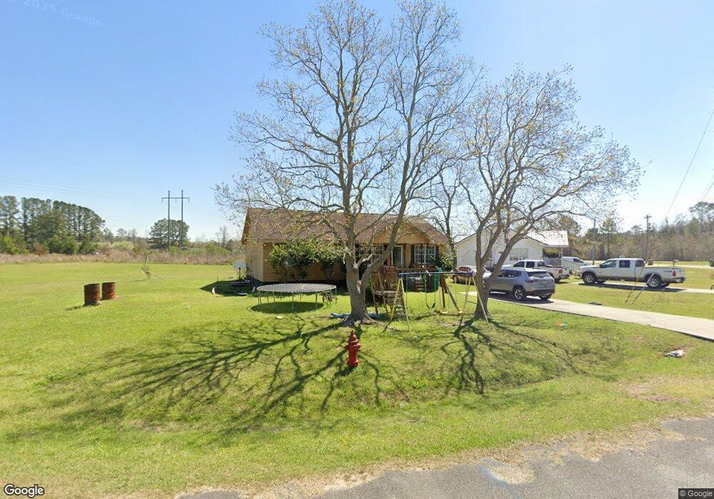
606 Ellis Ln Sparks, GA 31647
Estimated Value: $103,000 - $194,000
3
Beds
2
Baths
1,260
Sq Ft
$114/Sq Ft
Est. Value
About This Home
This home is located at 606 Ellis Ln, Sparks, GA 31647 and is currently estimated at $143,570, approximately $113 per square foot. 606 Ellis Ln is a home located in Cook County with nearby schools including Cook Primary School, Cook Elementary School, and Cook County Middle School.
Ownership History
Date
Name
Owned For
Owner Type
Purchase Details
Closed on
Jul 8, 2015
Sold by
Fdic
Bought by
Acree Investments Ltd
Current Estimated Value
Purchase Details
Closed on
Sep 17, 2013
Sold by
C & S Managing Svcs Inc
Bought by
Capitol City Bank & Trust Co
Purchase Details
Closed on
Sep 18, 2006
Sold by
Capitol City Bann & Trust
Bought by
C & S Managing Svcs Inc
Create a Home Valuation Report for This Property
The Home Valuation Report is an in-depth analysis detailing your home's value as well as a comparison with similar homes in the area
Home Values in the Area
Average Home Value in this Area
Purchase History
| Date | Buyer | Sale Price | Title Company |
|---|---|---|---|
| Acree Investments Ltd | $20,000 | -- | |
| Capitol City Bank & Trust Co | -- | -- | |
| C & S Managing Svcs Inc | $843,000 | -- |
Source: Public Records
Tax History Compared to Growth
Tax History
| Year | Tax Paid | Tax Assessment Tax Assessment Total Assessment is a certain percentage of the fair market value that is determined by local assessors to be the total taxable value of land and additions on the property. | Land | Improvement |
|---|---|---|---|---|
| 2024 | $504 | $14,781 | $2,576 | $12,205 |
| 2023 | $344 | $12,778 | $2,300 | $10,478 |
| 2022 | $344 | $12,778 | $2,300 | $10,478 |
| 2021 | $313 | $10,833 | $2,300 | $8,533 |
| 2020 | $313 | $10,833 | $2,300 | $8,533 |
| 2019 | $313 | $10,833 | $2,300 | $8,533 |
| 2018 | $397 | $10,833 | $2,300 | $8,533 |
| 2017 | $313 | $10,833 | $2,300 | $8,533 |
| 2016 | $232 | $27,020 | $2,300 | $24,720 |
| 2015 | $784 | $27,020 | $2,300 | $24,720 |
| 2014 | $785 | $27,020 | $2,300 | $24,720 |
| 2013 | -- | $27,020 | $2,300 | $24,720 |
Source: Public Records
Map
Nearby Homes
- 284 Barrett Rd
- 103 N College St
- 105 Orchard Cir
- 2603 Dianne St
- 2302 Thomas St
- 2503 Dianne St
- 1402 Bear Creek Rd
- 1306 Bear Creek Rd
- 134 Brandy Ct
- 137 Hood Dr
- 120 Westover Dr
- 123 Westover Dr
- 701 Gloria St
- 625 Coxstill Rd
- 315 Newton Dr
- 0 Barneyville Rd
- 1377 Hutchinson Parrish Rd
- 304 E 3rd St
- 418 E 3rd St
- 901 E 4th St