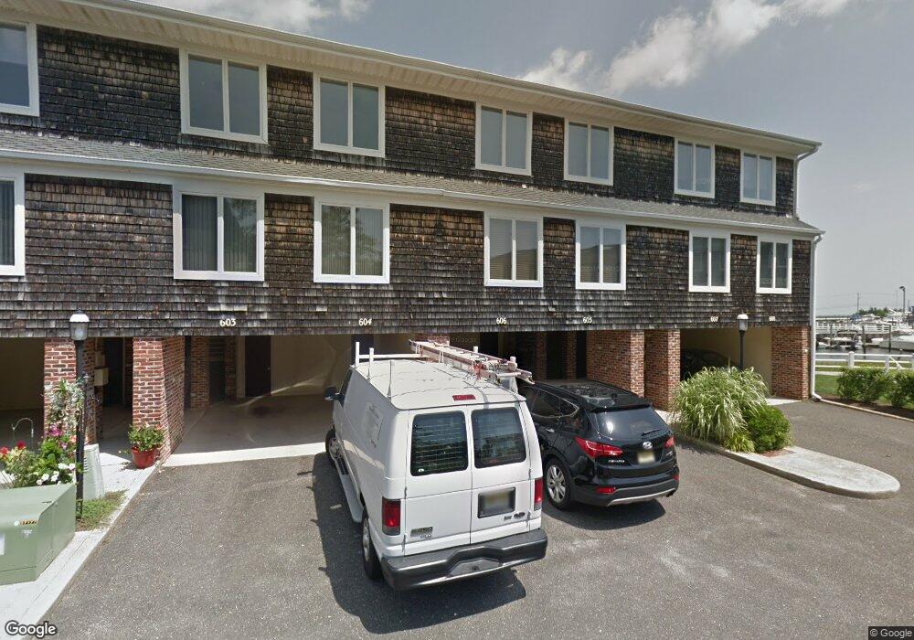
606 Harbour Cove Unit 606 Somers Point, NJ 08244
Estimated Value: $700,310 - $818,000
--
Bed
--
Bath
1,600
Sq Ft
$483/Sq Ft
Est. Value
About This Home
This home is located at 606 Harbour Cove Unit 606, Somers Point, NJ 08244 and is currently estimated at $773,578, approximately $483 per square foot. 606 Harbour Cove Unit 606 is a home located in Atlantic County with nearby schools including Mainland Regional High School, ChARTer TECH High School for the Performing Arts, and Saint Joseph Regional School.
Ownership History
Date
Name
Owned For
Owner Type
Purchase Details
Closed on
Aug 30, 2005
Sold by
Donohoe Dane
Bought by
Rainone Bonnie and Rainone Richard
Current Estimated Value
Purchase Details
Closed on
May 31, 2002
Sold by
Hoak Larry R and Hoak Mary L
Bought by
Donohoe Dane and Donohoe Jill
Home Financials for this Owner
Home Financials are based on the most recent Mortgage that was taken out on this home.
Original Mortgage
$240,000
Interest Rate
6.36%
Mortgage Type
Purchase Money Mortgage
Purchase Details
Closed on
Sep 2, 1997
Sold by
Hoak Larry R
Bought by
Hoak Larry R and Hoak Mary L
Home Financials for this Owner
Home Financials are based on the most recent Mortgage that was taken out on this home.
Original Mortgage
$136,000
Interest Rate
6.84%
Purchase Details
Closed on
Aug 31, 1992
Sold by
Dugan Joseph T
Bought by
Hoak Larry R
Create a Home Valuation Report for This Property
The Home Valuation Report is an in-depth analysis detailing your home's value as well as a comparison with similar homes in the area
Home Values in the Area
Average Home Value in this Area
Purchase History
| Date | Buyer | Sale Price | Title Company |
|---|---|---|---|
| Rainone Bonnie | $535,000 | -- | |
| Donohoe Dane | $300,000 | Commonwealth Land Title Ins | |
| Hoak Larry R | -- | The Title Company | |
| Hoak Larry R | $175,000 | -- |
Source: Public Records
Mortgage History
| Date | Status | Borrower | Loan Amount |
|---|---|---|---|
| Previous Owner | Donohoe Dane | $240,000 | |
| Previous Owner | Hoak Larry R | $136,000 |
Source: Public Records
Tax History Compared to Growth
Tax History
| Year | Tax Paid | Tax Assessment Tax Assessment Total Assessment is a certain percentage of the fair market value that is determined by local assessors to be the total taxable value of land and additions on the property. | Land | Improvement |
|---|---|---|---|---|
| 2025 | $12,520 | $350,100 | $190,000 | $160,100 |
| 2024 | $12,520 | $350,100 | $190,000 | $160,100 |
| 2023 | $11,697 | $350,100 | $190,000 | $160,100 |
| 2022 | $11,697 | $350,100 | $190,000 | $160,100 |
| 2021 | $11,522 | $350,100 | $190,000 | $160,100 |
| 2020 | $11,287 | $350,100 | $190,000 | $160,100 |
| 2019 | $10,969 | $350,100 | $190,000 | $160,100 |
| 2018 | $11,044 | $360,100 | $200,000 | $160,100 |
| 2017 | $10,648 | $360,100 | $200,000 | $160,100 |
| 2016 | $10,166 | $360,100 | $200,000 | $160,100 |
| 2015 | $10,061 | $360,100 | $200,000 | $160,100 |
| 2014 | $9,723 | $360,100 | $200,000 | $160,100 |
Source: Public Records
Map
Nearby Homes
- 308 Harbour Cove Unit 308
- 1002 Pleasant Ave
- 1020 Pleasant Ave
- 1013 Pleasant Ave
- 1014 Pleasant Ave
- 1024 Pleasant Ave
- 1015 Pleasant Ave
- 42 E New York Ave
- 28 E New York Ave
- 127 Higbee Ave
- 107 Stern Dr
- 123 E Cedar Ave
- 109 E Cedar Ave
- 101 E Johnson Ave
- 421 Shore Rd
- 114 E Pierson Ave
- 23 Point Dr
- 112 E Pierson Ave
- 825 Bay Ave
- 827 Bay Ave
- 605 Harbour Cove Unit 605
- 607 Harbour Cove
- 604 Harbour Cove
- 603 Harbour Cove
- 602 Harbour Cove
- 601 Harbour Cove Unit 601
- 512 Harbour Cove
- 511 Harbour Cove Unit 511
- 1110 Harbour Cove
- 701 Harbour Cove Unit 701
- 510 Harbour Cove Unit 510
- 1108 Harbour Cove
- 1108 Harbour Cove Unit 1108
- 509 Harbour Cove Unit 509
- 702 Harbour Cove
- 1106 Harbour Cove Unit 1106
- 1109 Harbour Cove
- 703 Harbour Cove
- 508 Harbour Cove