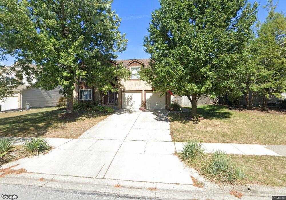
606 Locust Ct Westerville, OH 43082
Genoa NeighborhoodEstimated Value: $442,000 - $485,638
4
Beds
3
Baths
2,334
Sq Ft
$197/Sq Ft
Est. Value
About This Home
This home is located at 606 Locust Ct, Westerville, OH 43082 and is currently estimated at $460,410, approximately $197 per square foot. 606 Locust Ct is a home located in Delaware County with nearby schools including Robert Frost Elementary School, Heritage Middle School, and Westerville-North High School.
Ownership History
Date
Name
Owned For
Owner Type
Purchase Details
Closed on
Dec 12, 1990
Bought by
Horn Willie Janice L
Current Estimated Value
Create a Home Valuation Report for This Property
The Home Valuation Report is an in-depth analysis detailing your home's value as well as a comparison with similar homes in the area
Home Values in the Area
Average Home Value in this Area
Purchase History
| Date | Buyer | Sale Price | Title Company |
|---|---|---|---|
| Horn Willie Janice L | $25,000 | -- |
Source: Public Records
Tax History Compared to Growth
Tax History
| Year | Tax Paid | Tax Assessment Tax Assessment Total Assessment is a certain percentage of the fair market value that is determined by local assessors to be the total taxable value of land and additions on the property. | Land | Improvement |
|---|---|---|---|---|
| 2024 | $6,694 | $131,390 | $30,870 | $100,520 |
| 2023 | $6,618 | $131,390 | $30,870 | $100,520 |
| 2022 | $5,690 | $87,400 | $21,140 | $66,260 |
| 2021 | $5,739 | $87,400 | $21,140 | $66,260 |
| 2020 | $5,777 | $87,400 | $21,140 | $66,260 |
| 2019 | $4,999 | $72,250 | $18,380 | $53,870 |
| 2018 | $4,915 | $72,250 | $18,380 | $53,870 |
| 2017 | $4,869 | $68,500 | $13,370 | $55,130 |
| 2016 | $5,083 | $68,500 | $13,370 | $55,130 |
| 2015 | $4,863 | $68,500 | $13,370 | $55,130 |
| 2014 | $4,911 | $68,500 | $13,370 | $55,130 |
| 2013 | $4,690 | $65,380 | $13,370 | $52,010 |
Source: Public Records
Map
Nearby Homes
- 547 County Line Rd
- 718 Sugar Ct
- 200 Matthew Ave
- 150 Matthew Ave
- 589 E College Ave
- 175 Nottingham Ct
- 656 Olde Mill Dr
- 912 Lakeway Ct E
- 368 E College Ave
- 364 E College Ave
- 267 Windemere Place
- 974 Lakeland Dr
- 768 Collingwood Dr
- 754 Kingsmead Rd Unit 18754
- 223 Dogwood Ln
- 348 Buck Run Trail
- 192 Buckeye Ct
- 182 Hillcrest Dr
- 199 E College Ave
- 137 Abbeycross Ln
- 600 Locust Ct
- 305 Burns Dr N
- 603 Mulberry Way S
- 594 Locust Ct
- 315 Burns Dr N
- 597 Mulberry Way S
- 609 Locust Ct
- 603 Locust Ct
- 289 Burns Dr N
- 589 Mulberry Way S
- 590 Locust Ct
- 597 Locust Ct
- 292 Burns Dr N
- 583 Mulberry Way S
- 308 Burns Dr N
- 314 Burns Dr N
- 586 Locust Ct
- 300 Burns Dr N
- 331 Burns Dr N
- 320 Burns Dr N