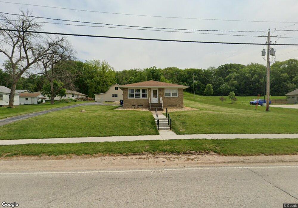
606 N High St Port Byron, IL 61275
Estimated Value: $188,000 - $205,981
--
Bed
--
Bath
1,373
Sq Ft
$145/Sq Ft
Est. Value
About This Home
This home is located at 606 N High St, Port Byron, IL 61275 and is currently estimated at $198,995, approximately $144 per square foot. 606 N High St is a home located in Rock Island County with nearby schools including Riverdale Elementary School, Riverdale Middle School, and Riverdale Senior High School.
Create a Home Valuation Report for This Property
The Home Valuation Report is an in-depth analysis detailing your home's value as well as a comparison with similar homes in the area
Home Values in the Area
Average Home Value in this Area
Tax History Compared to Growth
Tax History
| Year | Tax Paid | Tax Assessment Tax Assessment Total Assessment is a certain percentage of the fair market value that is determined by local assessors to be the total taxable value of land and additions on the property. | Land | Improvement |
|---|---|---|---|---|
| 2024 | $3,498 | $52,117 | $8,567 | $43,550 |
| 2023 | $3,498 | $47,814 | $7,860 | $39,954 |
| 2022 | $3,117 | $45,602 | $7,496 | $38,106 |
| 2021 | $3,023 | $43,224 | $7,105 | $36,119 |
| 2020 | $2,970 | $42,585 | $7,000 | $35,585 |
| 2019 | $2,980 | $42,585 | $7,000 | $35,585 |
| 2018 | $2,801 | $40,996 | $5,355 | $35,641 |
| 2017 | $2,759 | $40,996 | $5,355 | $35,641 |
| 2016 | $2,728 | $40,430 | $5,281 | $35,149 |
| 2015 | $2,666 | $39,329 | $5,137 | $34,192 |
| 2014 | -- | $40,566 | $5,036 | $35,530 |
| 2013 | -- | $40,566 | $5,036 | $35,530 |
Source: Public Records
Map
Nearby Homes