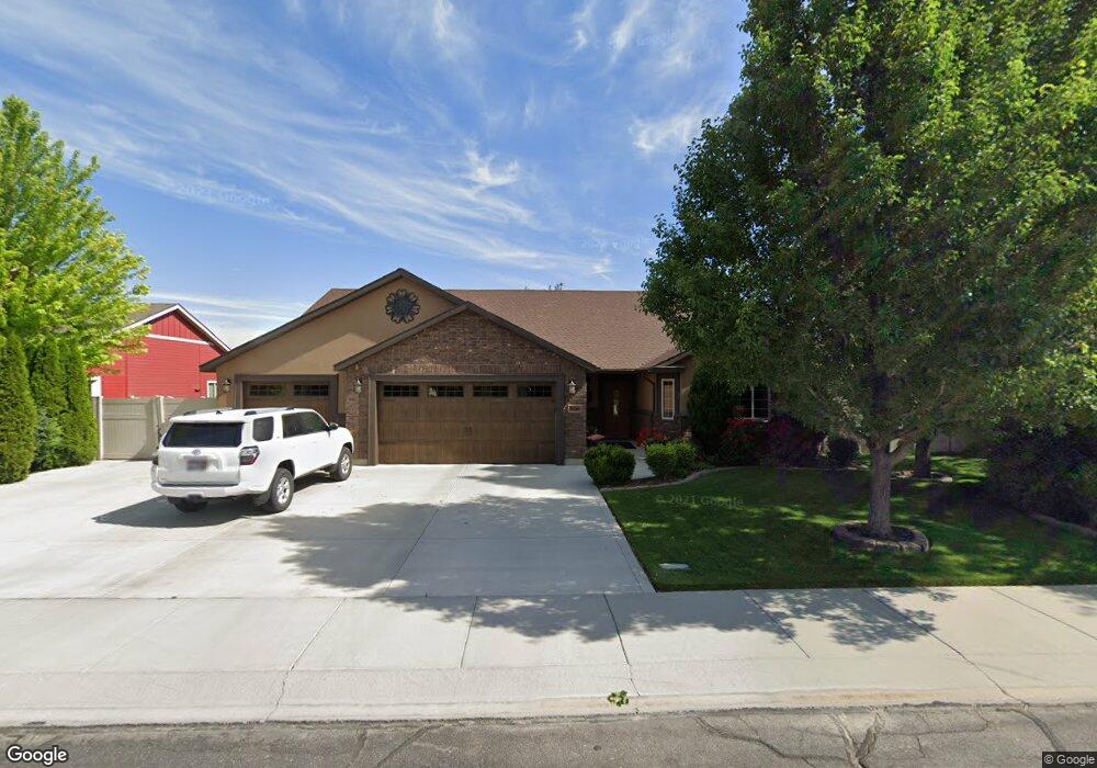
606 Northfork Rd Twin Falls, ID 83301
Estimated Value: $458,841 - $516,000
3
Beds
3
Baths
1,869
Sq Ft
$259/Sq Ft
Est. Value
About This Home
This home is located at 606 Northfork Rd, Twin Falls, ID 83301 and is currently estimated at $484,460, approximately $259 per square foot. 606 Northfork Rd is a home located in Twin Falls County with nearby schools including Rock Creek Elementary School, Robert Stuart Junior High School, and Canyon Ridge High School.
Ownership History
Date
Name
Owned For
Owner Type
Purchase Details
Closed on
Sep 28, 2021
Sold by
Nunneiley Joseph Anthony and Nunneiley Mary M
Bought by
Nunnelley Mary and Nunnelley Joseph
Current Estimated Value
Home Financials for this Owner
Home Financials are based on the most recent Mortgage that was taken out on this home.
Original Mortgage
$235,000
Outstanding Balance
$214,298
Interest Rate
2.8%
Mortgage Type
New Conventional
Estimated Equity
$270,162
Purchase Details
Closed on
Nov 18, 2009
Sold by
Nunnelley Joseph Anthony and Nunnelley Mary M
Bought by
Nunnelley Joseph Anthony and Nunnelley Mary M
Home Financials for this Owner
Home Financials are based on the most recent Mortgage that was taken out on this home.
Original Mortgage
$165,200
Interest Rate
4.83%
Mortgage Type
New Conventional
Create a Home Valuation Report for This Property
The Home Valuation Report is an in-depth analysis detailing your home's value as well as a comparison with similar homes in the area
Home Values in the Area
Average Home Value in this Area
Purchase History
| Date | Buyer | Sale Price | Title Company |
|---|---|---|---|
| Nunnelley Mary | -- | Alliance Title & Escrow Corp | |
| Nunnelley Joseph Anthony | -- | -- |
Source: Public Records
Mortgage History
| Date | Status | Borrower | Loan Amount |
|---|---|---|---|
| Open | Nunnelley Mary | $235,000 | |
| Previous Owner | Nunnelley Joseph Anthony | $165,200 |
Source: Public Records
Tax History Compared to Growth
Tax History
| Year | Tax Paid | Tax Assessment Tax Assessment Total Assessment is a certain percentage of the fair market value that is determined by local assessors to be the total taxable value of land and additions on the property. | Land | Improvement |
|---|---|---|---|---|
| 2024 | $2,978 | $440,293 | $106,202 | $334,091 |
| 2023 | $2,706 | $452,370 | $106,202 | $346,168 |
| 2022 | $3,609 | $440,147 | $76,217 | $363,930 |
| 2021 | $3,519 | $358,721 | $76,217 | $282,504 |
| 2020 | $3,293 | $315,836 | $76,217 | $239,619 |
| 2019 | $3,518 | $296,908 | $65,785 | $231,123 |
| 2018 | $3,926 | $309,654 | $81,570 | $228,084 |
| 2017 | $3,097 | $265,229 | $60,482 | $204,747 |
| 2016 | $2,773 | $233,094 | $0 | $0 |
| 2015 | $2,467 | $216,072 | $0 | $0 |
| 2012 | -- | $198,896 | $0 | $0 |
Source: Public Records
Map
Nearby Homes
- 595 I B Perrine Rd
- 2489 Blick Ln
- 2263 Columbia Dr
- 2320 Settlers Ln
- 2402 Columbia Dr
- 2329 Settlers Ridge Trail
- 2370 I B Perrine Place
- 2157 Cayuse St
- 2448 Village St
- 2194 Caribel St
- 2253 Caribel St
- 455 Coiner Cir
- 2239 Caribel St
- 2314 Bisbee Place
- 491 Canyon Rim Rd
- 2113 Columbia Dr
- 2209 Kooskia Loop
- 2137 Settlers Ln
- 2078 Red Rock Way
- 2079 Red Rock Way
- 596 Northfork Rd
- 596 Northfork Rd
- 618 Northfork Rd
- 618 Northfork Rd
- 606 N Fork Rd
- 605 I B Perrine Rd
- 617 I B Perrine Rd
- 599 Northfork Rd
- 632 Northfork Rd
- 584 Northfork Rd
- 632 Northfork Rd
- 617 Northfork Rd
- 584 Northfork Rd
- 591 Northfork Rd
- 631 I B Perrine Rd
- 583 I B Perrine Rd
- 570 Northfork Rd
- 644 Northfork Rd
- 583 Northfork Rd