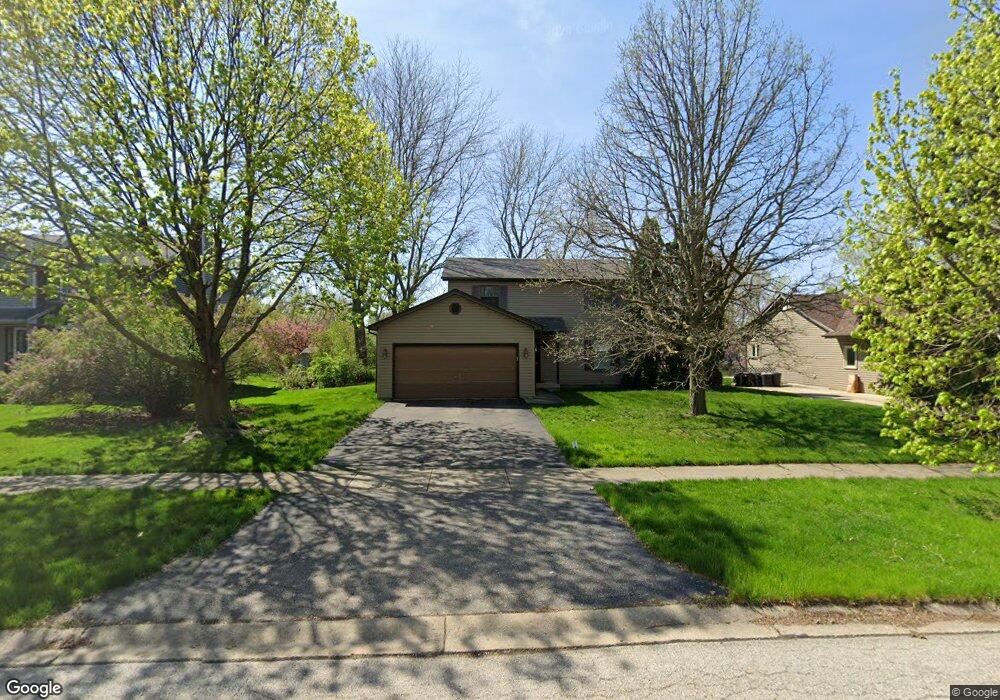
606 Pinewood Dr North Aurora, IL 60542
Estimated Value: $374,000 - $405,000
3
Beds
3
Baths
1,792
Sq Ft
$216/Sq Ft
Est. Value
About This Home
This home is located at 606 Pinewood Dr, North Aurora, IL 60542 and is currently estimated at $386,184, approximately $215 per square foot. 606 Pinewood Dr is a home located in Kane County with nearby schools including Goodwin Elementary School, Jewel Middle School, and West Aurora High School.
Ownership History
Date
Name
Owned For
Owner Type
Purchase Details
Closed on
Nov 12, 2009
Sold by
Phelps Ronald G and Campbell Tammy J
Bought by
Karns Patrick
Current Estimated Value
Home Financials for this Owner
Home Financials are based on the most recent Mortgage that was taken out on this home.
Original Mortgage
$194,750
Outstanding Balance
$127,877
Interest Rate
5.11%
Mortgage Type
New Conventional
Estimated Equity
$258,307
Create a Home Valuation Report for This Property
The Home Valuation Report is an in-depth analysis detailing your home's value as well as a comparison with similar homes in the area
Home Values in the Area
Average Home Value in this Area
Purchase History
| Date | Buyer | Sale Price | Title Company |
|---|---|---|---|
| Karns Patrick | $205,000 | First American Title |
Source: Public Records
Mortgage History
| Date | Status | Borrower | Loan Amount |
|---|---|---|---|
| Open | Karns Patrick | $194,750 |
Source: Public Records
Tax History Compared to Growth
Tax History
| Year | Tax Paid | Tax Assessment Tax Assessment Total Assessment is a certain percentage of the fair market value that is determined by local assessors to be the total taxable value of land and additions on the property. | Land | Improvement |
|---|---|---|---|---|
| 2024 | $7,197 | $103,741 | $13,396 | $90,345 |
| 2023 | $7,010 | $94,156 | $12,158 | $81,998 |
| 2022 | $6,776 | $87,997 | $11,363 | $76,634 |
| 2021 | $6,585 | $83,457 | $10,777 | $72,680 |
| 2020 | $6,561 | $81,853 | $10,570 | $71,283 |
| 2019 | $6,632 | $78,956 | $10,196 | $68,760 |
| 2018 | $6,575 | $75,949 | $9,808 | $66,141 |
| 2017 | $6,527 | $73,445 | $9,485 | $63,960 |
| 2016 | $6,511 | $71,306 | $9,209 | $62,097 |
| 2015 | -- | $69,682 | $8,999 | $60,683 |
| 2014 | -- | $67,489 | $8,716 | $58,773 |
| 2013 | -- | $69,835 | $12,209 | $57,626 |
Source: Public Records
Map
Nearby Homes
- 302 Pin Oak Dr
- 438 Mallard Point Dr
- 442 Mallard Point Dr
- 341 Pheasant Hill Dr
- 503 Redwood Ct
- 413 N Sycamore Ln
- 791 Cottonwood Dr
- 202 Larchwood Ln
- 426 Prairie Ridge Ln
- 427 Prairie Ridge Ln
- 444 Prairie Ridge Ln
- 448 Prairie Ridge Ln
- 523 Mallard Point Dr Unit 1
- 460 Prairie Ridge Ln
- 6 S Sycamore Ln
- 504 Dogwood Ct
- 727 Harmony Ct
- 218 Timber Oaks Dr
- 344 Hilltop Dr
- 459 Prairie Ridge Ln
- 608 Pinewood Dr
- 604 Pinewood Dr
- 310 N Sycamore Ln Unit 5D
- 610 Pinewood Dr
- 308 N Sycamore Ln
- 605 Pinewood Dr
- 607 Pinewood Dr
- 603 Pinewood Dr
- 609 Pinewood Dr
- 306 N Sycamore Ln
- 612 Pinewood Dr
- 611 Pinewood Dr
- 304 N Sycamore Ln
- 613 Pinewood Dr
- 614 Pinewood Dr
- 313 N Sycamore Ln
- 406 Mallard Point Dr
- 311 N Sycamore Ln
- 414 Mallard Point Dr