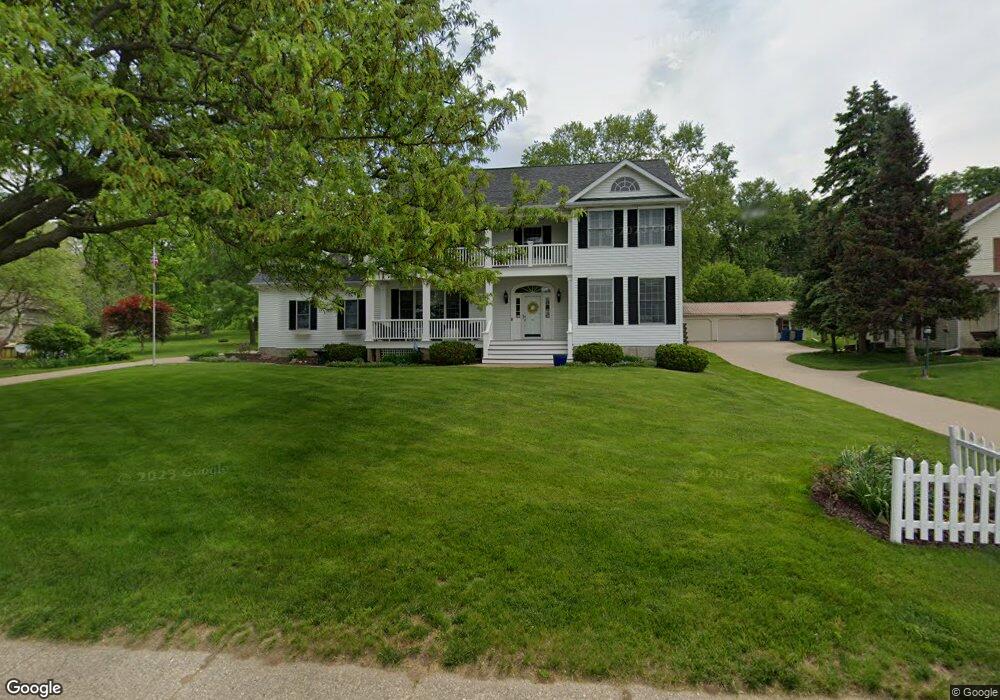
606 S Main St Port Byron, IL 61275
Estimated Value: $498,000 - $572,000
--
Bed
--
Bath
3,084
Sq Ft
$171/Sq Ft
Est. Value
About This Home
This home is located at 606 S Main St, Port Byron, IL 61275 and is currently estimated at $526,862, approximately $170 per square foot. 606 S Main St is a home located in Rock Island County with nearby schools including Riverdale Elementary School, Riverdale Middle School, and Riverdale Senior High School.
Create a Home Valuation Report for This Property
The Home Valuation Report is an in-depth analysis detailing your home's value as well as a comparison with similar homes in the area
Home Values in the Area
Average Home Value in this Area
Tax History Compared to Growth
Tax History
| Year | Tax Paid | Tax Assessment Tax Assessment Total Assessment is a certain percentage of the fair market value that is determined by local assessors to be the total taxable value of land and additions on the property. | Land | Improvement |
|---|---|---|---|---|
| 2024 | $11,749 | $165,906 | $18,357 | $147,549 |
| 2023 | $11,749 | $152,207 | $16,841 | $135,366 |
| 2022 | $10,256 | $141,301 | $16,062 | $125,239 |
| 2021 | $9,983 | $133,935 | $15,225 | $118,710 |
| 2020 | $9,821 | $131,956 | $15,000 | $116,956 |
| 2019 | $9,582 | $131,956 | $15,000 | $116,956 |
| 2018 | $9,582 | $130,732 | $17,413 | $113,319 |
| 2017 | $9,440 | $130,732 | $17,413 | $113,319 |
| 2016 | $9,345 | $128,927 | $17,173 | $111,754 |
| 2015 | $9,150 | $125,415 | $16,705 | $108,710 |
| 2014 | $2,241 | $146,404 | $16,377 | $130,027 |
| 2013 | $2,241 | $146,404 | $16,377 | $130,027 |
Source: Public Records
Map
Nearby Homes