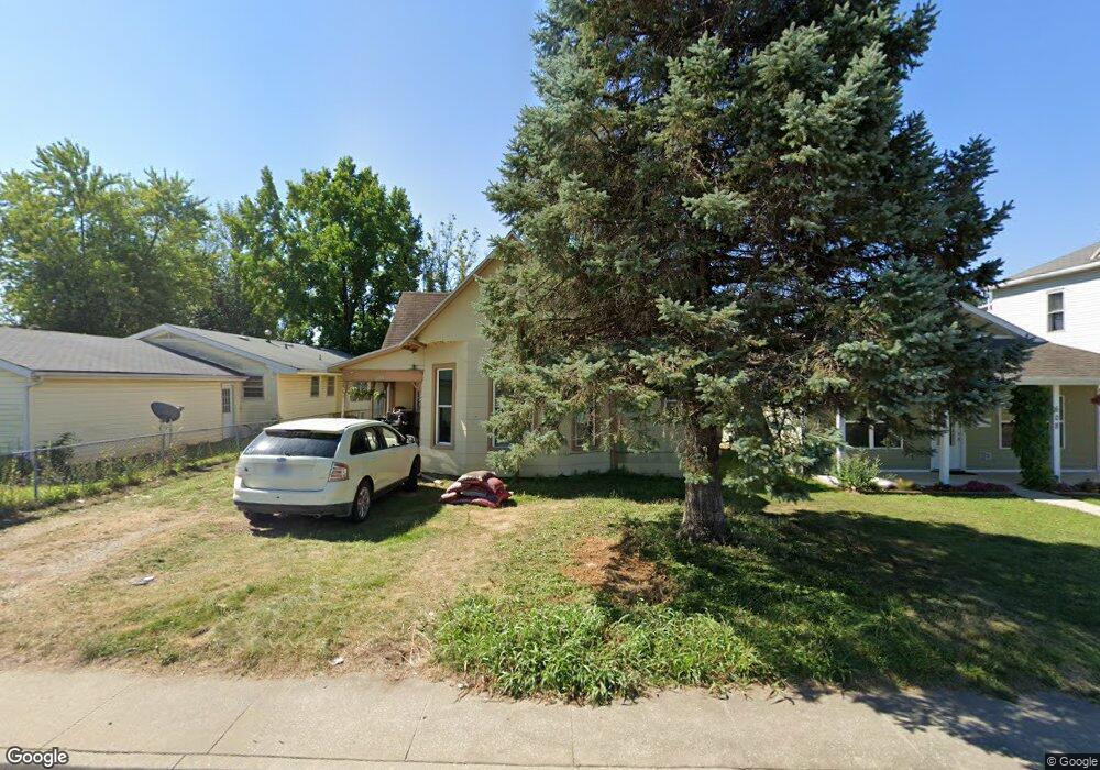
606 W Rollins St Moberly, MO 65270
Estimated Value: $58,000 - $858,000
4
Beds
2
Baths
1,340
Sq Ft
$200/Sq Ft
Est. Value
About This Home
This home is located at 606 W Rollins St, Moberly, MO 65270 and is currently estimated at $267,617, approximately $199 per square foot. 606 W Rollins St is a home located in Randolph County with nearby schools including Moberly Senior High School, St. Pius X. Catholic School, and Maranatha Seventh-day Adventist School.
Ownership History
Date
Name
Owned For
Owner Type
Purchase Details
Closed on
Jul 27, 2024
Sold by
Cole Lee and Cole Jamie
Bought by
Cole Lee and Cole Jamie
Current Estimated Value
Home Financials for this Owner
Home Financials are based on the most recent Mortgage that was taken out on this home.
Original Mortgage
$71,000
Interest Rate
6.86%
Mortgage Type
Construction
Purchase Details
Closed on
Jul 6, 2021
Sold by
Abadi Elias and Abadi Martha
Bought by
Cole Lee
Purchase Details
Closed on
Oct 25, 2019
Sold by
Harrison Sarah A
Bought by
Abadi Elias and Cole Lee
Home Financials for this Owner
Home Financials are based on the most recent Mortgage that was taken out on this home.
Original Mortgage
$50,000
Interest Rate
3.6%
Mortgage Type
New Conventional
Create a Home Valuation Report for This Property
The Home Valuation Report is an in-depth analysis detailing your home's value as well as a comparison with similar homes in the area
Home Values in the Area
Average Home Value in this Area
Purchase History
| Date | Buyer | Sale Price | Title Company |
|---|---|---|---|
| Cole Lee | -- | Central Title | |
| Cole Lee | -- | None Available | |
| Abadi Elias | -- | -- |
Source: Public Records
Mortgage History
| Date | Status | Borrower | Loan Amount |
|---|---|---|---|
| Closed | Cole Lee | $71,000 | |
| Previous Owner | Abadi Elias | $50,000 |
Source: Public Records
Tax History Compared to Growth
Tax History
| Year | Tax Paid | Tax Assessment Tax Assessment Total Assessment is a certain percentage of the fair market value that is determined by local assessors to be the total taxable value of land and additions on the property. | Land | Improvement |
|---|---|---|---|---|
| 2025 | $286 | $4,900 | $1,093 | $3,807 |
| 2024 | $286 | $3,930 | $949 | $2,981 |
| 2023 | $291 | $3,930 | $949 | $2,981 |
| 2022 | $273 | $3,790 | $950 | $2,840 |
| 2021 | $273 | $3,790 | $950 | $2,840 |
| 2020 | $273 | $3,790 | $950 | $2,840 |
| 2019 | $272 | $3,790 | $950 | $2,840 |
| 2018 | $271 | $3,790 | $950 | $2,840 |
| 2017 | $271 | $3,790 | $0 | $0 |
| 2016 | $196 | $2,760 | $0 | $0 |
| 2014 | -- | $2,620 | $0 | $0 |
| 2013 | -- | $2,620 | $0 | $0 |
| 2012 | -- | $2,600 | $0 | $0 |
Source: Public Records
Map
Nearby Homes
- 710 W Rollins St
- 216 S 5th St
- 808 W Reed St
- 632 W Logan St
- 309 S 4th St
- 816 W Reed St
- 800 Franklin St
- 407 Epperson St
- 419 S 4th St
- LOT 2 County Rd
- 1377 Conestoga Trail
- 620 Burkholder St
- 101 N Ault St
- 817 Gilman St
- 809 Myra St
- 1029 Concannon St
- 812 N Moulton St
- 1126 Fisk Ave
- 4 Fair Oaks
- 1123 Concannon St
- 608 W Rollins St
- 109 Thompson St
- 610 W Rollins St
- 610 W Rollins St Unit 4
- 115 Thompson St
- 614 W Rollins St
- 614 W Rollins St Unit 4
- 123 Thompson St
- 528 W Rollins St
- 528 W Rollins St Unit 3
- 110 Thompson St
- 618 W Rollins St
- 119 Thompson St
- 507 W Rollins St
- 112 Kirby St
- 116 Thompson St
- 526 W Rollins St
- 620 W Rollins St
- 114 Kirby St
- 120 Thompson St