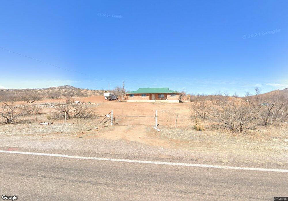
6060 W Gleeson Rd Elfrida, AZ 85610
Estimated Value: $84,171 - $457,000
--
Bed
--
Bath
1,909
Sq Ft
$136/Sq Ft
Est. Value
About This Home
This home is located at 6060 W Gleeson Rd, Elfrida, AZ 85610 and is currently estimated at $260,293, approximately $136 per square foot. 6060 W Gleeson Rd is a home with nearby schools including Tombstone High School.
Ownership History
Date
Name
Owned For
Owner Type
Purchase Details
Closed on
Mar 25, 2021
Sold by
Bono Joe R
Bought by
Bono Joe R and Joe R Bono Revocable Trust
Current Estimated Value
Purchase Details
Closed on
Oct 23, 2019
Sold by
Albright Richard E
Bought by
Bono Joe E
Home Financials for this Owner
Home Financials are based on the most recent Mortgage that was taken out on this home.
Original Mortgage
$15,000
Outstanding Balance
$13,168
Interest Rate
3.6%
Mortgage Type
New Conventional
Estimated Equity
$247,125
Create a Home Valuation Report for This Property
The Home Valuation Report is an in-depth analysis detailing your home's value as well as a comparison with similar homes in the area
Home Values in the Area
Average Home Value in this Area
Purchase History
| Date | Buyer | Sale Price | Title Company |
|---|---|---|---|
| Bono Joe R | -- | None Available | |
| Bono Joe E | $25,000 | Pioneer Title Agency Inc |
Source: Public Records
Mortgage History
| Date | Status | Borrower | Loan Amount |
|---|---|---|---|
| Open | Bono Joe E | $15,000 |
Source: Public Records
Tax History Compared to Growth
Tax History
| Year | Tax Paid | Tax Assessment Tax Assessment Total Assessment is a certain percentage of the fair market value that is determined by local assessors to be the total taxable value of land and additions on the property. | Land | Improvement |
|---|---|---|---|---|
| 2025 | $721 | $9,553 | $1,268 | $8,285 |
| 2024 | $721 | $9,502 | $1,268 | $8,234 |
| 2023 | $682 | $8,190 | $1,268 | $6,922 |
| 2022 | $670 | $7,087 | $1,268 | $5,819 |
| 2021 | $687 | $7,011 | $1,268 | $5,743 |
| 2020 | $603 | $0 | $0 | $0 |
| 2019 | $542 | $0 | $0 | $0 |
| 2018 | $583 | $0 | $0 | $0 |
| 2017 | $585 | $0 | $0 | $0 |
| 2016 | $604 | $0 | $0 | $0 |
| 2015 | $680 | $0 | $0 | $0 |
Source: Public Records
Map
Nearby Homes
- Lot 116 W Stetson Dr
- Lot 116 W Stetson Dr Unit 116
- 11003 N Legend Trail Unit 119
- TBD N High Lonesome Rd Unit 52
- 39 + - Acre On Rambling Rd Unit 100
- 77 + - Acre On Rambling Rd Unit 3/100
- 38 + - Acre On Rambling Rd Unit 3/1
- 5995 W Buckskin Trail Unit 82
- 10632 N Double U Ranch Rd
- TBD N Double U Ranch Rd
- 10632 N Double U Ranch Rd
- 0 N Double U Ranch Rd Unit 22910789
- 62 Acres N Ghost Town Trail
- 286 Acres N Ghost Town Trail
- 348 Acres N Ghost Town Trail
- 36.28 Acre Gleeson Rd Unit 6
- 4842 W Gleeson Rd
- TBD W Gleeson Rd
- TBD W Gleeson Rd
- 4256 W Gleeson Rd
- 6035 W Gleeson Rd
- 6715 W Gleeson Rd
- 6053 W Gleeson Rd
- 11101 N High Lonesome Rd
- 0 W High Lonesome & Gleeson Rd Unit 21326351
- 0 E Gleeson Unit 5 21031645
- 11010 N High Lonesome Rd
- 11081 N Emory Oak Ln
- 6180 W Stetson Dr
- 36 Ac Stetson Dr In High Lonesome
- 36 Acres Stetson Dr
- 36 Acres On W Stetson Dr
- 36 Acres On W Stetson Dr Unit 1
- 36 Acres On W Stetson Dr
- 36 Acres On W Stetson Dr Unit 115
- TBD N Emory Oak Ln Unit 2B
- TBD E 36 Ac Stetson Dr Unit 113
- Lot 116 W Stetson Dr
- 0 W Stetson Dr Unit 120 6566461
- 0 W Stetson Dr Unit 20918348