Estimated Value: $177,000 - $233,000
Studio
--
Bath
1,848
Sq Ft
$108/Sq Ft
Est. Value
About This Home
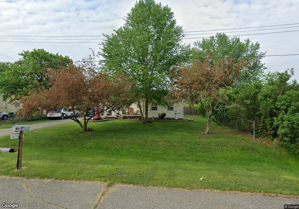
This home is located at 6062 Crown Point, Flint, MI 48506 and is currently estimated at $200,016, approximately $108 per square foot. 6062 Crown Point is a home located in Genesee County with nearby schools including Weston Elementary School, Leota Fiedler Elementary School, and Kate Dowdall Elementary School.
Ownership History
Date
Name
Owned For
Owner Type
Purchase Details
Closed on
Apr 12, 2006
Sold by
Moss Wendy M and Diamond Wendy M
Bought by
Barnier Wayne B and Barnier Ruth A
Current Estimated Value
Home Financials for this Owner
Home Financials are based on the most recent Mortgage that was taken out on this home.
Original Mortgage
$79,900
Outstanding Balance
$45,995
Interest Rate
6.39%
Mortgage Type
Fannie Mae Freddie Mac
Estimated Equity
$154,021
Purchase Details
Closed on
Apr 28, 2005
Sold by
Tufford Carl and Tufford Robin K
Bought by
Diamond Wendy M
Home Financials for this Owner
Home Financials are based on the most recent Mortgage that was taken out on this home.
Original Mortgage
$121,500
Interest Rate
5.87%
Mortgage Type
New Conventional
Purchase Details
Closed on
Mar 11, 2004
Sold by
Rosser Irene T and Rosser John T
Bought by
Tufford Carl and Tufford Robin K
Create a Home Valuation Report for This Property
The Home Valuation Report is an in-depth analysis detailing your home's value as well as a comparison with similar homes in the area
Home Values in the Area
Average Home Value in this Area
Purchase History
| Date | Buyer | Sale Price | Title Company |
|---|---|---|---|
| Barnier Wayne B | $129,900 | Title Mi | |
| Diamond Wendy M | $135,000 | Title Michigan Agency Ltd | |
| Tufford Carl | $9,750 | Guaranty Title Company |
Source: Public Records
Mortgage History
| Date | Status | Borrower | Loan Amount |
|---|---|---|---|
| Open | Barnier Wayne B | $79,900 | |
| Previous Owner | Diamond Wendy M | $121,500 |
Source: Public Records
Tax History
| Year | Tax Paid | Tax Assessment Tax Assessment Total Assessment is a certain percentage of the fair market value that is determined by local assessors to be the total taxable value of land and additions on the property. | Land | Improvement |
|---|---|---|---|---|
| 2025 | $1,953 | $99,100 | $0 | $0 |
| 2024 | $522 | $91,100 | $0 | $0 |
| 2023 | $498 | $81,300 | $0 | $0 |
| 2022 | $1,607 | $76,100 | $0 | $0 |
| 2021 | $1,593 | $68,700 | $0 | $0 |
| 2020 | $455 | $62,300 | $0 | $0 |
| 2019 | $448 | $54,500 | $0 | $0 |
| 2018 | $1,509 | $47,600 | $0 | $0 |
| 2017 | $1,456 | $45,800 | $0 | $0 |
| 2016 | $1,448 | $44,000 | $0 | $0 |
| 2015 | $1,237 | $41,500 | $0 | $0 |
| 2014 | $413 | $38,300 | $0 | $0 |
| 2012 | -- | $34,500 | $34,500 | $0 |
Source: Public Records
Map
Nearby Homes
- 4062 N Belsay Rd
- 6054 E Pierson Rd
- 6161 Finch Ln
- 3365 Eastdale Dr
- 6443 Richfield Rd
- 3296 Mills Acres St
- 6363 Bluejay Dr
- 3267 Mills Acres St
- 3179 Gehring Dr
- 3485 N Vassar Rd
- 3148 Gehring Dr
- 5067 Paro Dr
- 4413 Esta Dr
- 4435 Meadowbrook Dr
- 4455 N Genesee Rd
- 0 Sugar Maple Farms Unit 50195365
- 4452 Muriel Dr
- 3413 Blue Lake Dr
- 3246 Comer Dr
- 0 Whisper Ridge Ct
- 6056 Crown Point
- 6072 Crown Point
- 6080 Crown Point
- 6059 Freedom Ln
- 6080 Crown Point St
- 6039 Freedom Ln
- 6042 Crown Point
- 6069 Freedom Ln
- 6061 Crown Point
- 6069 Crown Point
- 6033 Freedom Ln
- 6079 Freedom Ln
- 6088 Crown Point Unit Bldg-Unit
- 6088 Crown Point
- 6055 Crown Point
- 6085 Freedom Ln
- 6028 Crown Point
- 6025 Freedom Ln
- 6087 Crown Point St
- 6087 Crown Point
Your Personal Tour Guide
Ask me questions while you tour the home.