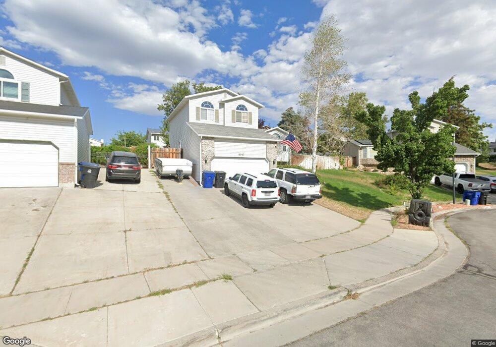
6062 S 6070 W Salt Lake City, UT 84118
Estimated Value: $484,972 - $501,000
4
Beds
2
Baths
2,002
Sq Ft
$246/Sq Ft
Est. Value
About This Home
This home is located at 6062 S 6070 W, Salt Lake City, UT 84118 and is currently estimated at $491,993, approximately $245 per square foot. 6062 S 6070 W is a home located in Salt Lake County with nearby schools including Thomas W Bacchus School, Thomas Jefferson Jr High School, and Kearns High School.
Ownership History
Date
Name
Owned For
Owner Type
Purchase Details
Closed on
Apr 21, 2017
Sold by
Cha James P and Cha Jennifer
Bought by
Lin Yuan and Xu Hongwei
Current Estimated Value
Purchase Details
Closed on
Apr 23, 2009
Sold by
Cha James P and Washburn Jennifer
Bought by
Cha P and Cha Jennifer
Home Financials for this Owner
Home Financials are based on the most recent Mortgage that was taken out on this home.
Original Mortgage
$135,000
Interest Rate
4.99%
Mortgage Type
New Conventional
Purchase Details
Closed on
Nov 8, 2002
Sold by
Kendall Michael G and Kendall Michelle
Bought by
Cha James P and Washburn Jennifer
Purchase Details
Closed on
Aug 12, 1994
Sold by
Ron Thorne Construction Inc
Bought by
Kendall Michael G and Kendall Michelle
Home Financials for this Owner
Home Financials are based on the most recent Mortgage that was taken out on this home.
Original Mortgage
$86,401
Interest Rate
8.65%
Mortgage Type
FHA
Create a Home Valuation Report for This Property
The Home Valuation Report is an in-depth analysis detailing your home's value as well as a comparison with similar homes in the area
Home Values in the Area
Average Home Value in this Area
Purchase History
| Date | Buyer | Sale Price | Title Company |
|---|---|---|---|
| Lin Yuan | -- | None Available | |
| Cha P | -- | Surety Title | |
| Cha James P | -- | Superior Title | |
| Kendall Michael G | -- | -- |
Source: Public Records
Mortgage History
| Date | Status | Borrower | Loan Amount |
|---|---|---|---|
| Previous Owner | Cha P | $135,000 | |
| Previous Owner | Kendall Michael G | $86,401 |
Source: Public Records
Tax History Compared to Growth
Tax History
| Year | Tax Paid | Tax Assessment Tax Assessment Total Assessment is a certain percentage of the fair market value that is determined by local assessors to be the total taxable value of land and additions on the property. | Land | Improvement |
|---|---|---|---|---|
| 2025 | $3,216 | $457,400 | $100,300 | $357,100 |
| 2024 | $3,216 | $431,700 | $94,500 | $337,200 |
| 2023 | $3,056 | $393,900 | $90,900 | $303,000 |
| 2022 | $3,107 | $411,300 | $89,100 | $322,200 |
| 2021 | $2,799 | $335,400 | $68,500 | $266,900 |
| 2020 | $2,634 | $294,800 | $62,600 | $232,200 |
| 2019 | $2,539 | $281,200 | $62,600 | $218,600 |
| 2018 | $2,418 | $259,000 | $62,600 | $196,400 |
| 2017 | $2,025 | $226,900 | $58,700 | $168,200 |
| 2016 | $1,916 | $215,100 | $58,700 | $156,400 |
| 2015 | $1,816 | $189,900 | $73,700 | $116,200 |
| 2014 | $1,835 | $187,600 | $73,700 | $113,900 |
Source: Public Records
Map
Nearby Homes
- 6103 S 6105 W
- 6271 W Clear Vista Dr
- 5940 S Woodview Dr
- 6149 Trowbridge Way
- 5752 S Izapa Cove
- 5749 S Mirador Ct
- 5768 Lodestone Ave
- 6248 S High Bluff Dr
- 5745 Lodestone Ave
- 6223 W Mill Valley Ln
- 5663 S China Clay Cir
- 6470 S Wakefield Way
- 5929 W Dry Bone Cir
- 5716 Trowbridge Way
- 5927 S 5665 W
- 5627 Walnut Ridge Cir
- 5657 S Woodview Dr Unit 424
- 6515 S Mount Whitney Ln
- 5733 W Plumbago Ave
- 5818 W Plumbago Ave
- 6070 S 6070 W
- 6061 S 6105 W
- 6054 S 6070 W
- 6053 S 6105 W
- 6075 S 6105 W
- 6072 W Parkham Way
- 6072 W Parkham Way
- 6057 Parkham Way
- 6082 S 6070 W
- 6039 S 6105 W
- 6071 S 6070 W
- 6083 S 6105 W
- 6058 Parkham Way
- 6079 Swanbridge Dr
- 6083 S 6070 W
- 6069 W Swanbridge Dr
- 6094 S 6070 W
- 6069 Swanbridge Dr
- 6031 S 6105 W
- 6062 S 6105 W