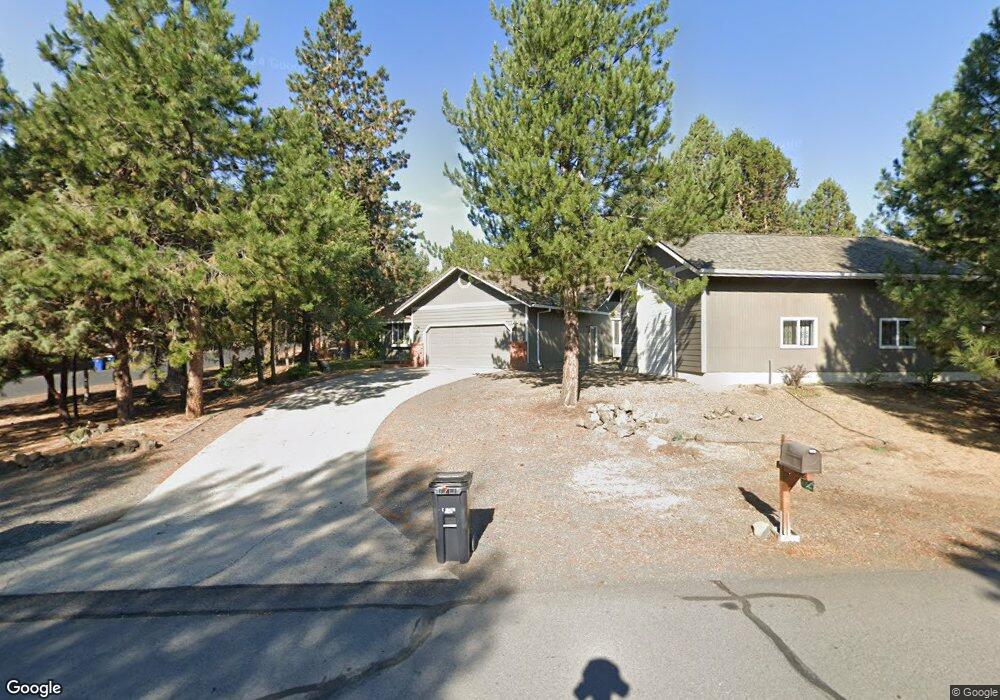
60625 Newcastle Dr Bend, OR 97702
Southeast Bend NeighborhoodEstimated Value: $655,000 - $715,892
3
Beds
2
Baths
1,441
Sq Ft
$477/Sq Ft
Est. Value
About This Home
This home is located at 60625 Newcastle Dr, Bend, OR 97702 and is currently estimated at $686,723, approximately $476 per square foot. 60625 Newcastle Dr is a home located in Deschutes County with nearby schools including R.E. Jewell Elementary School, High Desert Middle School, and Morning Star Christian School.
Ownership History
Date
Name
Owned For
Owner Type
Purchase Details
Closed on
Jan 19, 2023
Sold by
Cleavenger Thomas W
Bought by
Cleavenger Thomas W and Cleavenger Shelby L
Current Estimated Value
Purchase Details
Closed on
Apr 14, 2021
Sold by
Cleaveneer Michael J and Cleaveneer Kathleen M
Bought by
Cleaveneer Thomas W
Purchase Details
Closed on
Nov 28, 2012
Sold by
Lemstrom Roger William
Bought by
Spano James R and Spano Christeen L
Home Financials for this Owner
Home Financials are based on the most recent Mortgage that was taken out on this home.
Original Mortgage
$154,900
Interest Rate
3.33%
Mortgage Type
Seller Take Back
Purchase Details
Closed on
Apr 14, 2009
Sold by
Lemstrom Roger W
Bought by
Revocab Lemstrom Roger William and Roger William Lemstrom Revocable Living
Purchase Details
Closed on
Jan 17, 2005
Sold by
Lee Dorothy H
Bought by
Lemstrom Roger W
Create a Home Valuation Report for This Property
The Home Valuation Report is an in-depth analysis detailing your home's value as well as a comparison with similar homes in the area
Home Values in the Area
Average Home Value in this Area
Purchase History
| Date | Buyer | Sale Price | Title Company |
|---|---|---|---|
| Cleavenger Thomas W | $750,000 | -- | |
| Cleaveneer Thomas W | $450,000 | None Available | |
| Spano James R | $169,900 | Western Title & Escrow | |
| Revocab Lemstrom Roger William | -- | First American Title | |
| Lemstrom Roger W | -- | -- |
Source: Public Records
Mortgage History
| Date | Status | Borrower | Loan Amount |
|---|---|---|---|
| Previous Owner | Spano James R | $154,900 |
Source: Public Records
Tax History Compared to Growth
Tax History
| Year | Tax Paid | Tax Assessment Tax Assessment Total Assessment is a certain percentage of the fair market value that is determined by local assessors to be the total taxable value of land and additions on the property. | Land | Improvement |
|---|---|---|---|---|
| 2025 | $4,469 | $264,470 | -- | -- |
| 2024 | $4,299 | $256,770 | -- | -- |
| 2023 | $3,985 | $249,300 | $0 | $0 |
| 2022 | $3,560 | $206,380 | $0 | $0 |
| 2021 | $3,271 | $200,370 | $0 | $0 |
| 2020 | $3,103 | $200,370 | $0 | $0 |
| 2019 | $3,083 | $194,540 | $0 | $0 |
| 2018 | $2,998 | $188,880 | $0 | $0 |
| 2017 | $2,912 | $183,380 | $0 | $0 |
| 2016 | $2,780 | $178,040 | $0 | $0 |
| 2015 | $2,705 | $172,860 | $0 | $0 |
| 2014 | $2,627 | $167,830 | $0 | $0 |
Source: Public Records
Map
Nearby Homes
- 20589 Ambrosia Ln
- 20430 Snowmass
- 60781 Country Club Dr
- 20375 Big Bear Ct
- 20518 Pine Vista Dr
- 60811 Windsor Dr
- 20412 Buttermilk
- 60701 Willow Creek Loop
- 60733 Willow Creek Loop
- 60785 Willow Creek Ct
- 61039 High Lead Dr
- 20875 Sholes Rd
- 61000 Brosterhous Rd Unit 574
- 60523 SE Hedgewood Ln
- 61051 SE Ledger Ln
- 60851 SE Epic Place
- 60855 SE Epic Place
- 60852 SE Epic Place
- 60494 Hedgewood Ln
- 60858 SE Barstow Place
- 60633 Newcastle Dr
- 60624 Devon Cir
- 60626 Newcastle Dr
- 20539 Dorchester W
- 60641 Newcastle Dr
- 20531 Dorchester W
- 20557 Cambridge Ct
- 60636 Devon Cir
- 20555 Dorchester E
- 60642 Devon Cir
- 20525 Dorchester W
- 20564 Dorchester E
- 20561 Dorchester E
- 60653 Newcastle Dr
- 60631 Devon Cir
- 20567 Cambridge Ct
- 60607 Devon Cir
- 60623 Devon Cir
- 20554 Cambridge Ct