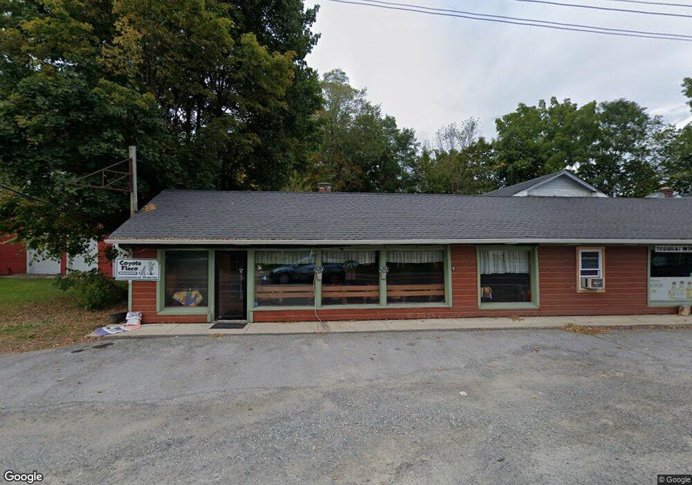
6063 Route 82 Stanfordville, NY 12581
Stanford NeighborhoodEstimated Value: $625,233
--
Bed
--
Bath
3,819
Sq Ft
$164/Sq Ft
Est. Value
About This Home
This home is located at 6063 Route 82, Stanfordville, NY 12581 and is currently estimated at $625,233, approximately $163 per square foot. 6063 Route 82 is a home located in Dutchess County with nearby schools including Stissing Mountain High School.
Ownership History
Date
Name
Owned For
Owner Type
Purchase Details
Closed on
Jan 26, 2015
Sold by
Still The One Llc
Bought by
Nancyco Enterprises Inc
Current Estimated Value
Purchase Details
Closed on
Jul 8, 2009
Sold by
Ironwood Millbrook Prop L
Bought by
Still The One Llc
Purchase Details
Closed on
Mar 15, 1999
Sold by
Statia Enterprises Inc
Bought by
Ties Ironwood Millbrook Proper
Create a Home Valuation Report for This Property
The Home Valuation Report is an in-depth analysis detailing your home's value as well as a comparison with similar homes in the area
Home Values in the Area
Average Home Value in this Area
Purchase History
| Date | Buyer | Sale Price | Title Company |
|---|---|---|---|
| Nancyco Enterprises Inc | $299,000 | Robert Grieco | |
| Still The One Llc | $225,000 | -- | |
| Ties Ironwood Millbrook Proper | $170,000 | -- |
Source: Public Records
Tax History Compared to Growth
Tax History
| Year | Tax Paid | Tax Assessment Tax Assessment Total Assessment is a certain percentage of the fair market value that is determined by local assessors to be the total taxable value of land and additions on the property. | Land | Improvement |
|---|---|---|---|---|
| 2024 | $7,441 | $494,600 | $72,400 | $422,200 |
| 2023 | $6,984 | $471,000 | $72,400 | $398,600 |
| 2022 | $6,560 | $395,200 | $67,000 | $328,200 |
| 2021 | $6,989 | $380,000 | $67,000 | $313,000 |
| 2020 | $6,613 | $380,000 | $67,000 | $313,000 |
| 2019 | $6,154 | $342,700 | $67,000 | $275,700 |
| 2018 | $6,447 | $342,700 | $67,000 | $275,700 |
| 2017 | $6,333 | $336,000 | $67,000 | $269,000 |
| 2016 | $7,183 | $126,750 | $25,736 | $101,014 |
| 2015 | -- | $126,750 | $25,736 | $101,014 |
| 2014 | -- | $126,750 | $25,736 | $101,014 |
Source: Public Records
Map
Nearby Homes
- 6099 New York 82
- 2 Hunns Lake Rd
- 22 Hunns Lake Rd
- 5-15 Old Depot Way
- 135 Sisters Hill Rd
- 966 S Anson Rd
- 0 New York 82
- 0 New York 82
- 62 Ernest Rd
- 5760 Route 82
- 287 Hunns Lake Rd
- 151 Ernest Rd
- 900 S Anson Rd
- 5654 Route 82
- 36 Market Ln
- 5646 Route 82
- 129 W Meadow Ln
- 62 Hicks Ln
- 465 Shunpike
- 1665 Bulls Head Rd
- 6073 Route 82
- 6050 Route 82 Unit 60
- 6054 Route 82
- 6056 Route 82
- 6048 Route 82
- 6081 Route 82
- 6046 Route 82
- 6085 Route 82
- 6087 Route 82
- 6091 Route 82
- 6091 Route 82 Unit 1
- 6089 Route 82
- 6093 Route 82
- 6030 Route 82 Unit 201
- 6030 Route 82 Unit 202
- 6102 Route 82
- 6024 Route 82 Unit 60
- 6101 New York 82
- 6103 Route 82 Unit 61
- 6020 Route 82