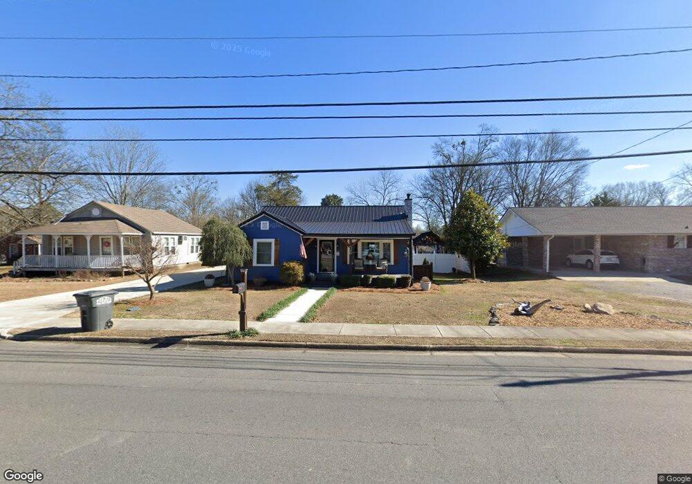
6065 Highway 114 Lyerly, GA 30730
Estimated Value: $120,000 - $176,000
--
Bed
1
Bath
1,030
Sq Ft
$132/Sq Ft
Est. Value
About This Home
This home is located at 6065 Highway 114, Lyerly, GA 30730 and is currently estimated at $135,865, approximately $131 per square foot. 6065 Highway 114 is a home located in Chattooga County with nearby schools including Chattooga High School.
Ownership History
Date
Name
Owned For
Owner Type
Purchase Details
Closed on
Oct 31, 2007
Sold by
Branch Banking Co
Bought by
Carnes Joey
Current Estimated Value
Home Financials for this Owner
Home Financials are based on the most recent Mortgage that was taken out on this home.
Original Mortgage
$41,646
Outstanding Balance
$26,186
Interest Rate
6.26%
Mortgage Type
FHA
Estimated Equity
$109,679
Create a Home Valuation Report for This Property
The Home Valuation Report is an in-depth analysis detailing your home's value as well as a comparison with similar homes in the area
Home Values in the Area
Average Home Value in this Area
Purchase History
| Date | Buyer | Sale Price | Title Company |
|---|---|---|---|
| Carnes Joey | -- | -- | |
| Carnes Joey | $42,300 | -- |
Source: Public Records
Mortgage History
| Date | Status | Borrower | Loan Amount |
|---|---|---|---|
| Open | Carnes Joey | $41,646 | |
| Closed | Carnes Joey | $41,646 |
Source: Public Records
Tax History Compared to Growth
Tax History
| Year | Tax Paid | Tax Assessment Tax Assessment Total Assessment is a certain percentage of the fair market value that is determined by local assessors to be the total taxable value of land and additions on the property. | Land | Improvement |
|---|---|---|---|---|
| 2024 | $1,201 | $42,632 | $760 | $41,872 |
| 2023 | $1,466 | $42,392 | $6,480 | $35,912 |
| 2022 | $795 | $30,324 | $860 | $29,464 |
| 2021 | $378 | $14,297 | $860 | $13,437 |
| 2020 | $352 | $12,996 | $860 | $12,136 |
| 2019 | $358 | $12,996 | $860 | $12,136 |
| 2018 | $356 | $13,400 | $860 | $12,540 |
| 2017 | $371 | $13,400 | $860 | $12,540 |
| 2016 | $252 | $13,399 | $860 | $12,539 |
| 2015 | -- | $10,835 | $860 | $9,975 |
| 2014 | -- | $10,836 | $860 | $9,976 |
| 2013 | -- | $10,835 | $860 | $9,975 |
Source: Public Records
Map
Nearby Homes
- 0 Georgia 100
- 0 Gaylor Rd Unit 22865068
- 0 Gaylor Rd Unit 10497505
- 0 Gaylor Rd Unit 10497539
- 441 Lyerly Dam Rd
- 557 Acres On Taliaferro Springs Rd
- 1503 Taliaferro Springs Rd
- 386 Oak Grove Rd
- 0 Tract 14 Unit 10476683
- #46 Owens Dairy Rd
- 0 Echols Rd
- 0 Back Valley Rd Unit 25316915
- 0 Back Valley Rd Unit 25591197
- 0 Back Valley Rd Unit 25602608
- 0 Back Valley Rd Unit 25369328
- 0 Back Valley Rd Unit 25606694
- 0 Back Valley Rd Unit 25602078
- 110 Dove Cir
- 8690 Silver Hill Rd
- 1516 Fish Hatchery Rd
- 6069 Highway 114
- 6041 Highway 114
- 00 Georgia 114
- 6070 Highway 114
- 0 Hwy 114 Unit 5914019
- 0 Georgia 114
- 6019 Highway 114
- 17 Lyerly Dam Rd
- 6038 Highway 114
- 6019 Highway 114
- 49 Lyerly Dam Rd
- 70 Lyerly Dam Rd
- 66 N Chattooga Ave
- 80 N Chattooga Ave
- 132 Hammond St
- 23 N Chattooga Ave
- 43 N Chattooga Ave
- 226 Tennessee Ave
- 284 Tennessee Ave
- 85 Lyerly Dam Rd