Estimated Value: $310,827
Studio
1
Bath
470
Sq Ft
$661/Sq Ft
Est. Value
About This Home
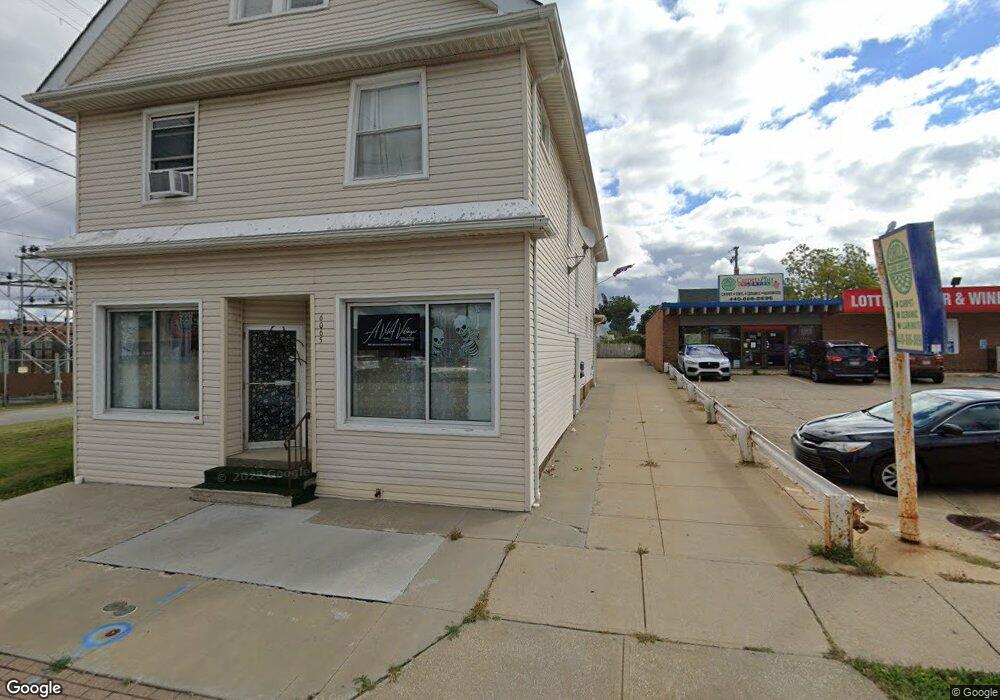
This home is located at 6065 State Rd, Parma, OH 44134 and is currently estimated at $310,827, approximately $661 per square foot. 6065 State Rd is a home located in Cuyahoga County with nearby schools including Shiloh Middle School, John Muir Elementary School, and Normandy High School.
Ownership History
Date
Name
Owned For
Owner Type
Purchase Details
Closed on
Jun 11, 2013
Sold by
6065 State Road Llc
Bought by
Komorowski Daniel N
Current Estimated Value
Home Financials for this Owner
Home Financials are based on the most recent Mortgage that was taken out on this home.
Original Mortgage
$70,000
Outstanding Balance
$48,840
Interest Rate
3.52%
Mortgage Type
Commercial
Estimated Equity
$261,987
Purchase Details
Closed on
Jul 22, 2003
Sold by
Mcdermott Brian J and Mcdermott Christina L
Bought by
6065 State Road Llc
Purchase Details
Closed on
Nov 18, 1999
Sold by
Laluk Nicholas and Laluk Wladimira
Bought by
Mcdermott Brian J and Mcdermott Christina L
Home Financials for this Owner
Home Financials are based on the most recent Mortgage that was taken out on this home.
Original Mortgage
$100,000
Interest Rate
7.88%
Mortgage Type
Commercial
Purchase Details
Closed on
Jan 1, 1975
Bought by
Laluk Nicholas and Laluk Wladimira
Create a Home Valuation Report for This Property
The Home Valuation Report is an in-depth analysis detailing your home's value as well as a comparison with similar homes in the area
Home Values in the Area
Average Home Value in this Area
Purchase History
| Date | Buyer | Sale Price | Title Company |
|---|---|---|---|
| Komorowski Daniel N | $130,000 | Boulevard Title Agency | |
| 6065 State Road Llc | -- | -- | |
| Mcdermott Brian J | $134,000 | -- | |
| Laluk Nicholas | -- | -- |
Source: Public Records
Mortgage History
| Date | Status | Borrower | Loan Amount |
|---|---|---|---|
| Open | Komorowski Daniel N | $70,000 | |
| Previous Owner | Mcdermott Brian J | $100,000 |
Source: Public Records
Tax History
| Year | Tax Paid | Tax Assessment Tax Assessment Total Assessment is a certain percentage of the fair market value that is determined by local assessors to be the total taxable value of land and additions on the property. | Land | Improvement |
|---|---|---|---|---|
| 2025 | $4,837 | $63,070 | $10,640 | $52,430 |
| 2024 | $5,090 | $63,070 | $10,640 | $52,430 |
| 2023 | $4,202 | $49,910 | $11,690 | $38,220 |
| 2022 | $4,190 | $49,910 | $11,690 | $38,220 |
| 2021 | $4,339 | $49,910 | $11,690 | $38,220 |
| 2020 | $4,129 | $45,400 | $10,640 | $34,760 |
| 2019 | $4,033 | $129,700 | $30,400 | $99,300 |
| 2018 | $4,012 | $45,400 | $10,640 | $34,760 |
| 2017 | $4,002 | $43,230 | $15,960 | $27,270 |
| 2016 | $3,978 | $43,230 | $15,960 | $27,270 |
| 2015 | $4,065 | $43,230 | $15,960 | $27,270 |
| 2014 | $4,065 | $44,870 | $15,960 | $28,910 |
Source: Public Records
Map
Nearby Homes
- 3407 Wellington Ave
- 3716 Grantwood Dr
- 3202 Parklane Dr
- 3406 Marioncliff Dr
- 3255 Woodlawn Dr
- 3319 Norris Ave
- 3303 Ingleside Dr
- 4115 Sheraton Dr
- 4515 Albertly Ave
- 3103 Norris Ave
- 3109 George Ave
- 4809 Wellington Ave
- 3323 Dellwood Dr
- 4918 Yorkshire Ave
- 4011 Liggett Dr
- 3214 Liggett Dr
- 3440 Winthrop Dr
- 5916 W 54th St
- 4312 Kenmore Ave
- 6466 Concord Dr Unit M6
- 6067 State Rd
- 3434 Wellington Ave
- 3437 Maplecrest Ave
- 6076 State Rd
- 3430 Wellington Ave
- 3433 Maplecrest Ave
- 3426 Wellington Ave
- 3426 Wellington Ave
- 6034 State Rd
- 6084 State Rd
- 3429 Maplecrest Ave
- 3435 Wellington Ave
- 6033 State Rd
- 3703 Maplecrest Ave
- 6080 State
- 6034 State Rd
- 3422 Wellington Ave
- 3431 Wellington Ave
- 3425 Maplecrest Ave
- 3710 Wellington Ave
Your Personal Tour Guide
Ask me questions while you tour the home.