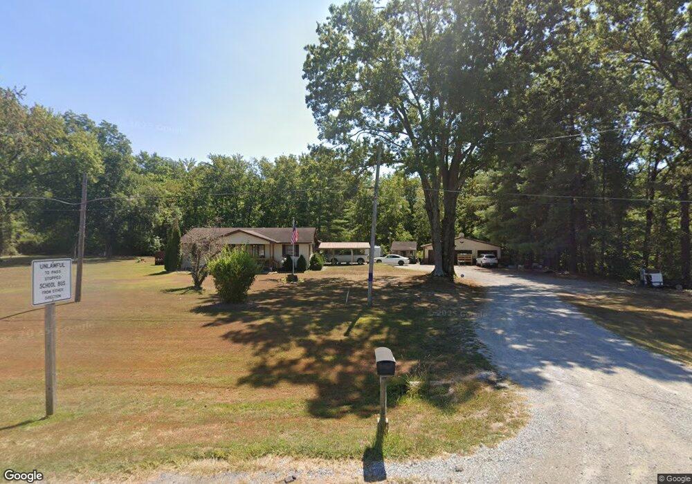
6065 Us 45 S Carrier Mills, IL 62917
Estimated Value: $118,000 - $166,649
--
Bed
--
Bath
--
Sq Ft
1.35
Acres
About This Home
This home is located at 6065 Us 45 S, Carrier Mills, IL 62917 and is currently estimated at $131,912. 6065 Us 45 S is a home located in Saline County with nearby schools including Carrier Mills-Stonefort Elementary School and Carrier Mills-Stonefort High School.
Ownership History
Date
Name
Owned For
Owner Type
Purchase Details
Closed on
Jan 23, 2020
Sold by
Hankins Larry Wayne and Hankins Lisa Jo
Bought by
Davis Brian T and Davis Karen C
Current Estimated Value
Home Financials for this Owner
Home Financials are based on the most recent Mortgage that was taken out on this home.
Original Mortgage
$85,182
Outstanding Balance
$75,450
Interest Rate
3.73%
Mortgage Type
New Conventional
Estimated Equity
$56,462
Purchase Details
Closed on
Nov 20, 2014
Sold by
Steapleton Paul D
Bought by
Hankins Larry Wayne and Hankins Lisa Jo
Home Financials for this Owner
Home Financials are based on the most recent Mortgage that was taken out on this home.
Original Mortgage
$84,550
Interest Rate
4.12%
Mortgage Type
New Conventional
Create a Home Valuation Report for This Property
The Home Valuation Report is an in-depth analysis detailing your home's value as well as a comparison with similar homes in the area
Home Values in the Area
Average Home Value in this Area
Purchase History
| Date | Buyer | Sale Price | Title Company |
|---|---|---|---|
| Davis Brian T | $85,500 | Attorney | |
| Hankins Larry Wayne | $89,000 | None Available |
Source: Public Records
Mortgage History
| Date | Status | Borrower | Loan Amount |
|---|---|---|---|
| Open | Davis Brian T | $85,182 | |
| Previous Owner | Hankins Larry Wayne | $84,550 |
Source: Public Records
Tax History Compared to Growth
Tax History
| Year | Tax Paid | Tax Assessment Tax Assessment Total Assessment is a certain percentage of the fair market value that is determined by local assessors to be the total taxable value of land and additions on the property. | Land | Improvement |
|---|---|---|---|---|
| 2023 | $2,124 | $32,530 | $1,103 | $31,427 |
| 2022 | $1,982 | $30,255 | $1,026 | $29,229 |
| 2021 | $1,821 | $27,504 | $933 | $26,571 |
| 2020 | $1,787 | $26,680 | $905 | $25,775 |
| 2019 | $1,790 | $26,680 | $905 | $25,775 |
| 2018 | $2,388 | $26,680 | $905 | $25,775 |
| 2017 | $2,470 | $26,680 | $905 | $25,775 |
| 2016 | $22 | $26,680 | $905 | $25,775 |
| 2015 | -- | $26,680 | $905 | $25,775 |
| 2014 | $876 | $26,680 | $905 | $25,775 |
| 2013 | $876 | $26,680 | $905 | $25,775 |
| 2012 | $876 | $26,680 | $905 | $25,775 |
Source: Public Records
Map
Nearby Homes
- 109 Delanor Dr
- 518 Fife St
- 315 W Furlong St
- 603 N Main St
- 720 N Mill St
- 104 Deborann Dr
- 205 W Washington St
- 736 N Mill St
- 437 N Thompson St
- 1501 Duncan Rd
- 615 Liberty Rd
- 0 Frond Rd Unit Lot WP001
- 002 Robinson Hill Rd
- 000 Robinson Hill Rd
- 001 Robinson Hill Rd
- 1501 Duncan Rd
- 180 Pinehill Ln
- 120 Southwest Dr
- 14 Acorn Dr
- Robinson Hill Rd Unit LotWP001
- 6035 Us 45 S
- 6015 Us 45 S
- 5940 U S 45
- 6065 U S 45
- 5900 U S 45
- 85 Bryant Rd
- 75 Ledford Rd
- 5900 Us Highway 45 S
- 180 Ledford Rd
- 5840 Us Highway 45 S
- 125 Ledford Rd
- 5800 Us Highway 45 S
- 370 Bryant Rd
- 165 Ledford Rd
- 5780 Us Highway 45 S
- 175 Ledford Rd
- 140 Ledford Rd
- 5730 U S 45
- 120 E Harrison St
- 5725 Us Highway 45 S