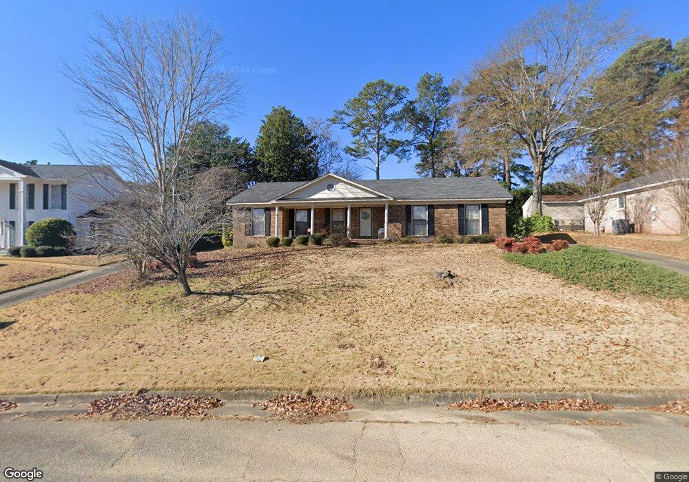
6067 Chrisbin Dr Columbus, GA 31909
North Columbus NeighborhoodEstimated Value: $262,170 - $304,000
3
Beds
3
Baths
2,218
Sq Ft
$130/Sq Ft
Est. Value
About This Home
This home is located at 6067 Chrisbin Dr, Columbus, GA 31909 and is currently estimated at $289,043, approximately $130 per square foot. 6067 Chrisbin Dr is a home located in Muscogee County with nearby schools including Blanchard Elementary School, Veterans Memorial Middle School, and Hardaway High School.
Ownership History
Date
Name
Owned For
Owner Type
Purchase Details
Closed on
Oct 1, 2020
Sold by
Soumphonphakdy Vethaphone
Bought by
Soumphonphakdy Vethaphone and Soumphonphakdy Chitpasong
Current Estimated Value
Home Financials for this Owner
Home Financials are based on the most recent Mortgage that was taken out on this home.
Original Mortgage
$193,700
Outstanding Balance
$171,577
Interest Rate
2.8%
Mortgage Type
VA
Estimated Equity
$117,466
Purchase Details
Closed on
Sep 1, 2020
Sold by
Porch Bobby W
Bought by
Soumphonphakdy Vethaphone
Home Financials for this Owner
Home Financials are based on the most recent Mortgage that was taken out on this home.
Original Mortgage
$193,700
Outstanding Balance
$171,577
Interest Rate
2.8%
Mortgage Type
VA
Estimated Equity
$117,466
Create a Home Valuation Report for This Property
The Home Valuation Report is an in-depth analysis detailing your home's value as well as a comparison with similar homes in the area
Home Values in the Area
Average Home Value in this Area
Purchase History
| Date | Buyer | Sale Price | Title Company |
|---|---|---|---|
| Soumphonphakdy Vethaphone | -- | -- | |
| Soumphonphakdy Vethaphone | $193,700 | -- |
Source: Public Records
Mortgage History
| Date | Status | Borrower | Loan Amount |
|---|---|---|---|
| Open | Soumphonphakdy Vethaphone | $193,700 |
Source: Public Records
Tax History
| Year | Tax Paid | Tax Assessment Tax Assessment Total Assessment is a certain percentage of the fair market value that is determined by local assessors to be the total taxable value of land and additions on the property. | Land | Improvement |
|---|---|---|---|---|
| 2025 | $3,317 | $84,724 | $13,496 | $71,228 |
| 2024 | $3,317 | $84,724 | $13,496 | $71,228 |
| 2023 | $3,337 | $84,724 | $13,496 | $71,228 |
| 2022 | $3,015 | $73,832 | $13,496 | $60,336 |
| 2021 | $3,130 | $76,652 | $13,496 | $63,156 |
| 2020 | $491 | $67,640 | $13,496 | $54,144 |
| 2019 | $494 | $67,640 | $13,496 | $54,144 |
| 2018 | $494 | $67,640 | $13,496 | $54,144 |
| 2017 | $498 | $67,640 | $13,496 | $54,144 |
| 2016 | $501 | $50,946 | $9,208 | $41,738 |
| 2015 | $503 | $50,946 | $9,208 | $41,738 |
| 2014 | $506 | $50,946 | $9,208 | $41,738 |
| 2013 | -- | $50,946 | $9,208 | $41,738 |
Source: Public Records
Map
Nearby Homes
- 6002 Canterbury Dr
- 5921 Canterbury Dr
- 6221 Charing Dr
- 3325 N Quay Dr
- 5836 Sherborne Dr
- 2 Biltmore Ct
- 3342 Windermere St
- 6104 Windsor Dr
- 4001 Twilight Dr
- 5820 Windsor Dr
- 3845 Arrel Dr
- 5829 Ventura Dr
- 3646 Weems Rd
- 3121 Bellanca St
- 6411 Michael Ave
- 5829 Moon Rd
- 3101 Waco St
- 4202 Cheshire Bridge Rd
- 6308 Adams Park Dr
- 5502 Southlea Ln
- 6061 Chrisbin Dr
- 6075 Chrisbin Dr
- 6070 Charing Dr
- 6062 Charing Dr
- 6076 Charing Dr
- 6055 Chrisbin Dr
- 6062 Chrisbin Dr
- 6070 Chrisbin Dr
- 6056 Charing Dr
- 6054 Chrisbin Dr
- 6076 Chrisbin Dr
- 6101 Chrisbin Dr
- 6046 Charing Dr
- 6049 Chrisbin Dr
- 6102 Charing Dr
- 6100 Chrisbin Dr
- 6046 Chrisbin Dr
- 6036 Charing Dr
- 6071 Charing Dr
- 6063 Charing Dr